


The Indus Valley Civilisation, Early Harappan phase started from 3200-2800 BC. Mohenjo-Daro belongs to the Mature Harappan phase 2600-1900 BC. This phase was characterised by the emergence of fortified settlements, early trade networks and specific pottery styles called Amri-Nal, Kot Diji and Sothi-Siswal. The key sites of this phase include Bhirrana (Haryana India) dating back to 7570 BC, Mehrgarh (Sibi-Balochistan Pakistan) 7000 BC, Rakhigarhi (Haryana India) 6500 BC, Lothal (Gujarat India) 3700 BC, Amri (Sindh Pakistan) 3600 BC, Kalibangan (Rajasthan India) 3500 BC, Kot Diji (Sindh Pakistan) 3300 BC, Dholavira (Gujarat India) 3000 BC, and Banawali (Haryana India) 2500 BC. These settlements demonstrate early mud brick houses, fortified mud brick walls, brick dockyards, evidence of ploughed fields and fire altars. The Early Indus Writing was discovered from Harappa which dates back to 3300-2800 BC.
Mohenjo-Daro, the Pearl of the Indus Valley Civilisation, was founded on the banks of the River Indus around 2500 BC. When Mohenjo-Daro was founded, the following major cities were flourishing in Mesopotamia: 1) Ur 2) Uruk 3) Eridu 4) Larsa 5) Lagash 6) Nippur 7) Kish and 8) Mari. On the other hand, during the Age of the Pyramids, several important cities flourished in Egypt, for example Memphis, Hierakonopolis (Nekhen), Abydos, Elephantine and Heliopolis.
Key Geographical Features Around Mohenjo-Daro
Why was the ancient city of Mohenjo-Daro built in this place? The city was constructed on elevated ground and artificial platforms to prevent the frequent floods of the River Indus, which formed a fertile, alluvial plain. The River Indus acted as a lifeline for agriculture, livestock rearing and fishing to the people of Mohenjo-Daro. The Khirthar Range (7,430 feet), a 190-mile (300 km) mountain system, formed the natural boundary from the west between Sindh and Balochistan. The range stretched from the Mula River and Bolan Pass in the north to the Arabian Sea in the south. The Bolan Pass, an 89 km natural valley, has served for centuries as a trade, migration and invasion route between the Indus Valley and Afghanistan, Iran and Central Asia.
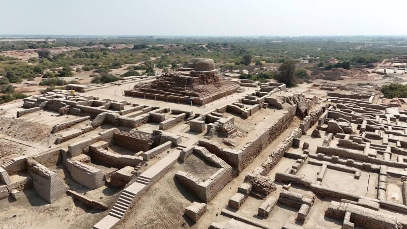
This mountain range protected Mohenjo-Daro and its neighbouring towns and villages from the invasions of the north and west. These mountains consist primarily of sedimentary rock. The Thar Desert, also known as the Great Indian Desert, is located in the east and south-east of the Mohenjo-Daro archaeological site and stretches across India and Pakistan with a total area of 264,091 sq km. Several Indus Valley Civilisation sites have been discovered from the Thar Desert area. The key findings include the 2025 discovery of a small rural Harappan settlement, Ratadiya Ri Dheri (2600-1900 BC), in Jaisalmer, Gujarat, India. The southern boundary of Sindh lies along the Arabian Sea with the Indus Delta and coastline. Many ancient sea ports, coastal lagoons and mangrove forests can be seen here today. This seacoast of Sindh is 270 km to 348 km, stretching from the Hub River to the Sir Creek from west to the east.
Mohenjo-Daro and the Prasiane Island of the River Indus
The deserted site of Mohenjo-Daro was located on the Prasiane Island of the River Indus. Megasthenes (350 – 290 BC) was a Greek ethnographer in the Hellenistic period, author of the work Indica, who has provided some details of this island to us in the Greek language. He was born in Asia Minor (modern-day Turkey) and became an ambassador of Seleucus I of Syria possibly to Chandragupta Maurya in Pataliputra, India. However, the exact date of his embassy is uncertain. Scholars place it before 298 BC, the date of Chandragupta's death. Arrian explains that Megasthenes lived in Arachosia, with the satrap Sibyrtius, from where he visited India. Megasthenes widely wrote about the size of India, its rivers, islands, geographical boundaries, history, tribes, castes, cities, fertility, wild beasts, elephants, horses, tigers, apes, serpents, scorpions, ants, trees, gold, silver, pearls, food, dress and customs.
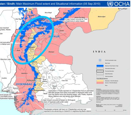
Giving a description of Prasiane Island, Megasthenes says, “The Indus Called by the inhabitants Sindus, rising on that spur of Mount Caucasus which is called Paropamisus, from sources fronting the sunrise, receives also itself nineteen rivers, of which the most famous are the Hydaspes, which has four tributaries; the Cantabra, which has three; the Acesines and the Hypasis, which are both navigable; but nevertheless, having no very great supply of water, it is nowhere broader than fifty stadia, or deeper than fifteen paces. It forms an extremely large island, which is called Prasiane, and a smaller one, called Patale. Its stream, which is navigable, by the lowest estimates, for, 1240 miles, turns westward as if following more or less closely the course of the sun, and then falls into the ocean.” (Fragments From Megasthenes: Indika. From: Ancient India As Described By Megasthenes And Arrian. Translated and edited by JW McCrindle. Calcutta and Bombay: Thacker, Spink, 1877, 30-174).
The Island of Prasiane was also called Oxykanos or Oxycanus by historians. According to Arrian of Nicomedia (86 BC-160 AD), a Roman (Greek) historian, public servant, military commander and philosopher of the 2nd century, Alexander the Great started a campaign against Oxykanos. He writes in Chapter XVI - under the title of Campaign against Oxykanos and Sambus; “then he took the archers and the Agrianians and the cavalry which was sailing with him, and marched against the governor of a district in that part of the country whose name was Oxykanos, because he neither came himself nor sent envoys to offer the surrender of himself and his country.”
The city was constructed on elevated ground and artificial platforms to prevent the frequent floods of the River Indus, which formed a fertile, alluvial plain
Quintus Curtius Rufus in his History Of Alexander The Great says; “Having thereafter the reduced the Musicani, Alexander put a garrison into their capital, and marched thence into the country of Praesti, another Indian tribe. Their king was Porticanus, and he with a great body of his countrymen had shut himself up within a strongly-fortified city. Alexander, however, took it after a three days siege. Porticanus, who had taken refuge within the citadel after the capture of the city, sent deputies to the king to arrange about terms of capitulation. Before they reached him, however two towers had fallen down with a dreadful crash, and the Macedonians having made their way through the ruins into the citadel, captured it and slew Porticanus, who with a few others had offered resistance. Having demolished the citadel and sold all the prisoners, he marched into the territories of Sambus, where he received the submission of numerous towns”.
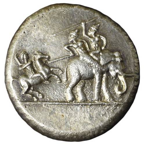
Curtius calls the subjects of Oxykanos the Praesti, a name which would indicate that they inhabited a level country, since the Sanskrit word of which their name is transcript - prastha - denotes a tableland or a level expanse. The name, Saint Martin thinks, is in Justin altered to Praesidae; but Justin, it appears to me, means the Praisioi thereby. Oxykanos is called both by Strabo and Diodoros Portikano; representing perhaps the Sanskrit Partha, “a prince”. It is not easy to determine where his domains lay. They were not on the Indus, for Alexander left that river to attack them. Cunningham places them to the west of the River Indus in the level country around Larkana, which though now close to the Indus, was in Alexander’s time about forty miles distant from it. Their capital he identifies with Mahorta/Mahota, a place about 10 miles north-west from Larkana, where there are remains of an ancient fortress on a huge mound, whence perhaps its name Mahaurddha, “very high”. (The Invasion Of India By Alexander The Great: As Described By Arrian, Quintus Curtius, Diodoros, Plutarch And Justin by JW M’Crindle 1896, Reprint 1992, Indus Publications Karachi Sindh Pages 158).
Mentioning Prasiane, HT Lambrick writes in Sindh: A General Introduction (1964) that, “Their king was Porticanus…This is obviously the provincial governor Oxycanus: and the name of the tribe has been taken to represent the Sanskrit word Prastha, meaning a level expanse. The tract mey be identified with the Prarjuna of the inscription on the Allahabad column; Pliny refers to the island of Prasiake. Ptolemy gives details of several branches thrown off by the Indus, one of them proceeding in the direction of the Arbita mountains, by which as we shall see he means the western hills of Sindh.” (Page 109).
Arrian further describes in Anabasis Of Alexander that, “Then he took the archers and the Agrianians and the cavalry which was sailing with him, and marched against the governor of a district in that part of the country whose name was Oxykanos, because he neither came himself nor sent envoys to offer the surrender of himself and his country. At the first assault he took by storm the two largest cities under the rule of Oxykanos, in the second of which that chief himself was taken prisoner. The booty he gave to the army, but the elephants he led away and reserved for himself. After Alexander, Seleucus Nicator I and Ptolemy used elephants in wars against their enemies. The other cities in the same country surrendered without attempting resistance wherever he advanced; so much were the minds of all the Indians paralysed with abject terror by Alexander and the success of his arms” (McCrindle, 1896: 158). Eggermont speculates these may have been distinct rulers—one governing Azeika (Axika), the other Pardabathra—though Lassen identifies them as one under the name Portikanos. Modern scholars often merge them as Oxykanos. I propose that Oxycanus might have been Ucha Channa, a prominent Sindhi tribe still present in Sindh and Balochistan, and that “Acha” could indeed refer to a specific caste within Sindhi society.
Quintus Curtius Rufus recounts the fate of King Porticanus, describing how “Having thereafter reduced the Musicani, Alexander put a garrison into their capital, and marched thence into the country of Paraesi, another Indian tribe. Their king was Porticanus, and he with a great body of his countrymen had shut himself up within a strongly fortified city. Alexander, however, took it after 3 day’s siege. Porticanus, who had taken refuge within the citadel after the capture of the city, sent deputies to the king to arrange about terms of capitulation. Before they reached him, however, two towers had fallen down with a dreadful crash, and the Macedonians having made their way through the ruins into the citadel, captured it and slew Porticanus, who with a few others had offered resistance” (McCrindle: 1896, Page 253).
Likewise, Diodorus Siculus narrates in Bibliotheca Historia: “He next invaded the territories under the sway of Portikanos, and took two cities at the first assault, which he permitted the soldiers to sack and then burned. Portikanos himself fled into a part of the country which offered means of defense, but in a battle he was defeated and slain. All the cities subject to his sceptre Alexander captured and razed to the ground, and by these severe measures spread consternation among surrounding tribes.”
Captain Charles Masson, a former East India Company soldier, writes in 1828: “On the banks of the Nari, near Ladkhana, are the remains of an ancient fortress, on a huge mound, called Maihota, a name not unknown to the ancient inhabitants of our isle, being yet preserved by an ancient castle in the northern countries, or in Scotland” (Masson: 1842, Page 261). Sir Alexander Cunningham later identified Oxycanus with Mahota, noting, “I would therefore identify it with the great mound of Mahorta on the bank of the Ghar River, 10 miles from Larkana” (Cunningham: 1871, Page 260). MH Panhwar suggests that Mahota may have been the capital of Oxycanus, a subordinate ruler of Upper Sindh (79). Local traditions also recount Alexander’s march through Mahota, Larkana.
Sir Alexander Cunningham, in his Coins Of The Indo Scythians, Sakas And Kushans (1888), describes Barda, stating: “No 13: May be read as Pardabathra, a city placed by Ptolemy on the western bank of the Indus. I presume that this must be the same place as the Barda of Isidorus; but I’m unable to identify it. Perhaps No 12, which seems to be simply B, may be intended for Barda” (Evans, 1888, Page 214). Waldemar Heckel, in The Marshalls Of Alexander’s Empire (1992), notes that, “Krateros had continued south with his troops, not much beyond as Pardabathra, where he appears to have remained with the main force while Alexander dealt with Sambos, the defecting satrap of the hill country to the west of the Indus” (Page 112).
Ancient Cartography and the Courses of the River Indus
The Greek geographer Claudius Ptolemy (b 100 AD, d 170 AD) mentions Piska, a town of Indo-Scythia on the River Indus, in his Map Of World/South Asia (150 AD) (Ptol. 7.1.58). MU Erdosy (1997) includes both Piska and Pardabathra in his Map 6 Asia Orientalis, showing Pardabathra as Piska’s western neighbour. MH Panhwar believes Piska to be Mohenjo-Daro (An Illustrated Historical Atlas Of Soomra Kingdom Of Sindh, 2003, Page 40). Meanwhile, I identify Pardabathra as Badeh Bothra, a historic town situated 12 km west of the Mohenjo-Daro archaeological site. The ancient Sukkur Sehwani Road, a significant trade route linking northern and southern Sindh, still exists in this region. Near Badeh City are ruins of Dhamraho Jo Daro, a Buddhist Stupa and Monastery dating back to 400 AD. I have also associated Piska with Portiska (Portica), believed to have been ruled by Porticanus, the Prince of Oxycanus or Upper Sindh, whose territory constituted an island in the Indus called Prasiane.
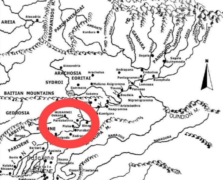
A town called Fatira was situated in the neighbourhood of Mohenjo-Daro on the west bank of the River Indus during the 12th century AD. Close to Fatira was the town of Samir. A river, probably the Mula, came from Kirkan or Kaikan, which is modern-day Kalat District, Majak and Qandabil (Gundava) Balochistan. The town of Al Haur or Alor stood on the eastern bank of the Indus. These city names are given in Sind And The Neighbouring Territories From Arab Traveler Al Sharif Al Idrisi 1150 AD. As per research and exploration, Samir was the famous town of the Samira or Soomra tribe that was called Junani by Ibn Battuta in 1333 AD. While regarding Fatira, I would say that I have identified it with Fatih or present Badeh, located at the distance of 10 km in the west of Mohenjo-Daro.
Lous Flam (PhD U Penn, 1981; Asst Prof) in his research paper; “Fluvial Geomorphology of the Lower Indus Basin (Sindh Pakistan) and the Indus Civilization” published in Himalaya To The Sea: Geology, Geomorphology, And The Quaternary compiled by John F Shroder, London: Routledge, (1993), says, “The Lower Indus Project (1965) and Holmes (1968) used the comprehensive methodology to delineate 6 major Post-Pleistocene River remnants in the northwest and north central plain of the Lower Indus Basin: (1) Kandhkot Course; (2) Jacobabad Course; (3) Shahdadkot Course; (4) Warah Course; (4) Khairpur Course; and (6) present day course of the Indus River. Of the course remnants listed above, numbers 1-6 belong to former or recent course of the Indus River. Following Butler (1950), Pels (1964) and Schum f bg (1968), the Jacobabad, Shahdadkot, Warah, Sanghar, and Samaro-Dhoro Badahri course remnants can be considered the older or ‘prior stream’ course of the present Indus River, and the Kandhkot, Khairpur, and Shahdadpur course remnants can be considered younger or ancestral courses of the Indus River.
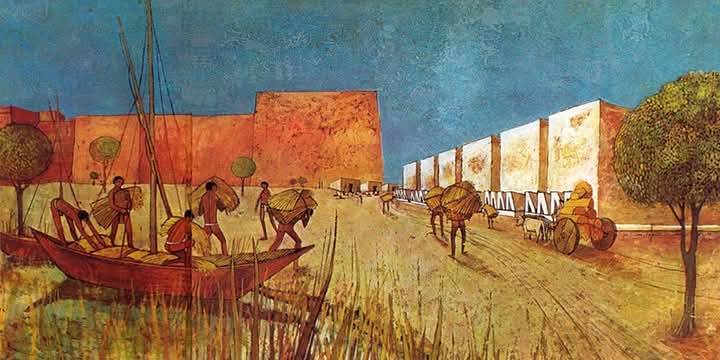
The Jacobabad Course, marked by sub-recent river terraces, is traceable as the most north-westerly and oldest of the former river courses of the Lower Indus Basin. Traces of this course emerge from the present Indus River near Kandhkot, and run in a westerly direction toward Jacobabad where the course’s remnant deposits become mixed with Kachhi Plain piedmont sediments and the course becomes untraceable any further west.
The Shahdadkot Course remnant is traceable as a zone of bars and channels from south-west of Jacobabad down to Shahdadkot where it disappears (Holmes 1968). This course is perhaps the remnant of a distinct and independent river course; i.e. separate from the Jacobabad course. Aerial photographs and maps of the prior river courses of the Lower Indus Basin permit speculation that the Jacobabad and Shahdadkot Channels should have been two reaches of the same river.
The Warah Course occurs as a distinctive broad zone of extensive high bar deposits and indicative of a major river (Holmes 1968). Similar to the Jacobabad course, the Warah Course had its origin near Kandhkot. Unlike the Jacobabad course, which ran due to west from Kandhkot, the Warah course turned toward the south-east a short distance west of Kandhkot. Running south-west of Kandhkot, the Warah course is clearly traceable as it passes west of Sukkur and Ratodero, through Warah, and west of Mehar towns. West of Mehar the alluvial deposits of the Warah Course are intermixed with and obscured by piedmont plain deposits of the Khirthar Mountains along the entire length of the trough extending from Jacobabad to Manchhar Lake (Bull 1972 & Ansari 1973).
Previously the Warah trough had been thought to have been a major independent river course of the westernmost part of the Lower Indus Basin, but this is not precisely the case. The trough was named Western Nara Channel by Pithawala (1936/1959), Fraser (1958) and Memon (1969), but should not be confused with the seasonal spillway of later times called the Western Nara (Holmes 1968). The trough was a major river course in that it was an extension and part of the Jacobabad and Warah courses. Raverty (1895) called it the Sindh Hollow, and noted that it was also referred to locally as the Ran or Marsh, the Pat or Desert, or the Dasht-i-Bedari. Sindh Hollow was the designation used by Panhwar (1969) and is used herein.
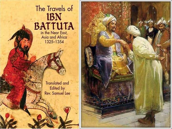
According to MH Panhwar, the Arab traveler Ibn Battuta (1304-1369), after crossing the western branch of the Indus between Kandhkot and Thul/Jacobabad and two days by boat or march along its embankment, reached Junnani, a large fine town on the bank of the Western Branch (called Warah Course). Ibn Battuta might have entered Sindh by the Suleman Range into the Lower Indus Valley. His original text (1333 AD) reads as follows; “After crossing the river of Sind called Banj Ab, we entered a forest of reeds, following the track which led through the midst of it, when we were confronted by a rhinoceros. In appearance it is a black animal with a huge body and a disproportionately large head. For this reason it has become the subject of a proverb, as the saying goes Al-karkaddan ras bila badan (rhinoceros, head and no torso). It is smaller than an elephant but its head in many times larger than an elephant’s. It has a single horn between its eyes, about three cubits in length and about a span in breadth. When it came out against us one of the horsemen got in its way; it struck the horse which he was riding with its horn, pierced his thigh and knocked him down, then went back into thicket and we could not get at it. I saw a rhinoceros a second time on this road after the hour of afternoon prayer. It was feeding on plants but when approached it, it ran away. I saw a rhinoceros yet another time when in the company of the king of India we had entered a jungle of reeds. The sultan was mounted on an elephant and we too were mounted on elephants along with him. The foot-soldiers and horsemen went in and beat it up, killed it and conveyed its head to the camp.”
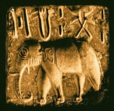
Ibn Battuta again gives a description of a beautiful city called Junani, which is situated in present Warah Taluka. He writes, “After two days’ march from (the crossing of) the river of Sind we reached the town of Janani, a large and finetown on the bank of the river Sind. It has beautiful bazzars and has been inhabited from ancient times by a people called the Samira, whose ancestors established themselves there on the conquest of Sind in the time of Al-Hajjaj [712 A.D], as the chroniclers of the conquest of Sind have noted.The Shaikh, the learned Imam, the ascetic doer of the law, and devout Rukn-Al-Din , son c of, the Shaikh , the devout and ascetic Imam Baha-Al-Din Zakariya, the Qurashite (he was one of the three whom the Shaikh and virtuous saint Burhan-Al-Din the lame told me in the city of Alexandria that I should meet them, God be praised), told me that his earliest ancestor was called Muhammd Ibn Qasim the Qurashite, and he took part in the conquest of Sind in the army which Al-Hajjaj Ibn Yusuf dispatched for that purpose during his governorship in Al-Iraq and settled there and founded a numerous family. These people called Samira never eat with anyone nor may marry anyone outside their clan, nor do they allow anyone to marry into it. They had at this time an Amircalled Wunar whose history we shall relate in due course. From Janani we travelled to Siwasitan (Sehwan), a large town, outside which is a sandy desert, treeless except for Acacias. Nothing is grown on the river here except Pumpkins, and the food of the inhabitants consists of Sorghum and Peas, of which they make bread. There is a plentiful supply of fish and buffalo milk, and they eat also a kind of small lizard stuffed with curcuma.” (Travels In Asia & Africa 1325-1354; first published 1929, Reprinted in Great Britain by Redwood Burn Ltd. 1983).
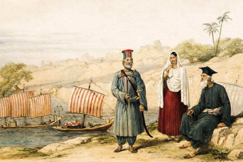
In 1955, MH Panhwar discovered the ruins of Ibn Battuta’s Janani settlement in Taluka Warah, Deh Junani at Junani Inspection Bungalow, constructed by the Sindh Public Works Department (PWD) in the 19th century. Before the advent of the automobile, this vast bungalow had stables for horses. It was built on a high mound of ruins and appears 3 to 4 feet high from the surrounding land, which had risen by 3 to 4 feet. From Junani, Ibn Battuta travelled down to Sehwan. He does not mention if he travelled by road or by boat and whether he passed through Manchhar Lake. Currently, Junani is known for its Islamic school, beautiful mosque and old library containing thousands of Arabic, Persian and Sindhi manuscripts and rare books. Junani is situated 3 miles to the west of Warah on the Warah-Hamal road.
Another important River Indus course was of Sirwah. It started from the Bolan River in the south of Sibi and finally reached Manchhar Lake near Sehwan. Amini-ul-Mulk Nawab Mir Muhammad Masoom Bakhri, the Amir of Mughal Emperor Akber the Great (1542-1605), has given details of this course in his Persian account Tareekh-e-Masoomi in 1600 AD. According to Yousif Merak Bin Mir Abu-al-Qasim Namkeen, the length of the Sibi/Bolan River was 50 miles and later it joined Sirwah on the Sindh border and finally its waters flowed down towards Manchhar Lake (Tareekh-e-Mazhar Shah Jahani 1634 AD). He also tells us about the Mulla River, cotton plants grown in the Sibi area and the poisonous snakes found in that part of the country. Main Shahal Muhammad Kalhoro (1657 AD) is said to have dug Ghar Wah from the River Indus near Larkana to irrigate lands of this area.
Sir Henry Pottinger writes in his book Travels In Beloochistan And Sinde, London 1816, that “From the spot at which the Indus receives such a vast addition to its waters, by the Punjnud disemboguing into it, I’m informed that it flows south-south-west, almost, without a curve, for a distance of one hundred and sixty miles, passing the cities of Sukor, Rohree, and Bhukor; the latter being situated on an island in the midst of the stream. Seventeen miles to the southward of these places it sends off a branch to the westward, that forms a circuit, and joins the main body at the town of Sehwan, fifty miles lower down than where it is disengaged. This branch is known by the two different names of the Kumbur Gundee and Larkana river; which last it derives from running past the town of that name, and in one place it expands into a lake, ten or twelve miles across, that lies immediately at the foot of the Brahooick mountains, and has its edges overgrown with impenetrable jungle and reeds, the haunt of lions and other ferocious animals. This district of Chandookee, that is encompassed and fertilized by this branch, is the finest in the territories of the Umeers, who receive from it a revenue of eight lacs of rupees per annum, an amount, not equal to one half what was thirty five years ago” (Page 357).
There were 18 beds of the River Indus between Mohenjo-Daro and the Khirthar Range. Mr RD Banerji visited the ruins of Vinjnot on 20 December 1919. From December 1919 to December 1922, surveying between the present channel of the River Indus and the Khirthar Range, Banerji came across no fewer than 18 old beds of the River Indus. Banerji conducted this survey in the western parts of the Shahdadkot, Kamber, Ghaibidero, Kakar, Johi and Sehwan areas of Larkana District. Mostly these were backward and remote areas at that time.
Old Trade Routes and Modes of Communication
The distance from Nasirabad via Badeh to Mohenjo-Daro is 25 km today. Once there was an old route called Route No. XVI. The description of this route is provided in the Selections From The Records Of The Bombay Government No. XVII - New Series Memoirs Of Sind edited by R Hughes Thomas, Bombay 1855. This ancient route started from Karachi to Shikarpur by the west of the Manchhar Lake and Larkana. While Route No. XVIII (306 miles) started from Karachi to Sukkur via the west bank of the Manchhar Lake and Larkana. The names of the important places in Route No. XVI and Route No. XVIII were as follows: Karachi Cantonment, Murrye River, Dooba or Dooee River, Kajoor River, Pokun or Pokrun River, Muleer, Chorla River, Nur Ka Shahur, Shah Hussan, Chinnee, Johee (Johi), Drigg or Dreigh, Tulree, Peer Goza, Mahir or Maihir (Mehar), Nuseerabad, Khyrpoor (Juso), Larkana, Nowadera, Bungool Dera, Khair (Dera), Muddunjee (Madeji), Julee, Shikarpur and Sukkur. Route No. XVI was 294 miles long with desert, jungle and cultivation on the banks of the Nara. There were pukka wells and pools in the bed of the Nara also. The villages had shops, plentiful water and supplies. Nasirabad, Khairpur Juso and Larkana were fortified with mud forts and towers.
The first reference to the archaeological site of Mohenjo-Daro is found in a Survey of India map. The title of this map is Districts Jacobabad, Shikarpoor, Rohree, Larkhana, And Mehur, Comprising The Shikarpoor Collectorate Upper Sindh 1856 To 64. At that time, the site was called Mayhun Jo Bohun or Mohen Jo Bohun by the local people. It means the mound of over-burnt or destroyed bricks. The villages of Vukro, Hassun Wahun, Buggee, Bindee, Shah Jamal, Bulludajee, Abra Potra, Gazee Dero and Dublee are shown around this mound. These villages still flourish there even today!