


The town of Larkana was the headquarter of the Chandookah Pargana. This City got its name from the Samma tribe called Larak. The earliest reference to Larkana and the Chandookah Pargana is found in Nusrat Nama I Tarkhan: a significant historical Persian text about the Tarkhan dynasty that ruled Sindh before the Mughal Emperors of India. This book was written by Abu Sa’id Muhammad Bin Bayazid Purani around 1560 AD, detailing their military conquests and rule (Puran is a place north of Afghanistan). According to Ma‘sumi, Sultan Husayn Ba’iqara appointed Dhu al Nun to govern the intractable regions of Zamindawar and Ghur in Afghanistan. In 884/1479 he embarked upon a difficult assignment. Sultan Husayn Ba’iqara pleased with this and added Farah and Qandahar together with Shal (Quetta) and Mastung. In 892/1479 according to Fath Nama written by Abd Allah Marwarid and corroborated by Nusrat Nama, Siwi (Sibi) was captured most likely by Shah Shuja (Shah Beh Arghun). It was followed by attacks on Bakkhar, Chandookah and (L) Akri or Larkana. This prompted a counter attack by Sindhi forces under Mubarak Khan in 895/1490 in which Yar Muhammad Mirak, brother of Shah Beg Arghun lost his life.
Nawab Ameer Muhammad Masum Bakhri Al Nami was a trusted lieutenant of the Mughal Emperor Akbar. He compiled Tarikh-e-Masumi (Tarikh-i-Sindh) in Persian around 1593. In around 1595, he led Akbar's army in a battle against Gajaba (Gundava) and the Panni Afghans’ stronghold of Sibi in northwest Quetta, resulting in Balochistan being annexed into the Mughal Empire. In 1598, he was appointed the governor of Sindh and Sibi by Akbar and was bestowed a Jagir in Chandookah Pargana. He built a 31-metre-high minaret with 84 steps at Sukkur which is called Masoom Shah Jo Minar. Mughal Emperor Akbar also sent Mir Muhammad Masum Bakhri as Ambassador at the Court of Safavid Shah Abbas I (commonly known as Abbas the Great) in 1602. He and his son Mir Buzrig commissioned over 54 stone inscriptions in Persian which have been discovered from India, Pakistan, Afghanistan and Iran. Some of his Persian inscriptions have been discovered from Baghban (Khuzdar), Pir Lakha (Mula River), Shaikarpur and Shah Jo Goth (Naudero) Larkana.
The name "Luckar" is likely a misinterpretation or misspelling of Larkana, a place name in Sindh. An antique map titled "Magni Mogolis Impervim" (Empire of the Great Mughal) created by the renowned Cartographer of the Dutch East India Company Netherlands. Cities like Buckar, Roree and Luckar are shown on the banks of the Indus. Willem Janszoon Blaeu (1571-1638) provides this name in 1630. Later on, this map was published by his sons Joan and Cornelis Blaeu. The name Luckar is also found in the old maps of 1638, 1640, 1650, 1655, 1665, 1686, 1700, 1708, 1720, 1740, 1752, 1764 and 1786.
The earliest reference to Larkana and the Chandookah Purguna is found in Nusrat Nama I Tarkhan, a significant historical Persian text about the Tarkhan dynasty
A hoard of copper coins had been found from graveyard of village Haji Khan Mashori, 1 km to the north of Mohenjo-Daro Archaeological Site in March 2022. According to the experts these coins belonged to Mughal Emperor Akbar the Great (1556-1605 AD). All of these 30 coins were thick and round in shape with Persian inscription. This Mughal dam weighs 20 grams.
A terracotta toy of a horse was also found from grave digging. This discovery shows that Mohenjo-Daro was situated on trade routes. The discovery of these copper coins from Mohenjo-Daro strongly suggests that this region was situated along a trade route in the 15th century AD. There is the tomb of Shah Baharah in Larkana. He was a celebrated minister of Mian Noor Muhammad Kalhoro, the Ruler of Sindh who ruled from 1719 to 1753. Shah Baharah had the sole management of the affairs of this part of the country, and commanded a division of 10,000 men. He dug several canals and built many forts to protect Sindh’s borders from invasions from the north and west. Mian Ghulam Shah Kalhoro constructed the tomb of Shah Bahrah at Larkana in a garden in 1188 AH/1774 AD.
Another important figure of Chandookah was Nawab Mitha Khan Kalhora. According to oral traditions, Mian Ghulam Shah Kalhoro deputed Nawab Mitha Khan Kalhoro, the governor of Larkana, for the construction of a mud fort locally known as Kot Ghulam Shah in Taluka Kamber. Kot Ghulam Shah was founded on Larkana, Kamber and Shikarpur route which was famous for trade and commerce. The famous ferry of Esaw Kalhoro was situated in the south of this fort on the banks of Noor Wah, which was dug by Mian Noor Muhammad Kalhoro. General John Jacob (1812- 1858) mentions Nawab Mitha Khan Kalhoro in his book The Sindh Irregular Horse published in 1849. Mitha Wah and Mitho Dero are named after this famous governor of Larkana.
Walter Hamilton writes about the Chandookah Pargana as follows in 1820:
“CHANDOOKEE:
A district, subject to the Ameers of Sinde, situated about the 27th degree of north latitude, and during floods completely insulated by the Indus, the Arul and the Larkhanu Rivers, forming an Island of triangular shape, which is reckoned the most productive in the province, and in 1813, was said to yield a revenue of 8 lacks of Rupees. The Ameers of Sinde here levy tolls on merchants entering their dominions from the north-west, and maintain a garrison to restrain the Beloochees of Cutch Gundava” (Hamilton: 1820 Pages 570 & 571).
Describing Chandookah Pargana in the Upper Sindh, Lieutenant Robert Leech writes in his Report on the Sindhian, Khelat And Daoodpota Armies with a collection of Routes By Lieutenant Robert Leech, Bombay Engineers, 1837, that,
“The Headqaurters of the Artillery of the 4 Hyderabad Ameers, Meer Noor Mahomed, Meer Naseer Khan, Meer Mahomed and Meer Sobdar, are at Ladkhana. There are in all 28 guns said to be ready for field service, 13 commanded by an Armenian of the name of Moosa Khan on 200 rupees pay, 7 by a European of the name of J.Howell, called by the natives Chota Khan, on the same pay, and 7 by a Hindustany Salabat Khan: there is 1 gun on the fort, and 1 mortar, although no one in the department knows the mixture necessary of the method of cutting the fuse. The Chota Khan confesses that the Artillery is capable of moving to any distance, there is no regular establishment of bullocks, but in the time of service they are all pressed, and villagers of course do not give up their best bullocks.
Detail of Moosa Khan’s Guns
No.1: Gun metal, 4 inches bore, 9 pounder, drawn by 8 pairs of Bullock and carrying a charge of 2 Seers.
No.2: Iron metal, 4 inches bore, 9 pounder, drawn by 8 pairs of Bullock and carrying a charge of 2 Seers.
Ten of the remainder are of iron and one of brass.
No.3: Iron metal, 3 inches bore, 4 pounders.
No.4: Iron metal, 3 inches bore, 4 pounders.
The rest are all of 2 inches and 1 inches bore.
Detail of Guns under Chota Khan
They are all of iron. One 3 inches bore, the others all 2 inches.
Detail of Guns under Salabat Khan
Two guns of gun metal, one of them 5 inches in bore, 18 pounder, the other 4 inches. The other five are of iron of small bores, of 2 and 3 inches. The gun on the fort is not mounted, it is of iron of 4 inches bore, the gubaree of 20 inches bore, there is little superintendence on the part of Government over this department, so important in European warfare. Rupees 8,000 were allowed by the Ameers at the time of the expected Sikh invasion to mount the guns, this sum was shared it is said by the Commandant of Artillery and the Baloch General, and the old carriages were patches up for 700 rupees, no powder is allowed by the Ameers for practice, and the guns are only fired when the new moon is seen, the powder is made at Bhaug where there is a Sulpher mine, the composition is 2 parts of Charcoal made from akh, 1 part of Sulpher, 1 ditto Saltpetre. There are 40 Hindoostany men under Moosa Khan and 40 under Chota Khan: these men have 7 rupees a month. Salabat Khan does not keep up the establishment for which he draws allowances: there is only one man in Sind, now in Hyderabad, of the name of Meer Khan, who can cast guns, the balls are cast in Shikarpoor. There are no carpenters who can make up carriages unless under special direction.
There are three guns belonging to Meer Rustam of Khyrpoor, which his Vizier has planted before his door, they are of three inches in bore. In Hyderabad there were seven small guns opposite Meer Khusrto’s door on carriage.
Garrison Guns of the Sindhian Army
In Hyderabad there are 12 guns, lying dismounted on the ramparts, of five and four inches bore, and about 50 more lying half buried of all sizes, under the former, throughout the fort.
In the fort of Bakar there are two nine pounder guns mounted, the rest were removed on the approach of Shah Sooja, to the fort of Deejy, belonging to Meer Ali Morad, where there were four serviceable mounted ones, and eight dismounted on the ramparts. Of the guns which were taken from Bakar 10 were given to Sehwan Saheb. There was formerly a large gun called Mulk I Maidan, but it is now dismounted and useless.
In time of service the artillerymen in addition to their pay get one Seer of flour and 2 Paees a day. The garrison guns are without platforms, they have a pench or elevating screw. The complement of men for serving each gun is eight. The movements of the Artillery within the recollection of a man who had served 10 years were the following, two or three times they have been moved to Shikarpoor, the last time was when the Sikhs were expected in January 1837: Seven guns were the brought the distance of 18 kos, and they reached in three days, they were moved eight months ago to Hyderabad on the occasion of a quarrel between the brothers: they were taken by water, and brought back by water, they were also taken to the Beebark Hills against the Jamalees, once or twice to a place beyond Rojhan, a day and night’s march , but have never bad a trial. The Meers in the time of peace have no more standing army, than is sufficient to guard their persons, and treasury, and to collect the revenue under the Kardars, and a few troops to look after the forts”
(Report on the Sindhian, Khelat And Daoodpota Armies with a collection of Routes By Lieutenant Robert Leech, Bombay Engineers, 1837, Pages 65, 66 & 67).
British Conquest of Sindh in 1843
Sir Charles Napier conquered Sindh in 1843. He divided the territory for better administration into 3 main districts: 1) Karachi, 2) Hyderabad and 3) Shikarpur. He appointed Collectors in each of the district for Revenue Collection and Judicial work who were supported by deputies. His aim was to establish more effective British Governance after annexation. Sindh was made part of Bombay Presidency in 1847. Shortly after Lieutenant Hugh James of the 44th Regimental Bengal Native Infantry compiled a comprehensive Report on the Pargana of Chandookah, in Upper Sind. Chandookah Pargana was called the Garden of Sindh due to its fertile lands and beauty.
Lieutenant Hugh James writes,
“The old fort of Larkhana, is a large square building, with four towers: a fifth tower, at the gateway, is of burnt brick, and higher than the others: the rest of the building is of mud. This was one of the arsenals of Talpoors, and now contains the fine hospital and the store rooms of the Camel Corps, and the Civil Jail. It was the residence of the elaborated Minister Futteh Mahomed Lugaree”. (Memoirs on Sind: Selections from the Records of the Bombay Government, No XVII New Series, Edited by R. Hughes Thomas, Bombay 1855 Pages 723)
He again writes that,
“Whilst to Meer Sobdar, the son of the ancient chief, Futteh Ali Khan, was apportioned in Jageer the division of Nalah Data, which had been given as above in dowry by Goolam Ali, with some other villages. After the battle with Shah Soojah, the Chandookah District was divided as under:
Meer Mahomed, son of Goolam Ali Talpoor
Lab Dariya, Anderoon Ghar, Futtehpoor, Nya Dera, Ruttah Dera and Nala Maksoodah
Meer Noor Mahomed, son of Moorad Ali Talpoor
Bukapoor, Myl Lahory, Anderoonee Beerah, Berunee Beerah and Shahpur
Meer Naseer Khan, son of Moorad Ali Talpoor
Myl Morady, Myl Wagun, Warah and Khyrah Guchul
Meer Sobdar Khan, son of Futteh Ali Talpoor
Kumber, Chiyrah, Esaw and Nala Datah
The Chandookah Pargana was called from the tribe of Chandia who formerly occupied the greater part of it. It extended to the Desert of Kutchee on the north, Shikarpur on north east, and had Hala (Khirthar Range) of hills in the west, and the River Indus on the eastern side, while Mehar was on its south, that separated it from Sehwan. The extreme length of Chandookah Pargana was 60 miles and its average breadth was 35 miles in December 1846. It was divided in 19 minor Divisions or Tapas, varying in size, to each of which a separate establishment was formerly appointed. The total number of villages was 392 in the same year. The Chandookah Pargana was consisted upon following 19 Tappas: 1) Bakapoor 2) Myl Lahory 3) Androonee Beerah 4) Lab Dariya 5) Androonee Ghar 6) Futtehpoor 7) Nya Derah 8) Ruttah Derah 9) Maqsoodah 10) Myl Morady 11) Myl Wagun 12) Warah 13) Khyrah Guchul 14) Bheronee Beerah 15) Kumbur (Kandi) 16) Chujrah 17) Esaw 18) Nala Datah (Kohawur) and 19) Nala Shah. The Principle towns of Chandookah Pargana were Larkana, Kumber, Khyrpoor (Juso), Nuseerabad, Rattah Derah, etc. The villages like Shahdadpoor (Shahdadkot), Poonoo (Bhatti), Khyrah Ke Gurhee, Shaho Jamalee and Shahpoor were formerly very large towns with a great number of populations. The Mulim population of Chandookah Pargana comprised upon agriculturists and artisans. The principal tribes were the Chndia, Jamali, Kohawar, Abra, Kalhora, Lahori, Juneja, Wagan, Hakra, Chajrah and Jats. Hindus mostly controlled the trade and Commerce.
Chandookah Pargana had also forest or wood land, in which trees like Karel, Khabar, Sisoo, Babool, Siris, Lasooree, Ber, Tamarisk, Kandah, Baw, Amaltas, Peepal and Neem. While the fruit trees like Mango, Date, Apple, Plaintain, Lime, Pomegranate were common but inferior. The principle grains were the Jowaree, Bajaree, Arzum, Barely, Rice, Wheat, Sesamum and various kinds of Vetches, Pulse, Millet and Oats. Besides this the farmers also grew in large quantities the Cotton, Sugarcane, Indigo and Tobacco. Vegetables like Turnips, Carrots, Radishes, Baingun, were commonly grown. The animals of note were the Camel, the Tattoo or Ass, Sheep, Buffalo, Ox, and Goat. The Tigers were found in the forests on the banks of the Indus occasionally. Lieu Hugh James saw 2 Tigers in the early part of 1846. Mostly they came from the forests above Sukkur. The Wild Hog and the Hog Deer, the Antelope, were common in the forests. The Ibex were found in the hills in the west. The common wild animals were the Wolf, the Fox, the Jackal, Pigs and the Hare. The Black and Grey Partridge, Quail, Snipe, Wild Duck and Oobara were found in great quantities.”
The Report on the Pargana of Chandookah, in Upper Sind was part of the Selections from the Records of the Bombay Government No. XVII-New Series, Bombay 1855. This 65 pages report is accompanied by a Map and 18 Appendices and provides information relative to the general features of the districts comprised in the Chandookah Pargana,-their natural productions; means of irrigation; towns, villages, buildings of importance; the population, their habits, manners, and character; the nature of land tenures, and the relation of the agricultural classes to each other and to government; the revenues of the Chandookah Pargana under the Talpur Ameers of Sindh, and subsequently under the British Government; the agriculture and manufactures of this Pargana; and the Civil and Criminal Jurisprudence.
Sir Charles Napier had organized a combined Canal and Forest Department. Lieutenant Col. Walter Scott of Bombay Royal Engineers was made Incharge of this department. He studied the then existing Canal System and identified defects in of the old irrigation system started by the rulers of the Kalhora and Talpur dynasties. Unfortunately he could not make any progress and the department was abolished in 1849. Sir Richard Francis Burton was also one of the early surveyors of this department who published many books on Sindh i.e. Scinde or the Unhappy Valley (1851), Sindh and the Races that Inhabit the Valley of the Indus (1851) and Falconry in the Valley of the Indus (1852). This was the time when Report on the Management of Canals & Forests in Scinde was published by Colonel Walter Scott from the Bombay Presidency in 1853. This report provides detailed account of how canals and forests were managed in Sindh after the British Conquest of Sindh. Soon after, Colonel J.G.A. Fife was appointed as Superintending Engineer Canal Department in 1855. He published A Sketch of Irrigation in Sindh with Proposals for its Improvement in the same year. Brigadier General John Jacob of Jacobabad had improved irrigation System in Upper Sindh by building canals and roads. He turned an arid desert into fertile land. Towards the end of 1858, he was surveying in the districts when he was taken ill due to brain fever on 5th December 1858. General John Jacob developed Begari Canal besides Nur Wah and Ghar Canal in the present day Jacobabad, Qamber Shahdadkot and Larkana districts of Sindh.
The Indus Flotilla was established by the Scinde Railway Company in 1856. The aim of this company was to operate riverine transport system for trade between Karachi, Multan and Lahore through steamers and barges. There was a 40 day journey from Karachi to Multan passengers and cargo. The key needs of this company were deep draft vessels, a link to the Arabian Sea, navigation aids, and coal supply. The Indus Flotilla Company got significant amounts of wood from the riverine forests of Sindh to use as firewood (fuel) for the fleet of steam powered boats. For timber and wood supply new forests in Sindh were surveyed by the officials of Bombay Presidency in 1860s. The important forests established by the British Officials in Sindh were the Macauley’s (1859), Dickenson’s (1860) and Brigg’s (1861) forests on the Nur Wah in Deh Alipur in Jacobabad which were watered from Begari Canal, located in the Upper Sindh Frontier District, Sindh. While other forests were in three Dehs Khairwah, Muhmudpur and Meeranpur. These forests provided wood for building purposes as well as for firewood for the town and cantonment of Jacobabad. The same attention was paid by Bombay Government to Larkana forests.
The first reference of the Archaeological Site of Mohenjo-Daro is found in a Survey of India map. The title of this map is: Districts Jacobabad, Shikarpoor, Rohree, Larkhana, and Mehur, Comprising the Shikarpoor Collectorate Upper Sindh 1856 to 64. At that time, the site was called Mayhun Jo Bohun or Mohen Jo Bohun by the local people. It means the Mound of over burnt or destroyed bricks. The villages of Vukro, Hassun Wahun, Buggee, Bindee, Shah Jamal, Bulludajee, Abra Potra, Gazee Dero & Dublee are shown around this mound. These villages still flourish there even today! Many of the above mentioned villages were affected by the River Indus floods of the Jhali, Muhromari and Kashmor. AW Hughes writes in The Gazetteer of the Province of Sind (1876) that, “Besides the three floods just mentioned, there used to be another, which, rising at Kanuri in the Beli Gaji tappa of the Labdria taluka, was formerly very destructive, but it has done little harm since the erection of the Abad -Hatri Band in 1862-63 (Page 449) The Labdraia Taluka of the Larkana District was spread on 207 square miles and it was divided into 4 tappas including Manand, Dokri, Beli Gaji and Sheikh Fojo. There were 58 large and small villages in this taluka. While the total population of Labdria Taluka was 20,225. Garelo was the largest town having a population of 800 or upwards.
According to the Sind Official Gazette, Karachi Saturday the 27th May 1876 following Talukas were in the Shikarpur Collectorate; 1) Shikarpur 2) Sukkur 3) Naushahro 4) Rohri 5) Syedpur 6) Ghotki 7) Mirpur 8) Ubauro 9) Larkana 10) Kamber 11) Ratodero 12) Sijawal 13) Labdaria 14) Mehar 15) Tigar 16) Kakar and 17) Nasirabad. The total area of Shikarpur Collectorate was 8,809 Square Miles. There were 5,236 villages, Mouzahs and Townships in it. While the number of houses was 1, 44,085. The total population of this Collectorate was 7, 76, 227. The Labdaria (Dokri) Taluka had following villages: Mano, Borri, Gujar, Tanwari, Yakhtiar, Karo, Gerelo, Mehrabpur, Tarai, Wakro, Dokri, Nurpur, Khoohana, Pahlani, Tharo Awan, Futtoo Sial, Bilri, Darya Khan, Moondhoo Jatoe, Chandio, Hatri, Salhiani, Faridabad, Amrot, Mad Bahoo, Panju, Chato, Ehsan, Gud, Oanooree, Bilnee, Hassan Wahan, Katohar, Deh Dubli, Shaikh Bhaya, Husharpur, Samno, Bhambha, Kumbhara, Beli Gaji, Deh Bagee, Arija, (Sheikh) Fojo, Tulah, Bakho, Shaikh Fojo, Drukha, Bukhu Sandilo, Bakrani, Koombie, Katiza, Boota Kalhora, and Hassan. There was a Travelers Bungalow at Dokri. Expenditure for Travelers Bungalow at Dokri was 100 Rupees. The closest village to Mohenjo-Daro was Hasan Wahan. A Musafirkhana was constructed by PWD at Hasan during 1874-75 with 19 Rupees expenditure.
Another important place near Mohenjo-Daro was the Bagi Village. The Village Bagi was among the 36 ferries in the Larkana District. Most of these ferries were on the River Indus and the Western Nara during 1876. The Muslim population of Deh Bagee was 487 including 272 males and 215 females. While there were 69 Hindus including 38 male and 31 females. In this way the total population of Deh Bagee was 556 including 380 males and 246 females (Page 113). The Bagi Forest was in Gaji Dero Forest Block and it was first surveyed in 1887 by the Forest Department Government of Bombay.
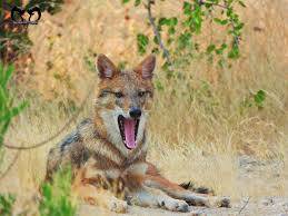
The Bagi Forest was crucial in preserving Mohenjo-Daro; it covered the ruins with scrub and soil for ADnturies, hiding them until rediscovery in the 1920s. The dense jungle including vegetation, wild beasts like wolves, jackals, foxes and snakes and layers of earth and sand from the nearby Indus River helped bury and protect the ancient city from the elements and early explorers for millennia. People did not enter the forest due to fear of wild animals, snakes and ghosts. The site of Mohenjo-Daro was preserved by the nature for thousands of years. Otherwise it would have been occupied by the modern human populations. Thanks to wolves, spirits and snakes that protected this marvelous mound of Sindh for ADnturies.
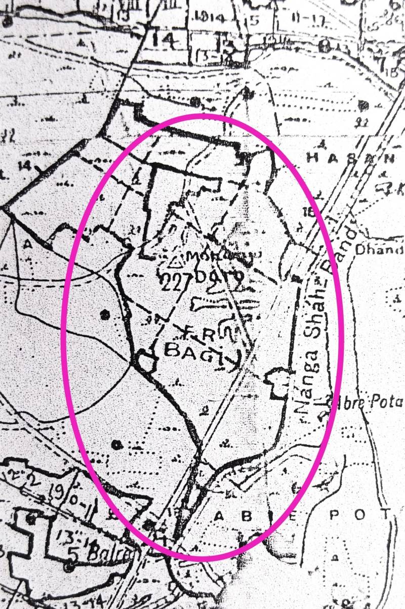
The Ruins of the Ancient City of Mohenjo-Daro were also identified in the Bagi Forest in Labdarya Taluka. This identification was marked in the Maps of Sind Survey Sheet No.41 District Larkana & Khairpur State Season 1901-02. According to this map Nanga Shah Band was situated in the east of Mohenjo-Daro. A village called Kanpur, Hasan Wahan and Gud were in the north, north east of the mound. While villages like Dhandh and Abre Pota were located close to the band on the banks of the River Indus. Village Balhreji was in the south and Bagi was located in the western side of the mound on a natural course of Nara Canal. The present Village Dhandh on the west of Mohenjo-Daro was founded later. According to the Land Register of taluka Labdaria, District Larkana (1901) Mohen-Jo-Daro was situated in Survey No. 970 in the Government area of Deh Bagi. While the total area of the site was 561 Acres and 10 ghunta.
According to The Sind Official Gazette, Bombay May 5, 1910 the Deserted Site of Mohan-Jo-Daro was situated in Survey No. 78 Village Bagi, Taluka Dokri in District Larkana, Sindh. According to The Sind Official Gazette:
“The ruins were spread in 734 Acre and 35 ghunta & 171 Acre and 16 ghunta. The area of the whole Survey Number (631) was 86.30 but a plot 10 acres in the south east corner adjoining the Public Works Department Bund on the east and Survey No. 180 on the south had been assigned by the Collector for a village site. This area had been deducted from the area of this survey number as well as 2 acres adjoining the north western corner of the village site which had been given to the villagers as a Khad or Pit.”
The Official Sind Gazette, June 18, 1914 provides following information about the above site:
Bombay Castle, 10th June 1914
No.5382-In exercise of the powers conferred by section 19 of Indian Forest Act No VII OF 1878, as amended by Acts No. V of 1890 and No. V of 1901, His Excellency the Governor in Council is pleased, with reference to Government notification No. 3682dated 23rd April 1910, published at pages 621 and 622of the Bombay Government Gazette of the 28th idem, Part I, to declare the lands in the Labdaria taluka of the Larkana District specified in the schedule hereto annexed to be Reserved Forest from 11th August 1914;-
Schedule Referred to above
Village: Bagi
Survey No: 78 Deserted Site of Mohan-Jo-Daro
Area: 734 Acre and 35 ghunta & 171 Acre and 16 ghunta
Boundaries: North, East, South- Survey No.78, West – Survey Nos. 78 and 746
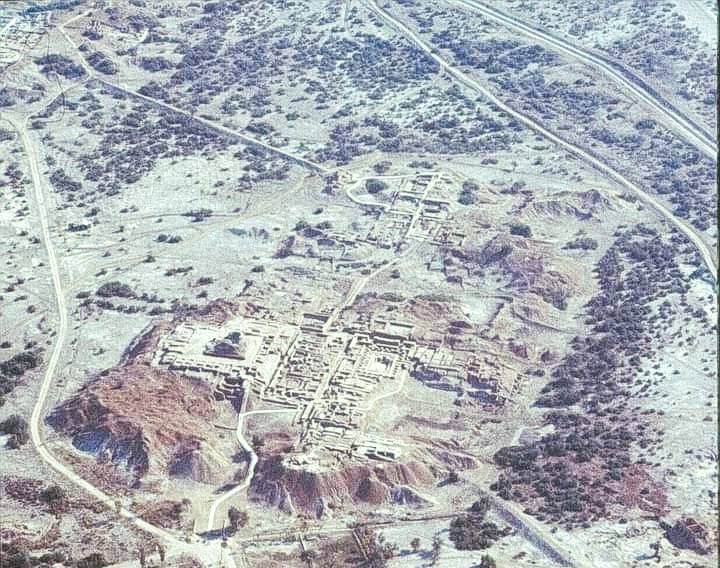
The site was identified in 1922 by RD Banerji, but remained buried until then, remaining hidden beneath forest and soil for centuries. Close to Village Bagi lies the small hamlet of Bindee, the birth place of Comrade Sobho Gianchandani. He was born there on May 3, 1920, to a Hindu family of moderate business and farming interests. Sobho Gianchandani had his schooling in the village and opened a small shop thereafter.
“After his father’s death, his elder brother advised him to take up his studies seriously. As a student, Gianchandani was so keen that he had read the Janamsakhi, the revered Sikh book spanning over 37 volumes. During his school days; he was already writing short stories. He received higher education at Qamber, Larkana, the NJV High School, Karachi, and later DJ College; Karachi. When the flames of the World War II broke out, the young man was deeply shocked and decided, on the advice of a classmate, that he would find mental refuge in Shantiniketan College. There, besides fine arts, Gianchandani studied other subjects and held discussions with people who later became leaders of the subcontinent. Tagore was at that time 78 years old, and used to call his student the “Man from Mohenjo-Daro”. He returned back to Sindh after 1942 due to Hindu Muslim Riots in the subcontinent. He obtained a Law Degree in 1967, from Larkana. He was also political activist, playwright and a short story writer.”
Since the British Period, there was a brick road that passed from the heart of Mohenjo-Daro Archaeological Site to nearby villages in south especially to Village Balhreji. The Bullock carts, Tonga horse carts, Suzuki Pickups and Buses used to pass through this jungle area upto 1973. After that a new metalled road was constructed around 1983 which connects Village Balhreji, Mohenjo-Daro and Dokri in north to south direction. This was the year when present Village Imam Bux Malah in the south of Mohenjo-Daro on Indus River Bank was founded by fishermen. This fishing community originally belonged to villages Gud, Hasan Wahan, Balhreji and Muhban Shah and lived on boats for many centuries. Upto that time Mohenjo-Daro seemed to be a forest area but afterwards it caught fire in 2010s. This fierce fire incident completely burned 1 kilometres long strip flora and fauna of this jungle in great numbers. Camels of Brahui Community of Village Bagi grazed thorny grass at Mohenjo-Daro until 1990s.
The present area of Mohenjo-Daro Archaeological Site is 555 Acres. According to Archaeologists officials only 10% of Mohenjo-Daro area has been excavated from 1922 to 1964 and later. A total area of 168.5 Acres of land was transferred to Pakistan International Airlines (PIA) for Mohenjo-Daro Airport construction in 1967. The PIA began air service between Karachi and Mohenjo-Daro in the same year. This was specially designed to support tourism and archaeological visits to the ancient city of Mohenjo-Daro. The Airport was extended with runway and terminal in 1973 and 1996. Mohenjo-Daro Airport is non functional for regular and commercial flights for last several years. PIA suspended flights in 2018.
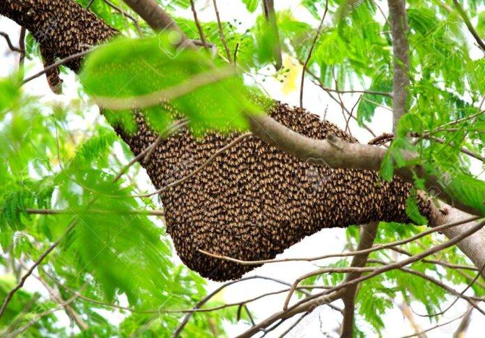
Once the Bagi Forest was known for its trees that provided timber, as well as valuable plants, mats and baskets, gums, fruits, drugs, soda and fodder – but today nothing is left there but memories of the past that echo loudly. No wood, no honey, no parrots. Alas!