

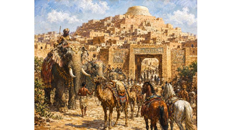
The Ancient Indus Valley Civilisation was dominated by various major urban centres that functioned as highly organised regional capitals or city-states. Mohenjo-Daro, Harappa, Ganweriwala, Chanhudaro, Lothal, Dholavira, Kalibangan, Rakhigarhi, Banawali, Manda, Alamgirpur, and Daimabad were the most prominent IVC sites in present-day India and Pakistan. These city-states in the Indus Valley Civilisation operated as autonomous, highly organised urban centres governed by councils of rulers, governors, officials, landowners, religious leaders, traders, and merchants. The city-states had standardised economic networks, industrial and agricultural hubs, and public infrastructure. There were also citadels, granaries, assembly halls, markets, factories, temples, and cemeteries. They had transportation networks, as well as drainage and sewage systems to carry away waste from the cities.
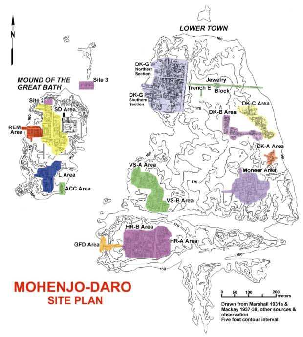
The Citadel Mound: SD Area
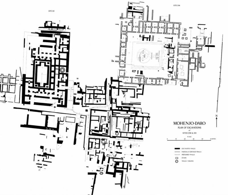
There are 10 blocks in the SD Area of Mohenjo-Daro. The very important among these are the Bath Section, the Middle Section, and the Southern Buildings Section. From 1922 to 1923, Mr RD Banerji excavated the following sites called Site No. 1 (Buddhist Stupas and Monastic Cells), Site No. 2 (North of the Great Bath and washrooms), and Site No. 3 (Small Mound in the north-east of the Stupa). Sir John Marshall carried out excavations at the SD Area in December 1925, and the work continued up to 1927. After him, Mr EJH Mackay with his team started excavating the remains of the SD Area at Mohenjo-Daro from 1927–1931. Later, Sir Mortimer Wheeler unearthed this part of Mohenjo-Daro in the 1950s. He excavated Block 1 (College), Block 2 (Stupa Section and Divinity Street), Block 6 (Group of Washrooms), Block 7 (RDB Site No. 2), Block 8 (Buddhist Building with 5 Votive Stupas), Block 9 (Rooms to the west of the Votive Stupas), and Block 10 (A Great Open Court).
The City Wall of Mohenjo-Daro and Its High Gateways
Once the Citadel of Mohenjo-Daro was surrounded by a city wall or fortification. These defensive walls were probably 40 feet high and 20 feet wide. There were at least 3 gateways from the north, south-east, and west. The main gates/entrances or Shahi Darwaza were made from fine wood. These were so high and wide that large animals like elephants, camels, and horses could easily pass through them without any disturbance. The average shoulder height of an Indian elephant ranges from 7 to 11 feet. Indian single-humped camels stand at 6 to 8 feet at the shoulder, while the height of Indian horses, like the Marwari or Kathiawari horse, ranges between 14 to 16 hands. Elephant bones and tusks were excavated at Mohenjo-Daro during 1925–1927 and later. The presence of these bones suggests that the region around Mohenjo-Daro possessed a much more forested, lush, and wetter environment 5,000 years ago. Some seals show elephants wearing blankets or cloths as though they were used to carry loads. Sir Mortimer Wheeler excavated a camel skeleton from a pit at Mohenjo-Daro in the 1950s.
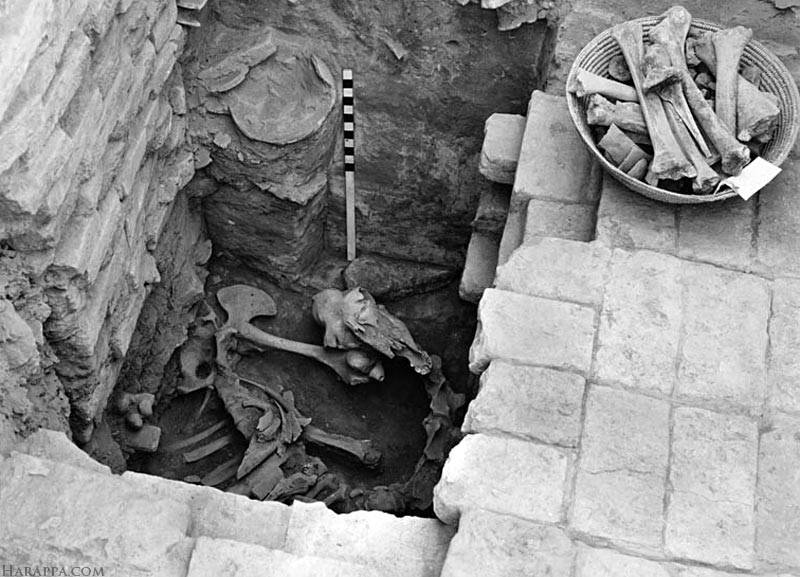
The City Wall of Mohenjo-Daro was a massive, ancient defensive structure which was built around 2700 BC. The remains of a mud-brick platform or the City Wall were excavated from the Citadel Mound on the 2nd of June 2026. This discovery was made under the supervision of Dr Jonathan Mark Kenoyer on the Citadel mound to the west of the Great Bath and the Granary. This City Wall was excavated at 90 cm or 3 feet below the common surface of the ground. This City Wall came out from the author’s (Sheikh Javed Ali Sindhi) trench, i.e., MD25, Lot 211, Fe 12. The size of these large Harappan mud bricks used for the City Wall or platform is 10x20x40 cm (a ratio of 1:2:4). Such kinds of large mud bricks had also been found earlier from the foundations of houses in the Lower Town: HR Area.
Describing the 6.5-metre or 21-foot-wide City Wall, Dr Kenoyer further writes that, “The eroded eastern western edges need to be investigated in future excavations to determine the overall structure of the wall and its original width. A section of drawing was made to connect the mud brick wall excavations with the existing eroded and conserved section of the so called Granary. This section view was then correlated with the original drawing published by Wheeler for his excavations to confirm that we had in fact reached the same levels and identified the same mud brick wall structure”. He again writes that, “These initial excavations were intended to extend beyond the area exposed by Wheeler to better define the nature of the mud brick platforms or walls that surround the mound. Due to limited time during the summer season, it was only possible to expose the surface of the mud brick wall, and the actual edge of Wheeler’s trench was assumed to be in the unexcavated area between Operation 1 and Operation 2 trenches.” According to a voice note from Dr Jonathan Mark Kenoyer on the 25th of March 2026, “The date for the lowest levels has not been collected yet. The date we have is for the first city wall: 2700-2600 BC.”
The Preliminary Report of the Mohenjo-Daro Excavations 2025-26 provides the following data on the discovery of the Kot Dijian pottery from Mohenjo-Daro. This report was prepared by Dr Jonathan Mark Kenoyer, Asma Ibrahim, and Ali Lashari, and was submitted to the Directorate of Archaeology, Government of Sindh, on the 16th of March 2026. Dr Jonathan Mark Kenoyer writes in the report, “The pottery however provides clear indication of the presence of Kot Dijian occupation prior to the construction of the first mud brick perimeter wall. The samples of mud brick from within the earliest wall also contained small pieces of Kot Dijian pottery that must have been in the mortar used to construct the wall. This indicates that the lowest section of the mud brick city wall dates to the Kot Dijian Period, approximately 3300-2800 BC based on comparative pottery at Harappa and other Sites” (p. 6).
A Great Open Court
This great open court was situated immediately to the north of Block 1 and the part of the mound covered by the Buddhist Stupa and surrounding monastery. Only a small part of this court was excavated by Mr Mackay during his excavations in 1927–1931. Its southern and western walls were some 6 feet 9 inches thick. According to Mackay, this enclosure contained no buildings until the re-occupation of the city in the Late II Phase. He believes that this court, Main Street, and the City wall had been washed away due to a flood disaster. Mr Mackay writes, “As elsewhere, the first arrivals of the new populations took heavy toll of the walls of this enclosure in the search for bricks to build their houses; but two doorways still remain. The one opposite the Stupa section was only 2 ft. 9 ins. wide and was perhaps reserved for priestly use. The second entrance, which seems to have been considerably wider, opened on to the Divinity Street” (p. 16). According to personal opinion, this great open court must have been used as an entry point for the kings, officials, traders, merchants, and travellers who came from different parts of the world along with their horses, camels, and elephants. There must have also been some shady trees to rest under for a while during the checking process by the Citadel officials and guards. There were some very roughly built walls inside the great enclosure which perhaps belonged to the Kushan Period (AD 150–500).
As per archival records and photographs, there were large trees in this ground a century ago. After monsoon rains, fragments of terracotta pottery, cakes, bangles, and chert blades, etc., are found from this area. The inaugural ceremony of the Sindh Festival and a musical concert was organised in this Great Open Court at Mohenjo-Daro on the 1st of February 2014. Spearheaded by Bilawal Bhutto Zardari, the two-week event was part of a campaign to celebrate and conserve the province's heritage. A number of foreign visitors, some wearing traditional Sindhi Ajrak outfits, were also seen among the approximately 1,000 guests. The event drew widespread criticism from both national and international archaeologists and experts.
How People Built Dwelling Houses at Mohenjo-Daro
Sir John Marshall writes in his book, Mohenjo-Daro and the Indus Valley Civilisation (London, 1931), that, “The buildings thus for exhumed at Mohenjo-Daro fall into three main classes, viz, (1) Dwelling houses (2) Buildings whose purpose has not yet been determined (3) Public baths which may have had either a religious or secular character” (p. 17). Every family at Mohenjo-Daro had its own house. The rich had large and double-storey houses; the poor had small and narrow houses. Everyone could get a piece of land according to their family size and needs through a proper survey by the Governor’s officials appointed in various parts of the city. After that, house plans were made, and the foundation work was started by the owner of the house. For constructing a house, the owner needed land, bricks, water, masons, labour, tools, and implements. After digging foundations, the construction of rising walls was started through approved measurements. Sun-dried and mud bricks were generally used for foundational platforms, filling, and less vulnerable upper storeys. Today, melted bricks and limestone pebbles are used in the foundations.
Indus city states operated as autonomous, highly organised urban centres governed by councils of rulers, governors, officials, landowners, religious leaders, traders, and merchants
Mostly, these house walls had been given windows, doors, and ventilators. Individual homes facing side lanes were approximately 15 feet (4.5 metres) tall with high ceilings designed to keep interiors cool during hot summers. The Kanai Community of Mohenjo-Daro provided reed roofs for covering houses. The owners plastered flat roofs with mud, mixed with wheat straw. Some solid pieces of the reed roof plaster were discovered by Sir John Marshall’s team during 1925–1927 from the DK Area of Mohenjo-Daro. The roofs were flat, accessible via internal stairs, and reinforced with wooden beams covered in rammed earth to make them waterproof. The roofs had a slight slope inwards towards the court for draining rainwater, which was carried off by a drain passing through the house. The houses had proper foundations, floors, living rooms, doorways, lintels, arches, wall niches for oil lamps, stairways, wells, and water chutes. Fireplaces, kitchens, ovens, cupboards, bathrooms, toilets, pavings, drains, and dustbins were also built inside the houses. There was no ornament or decoration on Mohenjo-Daro houses or buildings.
Where Were the Houses of the Ruling Class in the Citadel?
Probably the houses of the ruling class, priestly class, and officials were located on the top of a mound which is called RBD Site No. 2. This mound is situated to the north of the Great Bath, the oval-shaped well, the Octroi Post, and the Main Street. The sewage and drainage of the houses, including shrines, came to a large drain which was covered with limestone blocks. Mr RD Banerji excavated this mound during the winter season of 1922–1923. He mentions the following structures and buildings in Site No. 2 from page 81 to page 101 in Mohenjo-Daro: A Forgotten Report (1927): He briefly described in his report the Shrines of the East, the Shrines in the North-East, and the Main Shrine in the North and East.
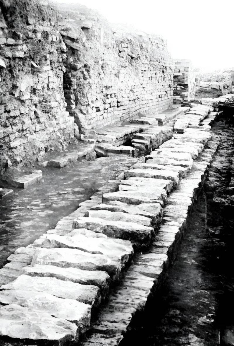
Limestone-Covered Drain
Mr Mackay called it a Chief Drain of Main Street. This stone-covered drain is 12.25 inches wide by 1 foot 4 inches deep. It slopes to the south with a fall of 3 feet 6 inches. The drain is approximately 350 feet in length. The roughly hewn stone blocks average 1 foot 6 inches by 9 inches by 5 inches in size. This channel received drainage not only from the northern buildings and houses but also from the Great Bath building via several outfalls. It has been dated to the Intermediate 1 Phase. There were two other drains and chutes from the western side of the Main Street which flowed towards the south like the above. These also took drainage water from the College Building Room 56. Probably limestone was brought from Sukkur, 65 miles away from Mohenjo-Daro. It was also procured from the Khirthar Range.
The Buddhist Building and Votive Stupas in Block 8
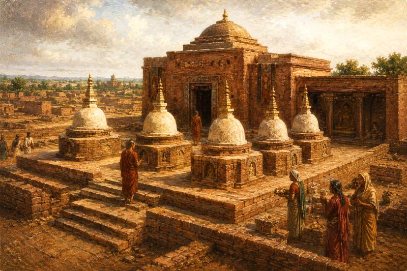
This was a square building with well-defined lanes on all four sides, and it was much smaller than the older buildings in this quarter of the city. Describing this Buddhist building, Mr Mackay writes that, “We have ample evidence, however that this block was built over in Buddhist times, for traces remain here and there of Buddhist masonry and also numerous potsherds of those days. This is not surprising, in view of the survival of a Buddhist building higher up the mound to the north of this block” (p. 21).
Mackay discovered Kushan pottery from the floor of Room 7 of this building, which is 20 feet long and 10 feet wide. Its 2-foot-10-inch wide entrance was from Main Street. A second doorway, 2 feet 2 inches wide, opened in the northern wall of Room 8, which was actually a sleeping place. Again, there is a two-roomed residence (9 and 10) which is like a monastic building round the stupa. The door of this residence was also blocked up. The 3-foot wide door/entrance to this building was probably from Room 1 in the south or from the south-west through a street. This Buddhist residence of Room 9 and Room 10 had been built by unskilled masons during the Buddhist occupation.

The remains of five Votive Stupas were also excavated by Mr Mackay during 1927–1931. He writes about these Buddhist buildings that, “Five circular construction, some 11 ft. 3 ins. in diameter, which stand on a roughly paved floor high up on the northern side of the block can only have been Buddhist. They had also been so badly denuded by time and climate that they now stand from 3 ins. only to 3 ft. high, the tallest being the easternmost. The interiors of these circular structures, hose bricks were all laid as stretchers, were filled in with masonry. They appear to be the bases of small stumps; and they were carefully examined for relics, but without success. The roughly paved platform upon which they stand was an average level of 6-7 ft. above datum, and it was partially enclosed on the north and completely on the west by walls which in places still stood 7 ft. above the pavement. These walls appeared to be of Kushan date, though built with ancient bricks” (p. 22). The antiquities and objects excavated from Block 8 were: a hollow, pottery figure of a monkey, an interesting fragment of a black steatite head, pottery group W, a ball of variegated coloured stone, a pottery model of a dove with outstretched wings, a yellow limestone gamesman, and an extremely pottery prism, etc.
The Main Street / Central Street
The Main Street is situated between Block 1 and the Great Bath building. The street is 12 feet 3 inches wide at the northern end while it is 14 feet 8 inches wide on the southern side. A stone-covered drain can be seen here which comes directly from the RDB Site 2 Mound to the south and south-east of the street. Two seals (697 and 695) were unearthed close to the well room in Block 6 and Point 1 in the Main Street. Once, there was a division wall at the northern end of the Main Street.
A Remarkable Building with a Large Platform of Burnt Bricks
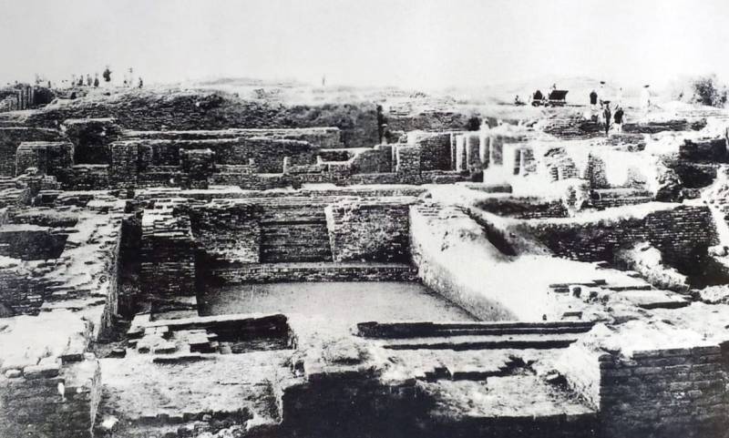
According to Mr Mackay, this remarkable building is situated in Block 6 in the Middle Section of the SD Area at Mohenjo-Daro. Its counterpart has not yet been excavated in any ancient city. The building is 185 feet long and 82 feet wide. It was surrounded by well-defined lanes with Main Street on its east. The building contains eight washrooms, an oval-shaped well, a drain, and other structures. The presence of a large platform of burnt bricks shows that it was an important structure of the Late II-I Phase. This platform still stands at the level of 3.9 feet above the datum. Chambers 9, 14, and 15 (entrance hall) appear not to have been filled in at the time this platform was built. There were two staircases to lead up to the rooms upon the platform.
Group of Bathrooms and Passage in Block 6
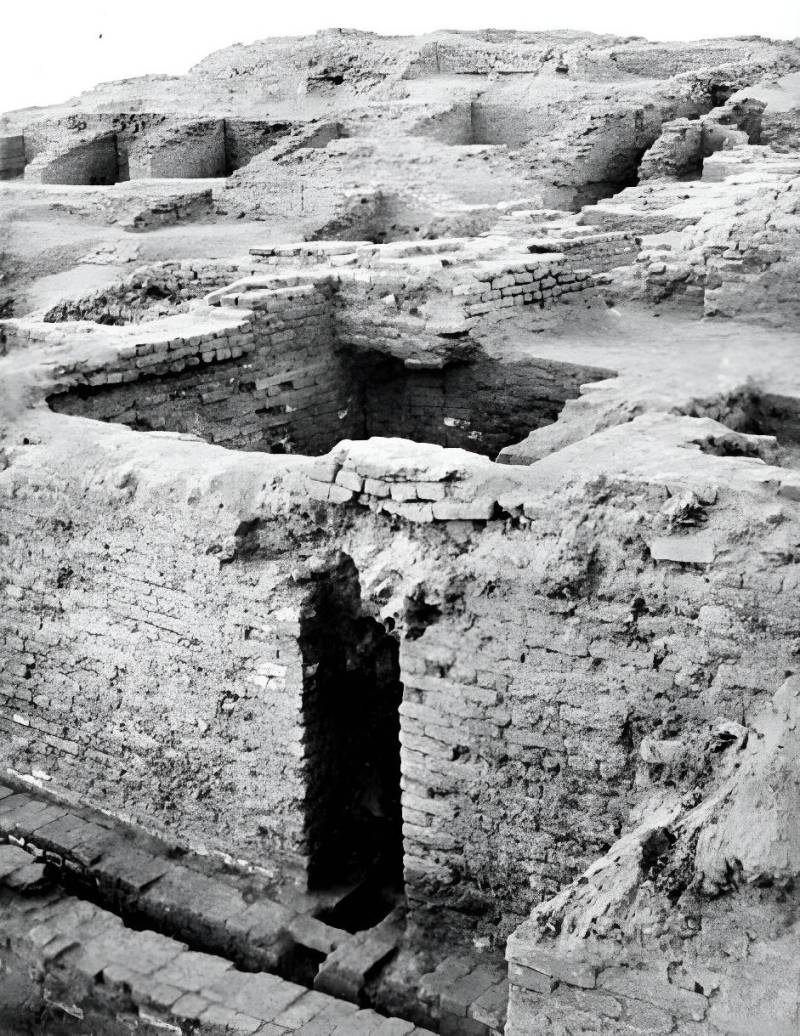
There is a series of bathrooms in two rows in the middle of Block 6. They are all alike in general design. There was a narrow passage and a remarkably well-built drain in the middle of both rows. These bathrooms varied in size. They have narrow doorways with immensely thick jambs, carefully paved floor drains that ran out through the door, and a staircase on one side. The drain is some 9.25 inches wide by 1 foot 8 inches deep with eight courses of bricks. The drain slopes towards the west with a drop of 1 foot in a length of 68 feet. There is a double curve to the north and west again; having found no traces in the last. The drain was never covered unless with wood, which might have perished away a long time ago. The narrow passages of the bathrooms are only 2 feet wide. The smallest being 1 foot 10 inches while the largest is 2 feet 2.5 inches. Mr Mackay writes that, “The narrowness in conjunction with the depth of the door jambs (some 3 ft. 3 ins) secured a high degree of privacy for the bathers, for no one in the central passage could see into any of the bathrooms without stepping into their doorways. Even further privacy was afforded by the fact the doors of the bathrooms on opposite sides of the passage alternate instead of being opposite to one another” (p. 19). The best-preserved bathrooms are Room No. 13 and 19. The former measures 9 feet 6 inches long by 5 feet 8.5 inches wide. Room No. 19 was 11 feet long by 5 feet 6 inches wide. These bathrooms had been added with pavements. Archaeologists also discovered the bases of water jars.
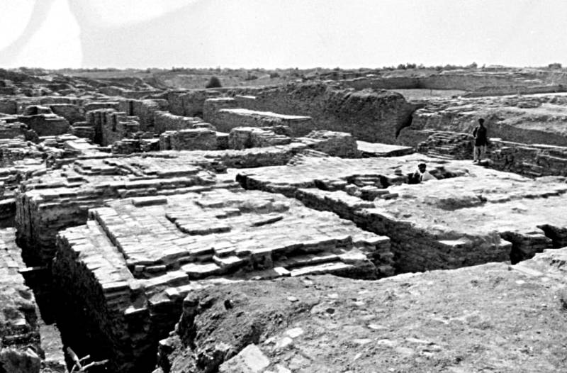
Mr Mackay writes that, “Most probably bathing was a religious duty, as with most Indians to-day and I am inclined to regard the bathrooms in Block 6 as provided for the members of some kind of priesthood, whereas the general public performed their ablutions in the Great Bath. This priestly community lived, I imagine, in rooms above the bathrooms, to which they descended at stated hours to perform the prescribed washings. Possibly they were monks or ascetics, who occupied this building, and they kept themselves apart from the world; the extreme narrowness of the doorways of the bathrooms ensured the utmost privacy, even if no doors of wood or matting (which would inevitably have disappeared) were provided. The narrow passage between the bathrooms was probably only used by the servants whose duty it was to provide each room with water from the nearby well.” He again writes that, “The proximity of these bathing establishments to what we surmise was a temple below the Stupa buildings supports the suggestion that they were connected in some way with the religious life of the city” (p. 20).
Layer of Gravel in Room 8, Block 6
Room 8 in Block 6 has a layer of gravel beneath the drain.
The Curved Drain
The curved drain is situated outside bathroom 26 in Block 6 of the SD Area. Mr Mackay published its photo in his book, Further Mohenjo-Daro Excavations at Mohenjo-Daro (1931).
The Octroi Post / Traffic Control Block
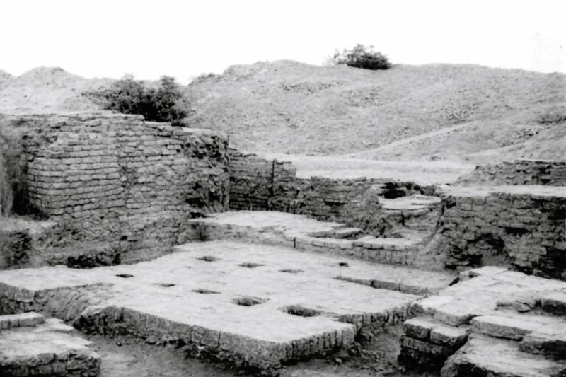
There was a block of paving or brick platform (Traffic Control Block) with 10 shallow pits on a direct route to the Columned Hall in the L Area. Mackay calls it an Octroi Post for a great marketplace commonly known as the Assembly Hall. The revenue of this Octroi Post was probably spent on the temple hidden under the Buddhist Stupa of Mohenjo-Daro. Mr Mackay, providing his excavation report, writes in Further Excavations at Mohenjo-Daro (1938) that, “In this platform, whose surface shows a great deal of wear, ten shallow pits are arranged in two parallel rows of five, 1 ft. 2.5 ins, apart. The pits are not now all the same size –they range from 8.6X7.25 by 4.6 ins, deep to 9.75 ins, square by 4.6 ins, deep-but originally they may have been so. At the north and south, this platform was edged with bricks standing on their ends with their flats together.”
Mackay further writes that, “I can suggest no meaning for this construction unless the holes in its floor once held that upright wooden supports or two rails between which all those who entered Main Street had to pass. The marked degree to which the surface of this platform is worn between the two lines of holes as compared with the sides strongly bears out this view. A restriction of this kind on the foot traffic down Main Street is comprehensible in view of the character of the buildings in this street. Some check may have been kept on the numbers of people who entered the Great Bath building. Or it is conceivable that this was an Octroi Post. It was situated on a direct route to the Columned Hall in the L Area, which has features that suggest its being a great market place” (p. 14).
The Holy Shrine with Apartments
There was a suite of apartments with a shrine (Room 44), a private chapel, and a pavement for the ablutions of the worshippers before they entered the precincts of the shrine. A room for water jars that were filled by skin carriers from the Great Bath wells was also identified. Domestic offices, sleeping quarters, water chutes, vertical chases, exploratory shafts, a bath with a small staircase, and a drain were also excavated during the clearance work carried out by Mr Mackay between 1927–1931.
The Oval-Shaped Well
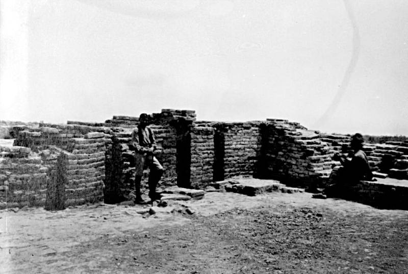
This well is found in Chamber 16, Block 6 in the SD Area of Mohenjo-Daro. The Octroi Post or the Traffic Control Block lies very close to it in the north-east. Mr Mackay writes about the elliptical/oval well as under: “The very fine well near the south-eastern corner of this building (Pl. V, d) evidently owes its peculiar oval shape to the chamber in which it was sunk. It measures 6 ft. 2 ins. by 4 ft. 3ins. in diameter and its well preserved coping, 0.9 ft. below datum, was constructed with wedge-shaped bricks, 10.9 ins. long. 5.4 ins. wide, and graduating in thickness from 1.75 to 1.85 ins. To prevent the coping from being displaced by the ropes employed in drawing the water, an edging was made around it of bricks set upright on their ends, and these in turn were kept in place by the pavement. The latter was more than usually well laid and shows signs of constant heavy wear” (p. 18).
Mohenjo-Daro: SD Area Bath Section
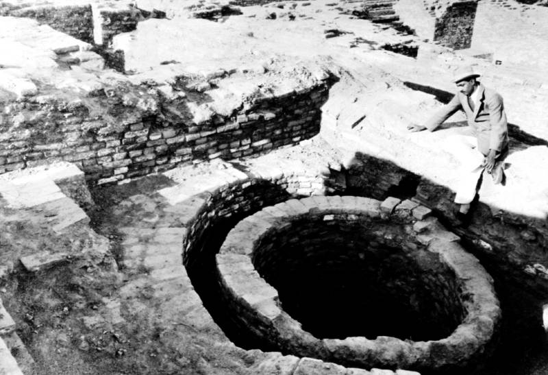
Mohenjo-Daro's SD Area Bath Section is divided into 5 blocks as under:
- The Great Bath Complex
- The State Granary
- Building with 11 chases and paving
- Court 4 with mud filling and paving
- Other solid structures
The Great Bath Complex / The Sacred Tank
The Great Bath Building was probably connected with the city’s religion. According to Sir John Marshall (1931), the dimensions of the bath are: west side, 39 feet 4 inches long; east side, 39 feet 3 inches long. Its breadth at the south is 22 feet 11 inches, and at the north 23 feet 4 inches. There is, therefore, a difference of 5 inches in the width of the two ends, and of 1 inch only in the length of the two sides. The depth of the Great Bath was 8 feet. This holy pool was fed by a double ring well located in Chamber 16. There were possibly foundations of a hypocaust or hot-air bath. A thick layer of bitumen was given under the floor for waterproofing the sacred tank. There are many halls, chambers, and extra retaining walls. Burnt clay plaster, and evidence of a burnt mass of copper and charcoal indicated that this building was set on fire during an invasion. According to archaeologists and experts like Mr Mackay, this bathing establishment belongs to the Late III and II Phase.
The following objects were found from the Great Bath during Marshall’s excavation: 2 phallic emblems in alabaster and faience, a miniature pot of blue faience, a copper spearhead, a copper chisel, several rectangular pieces of metal with animals and pictographic legends—one bearing a horned figure (Gilgamesh?) clad in leaves and carrying a bow—and two square seals of a bull and a rhinoceros with pictographs. Two large urns containing smaller pottery in the north entrance of the Great Bath were also discovered during the excavations. The other features of the Great Bath Complex are the 3 entrances to the building from the east, north, and south; platforms round the Great Bath supported on mud-filled masonry cells; watertight backing; wooden treads; Water Chamber (36) on the western side of the bath showing an inspection shaft from the east; a manhole; a drain (37) with a corbelled arch from the northern side; and fenestrations. There was a lining of bitumen between the outer and inner walls of the north-east corner of the bath. There was a street between the bath and the Southern Buildings Section.
There is a building in the south-east corner of Chamber 4 in Block 3 in this section which is 26 feet 9 inches long from N-S and 25 feet wide from E-W. On the eastern and western walls, there are 6 and 5 chases respectively, averaging 1 foot 1 inch wide by 10 inches deep (Pl. XXVI, b). This Late Period building was probably open to the sky. The following antiquities were found from this Court 4: a well-preserved copper awl (SD 2511). This awl was discovered from a level of 3 feet below the surface of the ground. An awl is a pointed hand tool which is used for piercing or making materials like leather, wood, and heavy canvas. The awl’s photo can be seen at (CXXXII, 6).
(to be continued)