

Among the controversies surrounding the partition of India about the Radcliffe Award, which partitioned the Muslim-majority provinces of Punjab and Bengal and became the international boundary between India and Pakistan remains the most persistent. Not surprisingly, with the passage of time the scope for distortions and obfuscations about it has expanded. It is time to bring back the facts into the picture.
By late 1945 Lord Wavell was convinced that the British could not hold on to India against the will of the people. The Quit-India movement and the Indian National Army (INA) formed by Indians captured by the Japanese had convinced Wavell that it was time to leave.
On 27 December 1945, Wavell sent a top-secret report titled ‘The Breakdown Plan’ in which he recommended that if the British were forced to leave, they should do so and if the Muslims wanted to have a separate state they should be granted their demand in Muslim-majority areas. (Transfer of Power vol. VI, p.700.)
On 7 February 1946 a follow-up, top-secret report titled ‘Demarcation Plan’ was sent by Wavell to London. In it, he presented how Punjab and Bengal should be partitioned. The following was the division based on the district as the unit for the allocation of territories. For Punjab the allocation of territory:
- Sindh, North-West Frontier Province, British Baluchistan, and Rawalpindi, Multan and Lahore-divisions of Punjab less Amritsar and Gurdaspur districts.
- In Bengal, the Chittagong and Dacca divisions, the Rajshahi division less (Jalpaiguri and Darjeeling), the Nadia, Murshidabad, and Jessore districts of Presidency division; and in Assam the Sylhet District. (Transfer of Power vol. VI., p. 912).
Wavell advised that in case the Congress and Muslim League did not agree to keep India united his proposals should be declared an Award. An award, it is to be noted, cannot be challenged. The British Government did not comply as advised. They tried to keep India united through the Cabinet Mission Plan of 16 May 1946. During talks with Jinnah, the Cabinet Delegation warned him that he may not get Gurdaspur and Calcutta.
Speculations about the interference of Mountbatten, Lady Mountbatten, Nehru, and others make interesting gossip and scandal, but their explanatory value is questionable
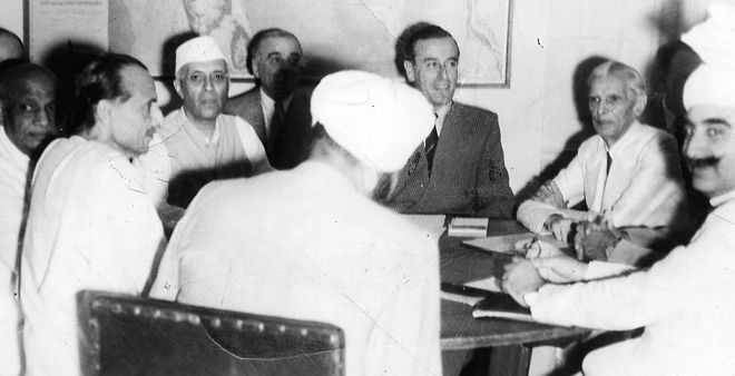
When the Cabinet Mission plan failed to achieve an agreement between the two main parties, they called back Wavell and sent Lord Mountbatten as the last viceroy. He was to transfer power to the Indians by June 1948.
Mountbatten conducted protracted negotiations with Indian leaders in which the whole range of Indian opinion was consulted. While the Congress insisted on keeping India united, the Muslim League was determined to get Pakistan through the partition of India.
On 3 June 1947, the Partition Plan was announced. India was to be partitioned between the dominions of India and Pakistan but not in June 1948; in mid-August 1947. The demand of the Sikhs for a separate state was overruled, and so was the demand of the last premier of united Punjab Sir Khizr Hayat Tiwana to keep Punjab united and make it a third dominion. Similarly, in Bengal Suhrawardy and Sarat Bose’s scheme of a united Bengal as a dominion was also rejected.
It was laid down that the Punjab and Bengal Assemblies shall vote on whether their provinces should remain united or partitioned. Muslim and non-Muslim majority districts were to form two blocs. If either bloc votes to partition the province it will be partitioned.
Further, if they voted for partitioning their provinces a boundary commission would hear their arguments for the allotment of territory to India and Pakistan.
On 21 June 1947, the Bengal Assembly voted. The Hindu-majority districts voted for partitioning Bengal so that it becomes part of India. On 23 June the Punjab Assembly voted. The Hindu-Sikh majority bloc voted for partitioning Punjab so that they could join India.
A Boundary Commission was formed with Sir Cyril Radcliffe being appointed as the head of the commission. He had never been to India before and that was considered a merit for his remaining impartial. A Punjab and a Bengal Boundary Commission were also appointed. Political parties and religious and caste groups were to present their claims on the partition of their province. The Congress and the Sikhs, on the one hand, and the Muslim League, on the other hand, were to nominate two high court judges to hear the claims to territory.
The terms of reference for dividing Punjab and Bengal were that contiguous Muslim and non-Muslim majority areas were to be separated and given to Pakistan and India. But ‘other factors’ were also to be considered. There were waterworks, railway lines, and such factors which were to be taken into account. A notional division of Bengal and Punjab was also laid down, but the outcome depended on the decision of the two boundary commissions and the chairman.
If the boundary commissions agreed on a unanimous demarcation of divided Punjab and Bengal the chairman was to accept that. In case they did not, he had the prerogative to give an award, which would be binding for all parties.
In this article, we look only at what happened to the Punjab. Justice Meher Chand Mahajan and Justice Teja Singh were nominated by the Congress and Sikhs respectively and Justice Din Muhammad and Justice Muhammad Munir by the Muslim to the Punjab Boundary Commission. From 21 July to 31 July, the Punjab Boundary Commission heard the arguments of the disputing parties.
Mr Setalvad represented the Congress and Harnam Singh the Sikhs while Sir Zafrulla was the Muslim League counsel.
Setalvad and Harnam Singh argued that simply contiguous Muslim and non-Muslim areas was not the only requirement; other factors were equally important. They argued that Hindus and Sikhs had contributed greatly to the development of Punjab. They owned almost entirely businesses and industries, paid 70% of the land revenue, and contributed greatly to the educational development of Punjab. Also, the Sikh religion was organically linked to many parts of Punjab. On such a basis they demanded that Sialkot, Gujranwala, Sheikhupura, Lahore, Montgomery (Sahiwal), and Lyallpur (Faisalabad) should be given to India. Harnam Singh even argued that instead of the district as the unit, the zail comprising 12 villages should be the basis for the demarcation of the boundary. On such a basis he connected Hindu-Sikh majority zails all the way to Lyallpur. Mahajan was willing to make Lahore a joint city between India and Pakistan.
Sir Zafrulla argued that contiguous Muslim and non-Muslim majority areas were the main term of reference while other factors were relevant only in special situations. Also, he asserted that the tehsil was the original administrative unit and not the district. On such a basis he could connect contiguous Muslim-majority tehsils all the way to Ludhiana.
Christians, Anglo-Indians, scheduled castes, and Ahmadis presented their own briefs. The Christians argued for keeping Punjab united as a part of Pakistan, and so did the Anglo-Indians. The scheduled castes were divided on this. The Ahmadis voted for keeping Punjab united and part of Pakistan.
The four learned judges supported the claims of the parties that had nominated them. It was now for the chairman to give an Award.
What choices or options were before Radcliffe? One can wonder. Speculations about the interference of Mountbatten, Lady Mountbatten, Nehru, and others make interesting gossip and scandal, but their explanatory value is questionable. Radcliffe simply accepted Wavell’s 7 February 1946 demarcation plan for Punjab.
The Muslim League was the main winner in Punjab. Radcliffe’s award was 99.99% identical to the 7 February Demarcation Plan of Wavell. Only 3 Sikh majority villages on the eastern bank of the Sutlej were taken from Kasur tehsil of Lahore district and given to India.
It may be noted that in Bengal too where two judges were nominated by Congress and two by the Muslim League, they supported the claims of the parties they had nominated them. The Bengal Award deviated from the demarcation plan but largely adhered to the 7 February demarcation plan.