


During August and September 2025, flooding in the River Ravi engulfed vast areas of Abdul Hakeem, Kot Islam, and surrounding localities in District Khanewal. Thousands of acres of agricultural land, rural settlements, roads, fish farms, and critical infrastructure were affected. However, residents of the affected areas continue to ask one fundamental question: if a spill channel (Nikaso) had been constructed decades ago to divert excess floodwater, why did the floodwater not pass through that channel during the 2025 floods?
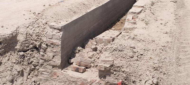
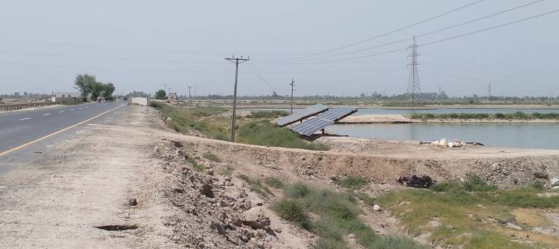
The fish farms spread across 6,000 acres on the Nikaso are an important part of Pakistan’s fishing industry. They were washed away by the floods. If proper efforts had been made to control the flood, this industry could have been saved from losses worth millions of rupees.
- Muhammad Zafar, Member, Fish Farmers Association Nikaso
According to a recent advisory issued by the National Disaster Management Authority (NDMA), climate change is not limited to rising temperatures; it is also altering rainfall patterns and increasing the intensity of rains. A warmer atmosphere can hold more moisture, increasing the chances of intense rainfall over shorter periods. Unusually high temperatures in northern Pakistan accelerate glacier melt, while this additional water combines with monsoon rains to further increase river flows. Consequently, in recent years Pakistan has faced floods in which heavy rainfall, glacier melt, human construction on natural floodplains, and obstructions to natural river flows collectively intensify the scale of destruction.
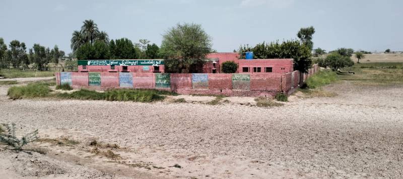
The old Sidhnai Headworks, constructed in 1886, came under increasing pressure from major floods in the River Ravi over time, compelling the government of that period to establish an alternative flood diversion system. For this purpose, the Sidhnai Spill Channel (Nikaso) was constructed in 1959. It was designed with a capacity of 30,000 cusecs, although in practice it was excavated to accommodate only around 20,000 cusecs.
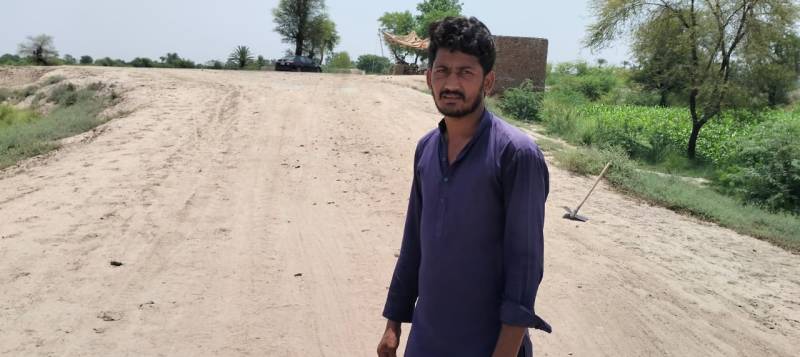
Later, under the Indus Basin Replacement Works, the new Sidhnai Headworks was constructed approximately 11 kilometers upstream of the old weir. During this project, only the spill channel’s head regulator was upgraded to a capacity of 45,000 cusecs, while the remainder of the channel was neither widened, rehabilitated, nor re-excavated.
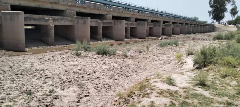
According to the official Flood Fighting Plan, this is the reason why, since the construction of the new Headworks, the spill channel has never received water according to its original design capacity, not even during the most severe floods.
The same question resurfaced after the 2025 floods.
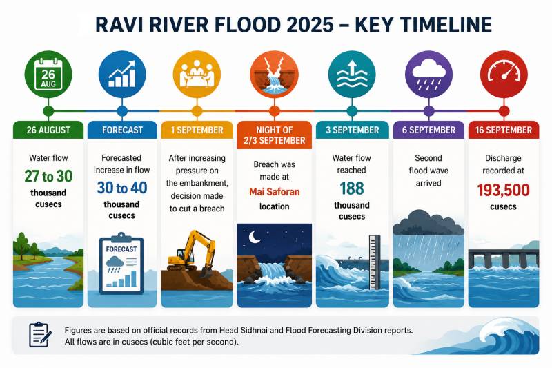
According to information obtained from the District Administration Khanewal, on 3 September 2025, a discharge of 188,000 cusecs was recorded at Sidhnai Headworks, while its approved discharge capacity is approximately 150,000 cusecs.
Timeline
These figures make the question even more significant: was the 2025 flood warning that millions of people living along the River Ravi are relying on a flood management system that is no longer adequate for today’s climate risks?
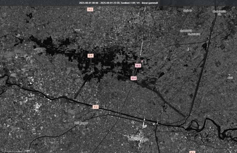
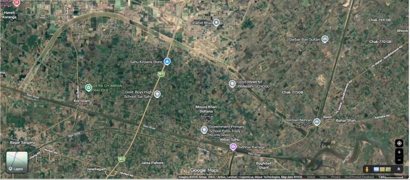
The flood in the River Ravi during August 2025 breached the embankment at Mai Saforan, located at RD Section 16, allowing floodwater to enter adjacent settlements. This location lies approximately 200 feet behind and to the right of the spill channel (Nikaso) constructed for Sidhnai Headworks.
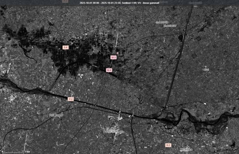
The flood affected 160 mouzas in Khanewal District, while 129,508 acres of agricultural and non-agricultural land were inundated.
However, official records present a different account of the incident.
According to information obtained from Sidhnai Headworks, low- and medium-level flooding continued throughout August. However, during the last week of the month, pressure on Sidhnai Headworks increased steadily. On 1 September, the relevant authorities decided that, to protect the embankment, controlled breaches would be made at Mai Saforan to relieve the pressure.
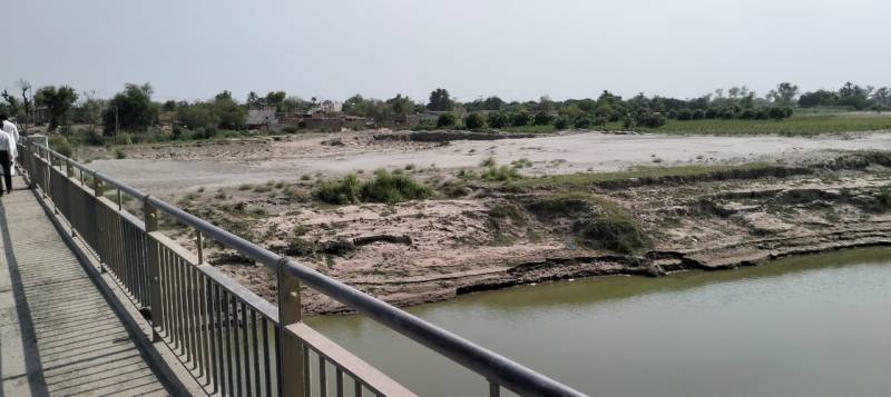
During the night between 2 and 3 September, a breach was made in the embankment at Mai Safuran, after which floodwater spread across a vast area. According to official records, water levels began to recede approximately 48 hours later. However, on the night of 6 September, a new flood wave combined with additional monsoon rains once again worsened the situation.
According to Muhammad Asad, Sub-Engineer at Sidhnai Headworks, flood warnings had been issued two weeks in advance for Sidhnai Headworks, areas adjacent to the River Ravi, and locations where embankments were considered vulnerable, and almost all settlements had been evacuated. Despite this, our effort was to avoid breaching the embankments. However, when floodwater began moving towards Abdul Hakeem, Kot Islam, Sarai Sidhu, Shahadat Kandhla, and Bagar Sargana, we had to breach the embankment late at night.
According to a resident journalist Safdar Sial, the floodwater travelled approximately 40 kilometers from east to west, passing through Mai Saforan before eventually joining the River Chenab. Meanwhile, from Kot Islam to Pul 25, an area extending roughly 20 kilometers from north to south remained in water.
According to him, traffic on the National Highway remained suspended for several days, while railway services between Khanewal and Faisalabad remained closed for more than two months.
According to social activist Shehzad Francis, water was flowing over the bridge at the old Sidhnai Headworks near Kot Islam, while the entire area from Mouza Doana towards Shorkot up to Pul 25 remained submerged.
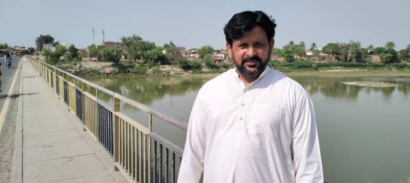
According to Muhammad Zafar, a member of the Fish Farmers Association Nikaso East, there are more than 300 fish farmers operating around the Nikaso, with farms ranging in size from one acre to fourteen acres. According to him, the cost of operating a one-acre fish farm is around PKR 500,000, producing a return worth approximately PKR 800,000, including profit. Based on these estimates, fish farmers collectively suffered losses of around PKR 3 billion in investment costs alone. He further stated that they received no government assistance. This year one can visit the area and observe that fish farming is being carried out on barely 2,000 acres.
According to Afzal, a resident of Palo Treli, floodwater remained in the area for approximately one and a half months, while even today signs of flood can still be seen in the form of ponds at some locations. Homes were accessible only by boat. Children could not attend school for two months, and his shop, which was destroyed by the flood, had to be rebuilt.
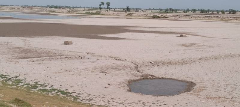
According to the Flood Fighting Plan 2023, the Irrigation Department has acknowledged that during all major floods in the past, the spill channel has never received water according to its design capacity.
Official documents identify several reasons for this.
The first reason is that while the spill channel’s limited capacity of holding cusecs.
The second reason is that between the railway bridge crossing the Nikaso and Kot Islam, there is an approximately seven-kilometer railway embankment with a height of 14 feet. There is no effective drainage system at this location.
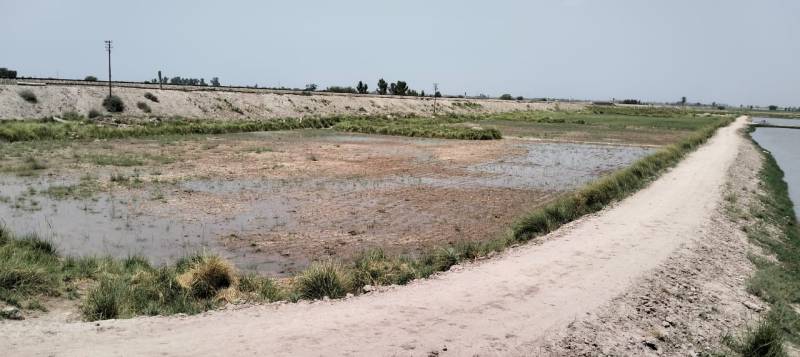
The third reason is that the M-3 and M-4 motorways, constructed later, have also obstructed the natural flow of floodwater. Their embankments rise more than 20 feet high.
Furthermore, in documents outlining its preparedness measures, the District Administration has acknowledged that the 2025 flood followed its old natural course before joining the River Chenab, while human-made structures along the route continued to obstruct its flow.
However, in these official documents there is no explanation of what practical plan exists to activate the spill channel to ensure its effective use in the future.
Map
The District Administration Khanewal has almost completed work to strengthen various river embankments. It has also ordered the evacuation of 1,200 residents living in the settlements of Oddan Wali Basti and Qabza Basti, located within 200 meters on both sides of the old Sidhnai Headworks.
According to Umar Shehzad, (XEN) at Sidhnai Headworks, during the previous flood four gates became inoperative because of Bela accumulated upstream of the Headworks. Under the ongoing development works, priority will be given to removing this Bela to improve floodwater flow. He further stated that formal briefings have already been given to the Deputy Superintendent of Railways, Multan Division, the General Managers of the M-3 and M-4 Motorways, and the relevant units of the Pakistan Army regarding obstacles to the river’s natural flow. It is now the responsibility of these departments to resolve these issues in a timely manner. He added that redesigning or expanding the existing Nikaso will require a long period of time, but that the Irrigation Department is working seriously on the matter. Because the existing spill channel is technically not useful due to reverse effects on exit of spill channel.
According to climate communication expert Dr. Shafeeq Kamboh, when this spill channel was constructed nearly 67 years ago, the climate realities were entirely different from those of today. Climate change and global warming are now accelerating glacier melting and increasing river flows. Temperatures in the Himalayan and Hindu Kush mountain ranges have already risen by seven to eight degrees Celsius. The only natural pathway for melting glaciers is through rivers, and if that pathway is obstructed, rivers will carve out their own natural course, with existing obstacles causing even greater destruction. Considering the Indus Waters Treaty, climate change, and global warming, we must modify the infrastructure along our rivers.