

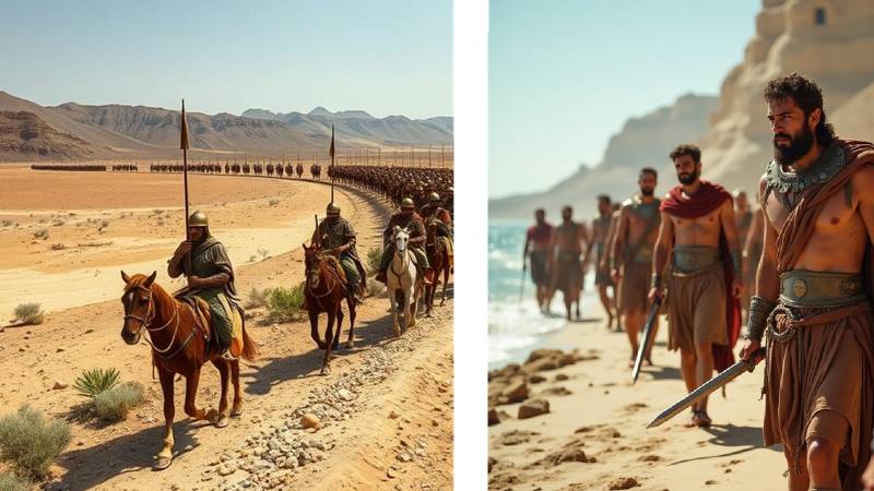
Arrian and other historians inform us that after leaving Patala (Hyderabad) harbour, the famed Macedonian world-conqueror Alexander came upon the banks of the Arabios River. He left behind Hephaistion with the main force, while Alexander, Leonnatos, and Ptolemy ravaged the land of the Oreitai in three columns.
Describing the base camp and the supplies, Robin Lane Fox (1973) states in his book Alexander the Great that "The region round Pattala was rich in grain and cattle, and a huge heap of corn had been plundered: 'four months' supplies for the expedition had been duly gathered near the base camp before the men set out for the River Hab, and four months was the likely length of the desert march through the country of the Oreitans and Gedrosians.'" (403)
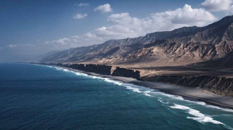
Alexander’s base camp at the Arabios River
Alexander crossed the River Arabios and invaded the Oreitans. WJ McCrindle has given various forms of this river's name, such as Arbis, Arabis, Aribes, Arbies, Arabies, and Artabius. Now it is called the Purali River, which flows through the Las Bela area. This river gave its name to the Arabioi, Arbitoi, and Ambritai, whose territory it divided from that of the Oreitai, who were further west. These people were tributary to King Darius of Persia. Their territory extended from the western mouth of the Indus to the River Purali. Alexander had reached Arabioi (Karachi) from Patala in nine days. The distance from Patala (Hyderabad) to Arabius (Karachi) was 114 miles, which remains the same to this day. The average day's march was therefore about 12 miles.
Robin Lane Fox further states that, "In India, Alexander had discovered luxuries and raw materials; throughout history, it is luxuries which have driven merchants down their most spectacular routes. His prospectors had found gold and silver and mounds of salt; his troops had picked stones as precious as jasper and onyx from the rivers they had been asked to cross. There was ivory, horn, muslin, and bales of cotton ready for the picking; Indian dogs and elephants were valuable cargo. Above all, there were the spices, the nards and cassia, cardamom, balsam and myrrh, sweet rush, resinous bdellium, and the putchuk which grew in the Punjab and the Indus delta." (401)
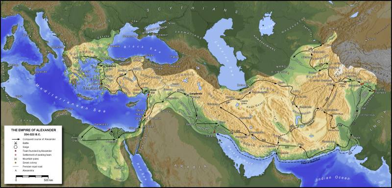
The Country of the Oreitans and the advance of the Macedonian army
Alexander marched through the Arabios River in the direction of Jau to Makran. He again traversed through Gwajak, Kolwah, and Gedrosia. During this expedition, Alexander’s army experienced severe fatigue, hunger and thirst.
Colonel Holdich (1904) identified Rambacia as the capital of the Oreitans in the Las Bela state. Sir Aurel Stein explored various parts of Balochistan and published his book entitled An Archaeological Tour in Gedrosia in 1931. He surveyed old mounds in Quetta, Qalat, Mastung, Drakalo, Khuzdar, Zidi, Nal, Wadh, Rakhshan, Kolwah, Awaran, Kharan, Kej, Makran, Panjgur, Dasht, Turbat, Kulli, Nundara, Mehi, Sokhta Koh, Sutkagendor, and Gawadar. He also published photographs of antiquities and maps in this volume. Dasht, Sokhta Koh, and Sutkagendor are Indus Valley Civilisation sites dating back to 2600–1900 BC.
The Dutch scholar PHL Eggermont has given a description of the ancient Oreitans and the present Brahui tribes. He writes in his book Alexander’s Campaigns in Sind and Baluchistan and the Siege of the Brahmin Town of Harmatelia (1974) that "In c. 325 BC, the plain of Las Bela was occupied by the Oreitans, an autonomous tribe, about which Arrianus gives the next particulars: 'such Oreitans as live indeed, away from the sea, dress as the Indians do, and equip themselves similarly for warfare; but their dialect and customs differ.'"
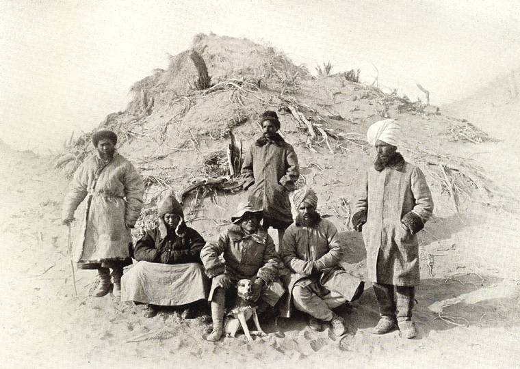
Diodorus reports that, "these Oreitans have the same customs as the Indians in other respects, but have one practice which is strange and quite unbelievable. The bodies of the dead are carried out by their relatives, who strip themselves naked and carry spears. They place the bodies in thickets which exist in the country and remove the clothing from them, leaving them to be the prey of wild beasts. They divide up the clothing of the dead, sacrifice to the heroes of the nether world, and give a banquet to their friends." (58)
The recent excavations of 1924 at the Nal Complex in Balochistan show that the prehistoric Nal tribes, most probably of Dravidian/Iranian origin, practiced fractional burial. This site belongs to the prehistoric Amri Nal Culture, which dates back to around 3800–2300 BC. According to P.H.L. Eggermont, the Bactrians and Sogdians used to throw out their sick and elderly to be devoured by dogs. The Sogdians killed their parents, while the Scythians ate them. In Hyrcania, the dead were devoured by dogs, but in Bactria by birds.
Waldemar Heckel writes in his book The Marshals of Alexander’s Empire (1992) that, according to Arrian (6.21.5), during his return march from India in 325 BC, Alexander arrived at Rhambakia, the largest village of the Oreitai. He was impressed with the site and believed that it would become a great and prosperous city if people were settled there. This was actually a sheltered harbour by the sea. Waldemar Heckel tells us that, "In the land of Oreitai, Hephaistion made preparations for the synoecism of Rhambakia, while Alexander attended to military matters on the frontiers of Gedrosia." (71)
Later, after Hephaistion, Alexander the Great placed Apollophanes as satrap. Along with him, he left Leonnatos, an officer of the bodyguard, in Ora. Heckel again writes that, "When these had been overcome without much difficulty, Alexander sent Leonnatos, with the Agrianes, some archers and cavalry, and a force of mercenary cavalry and infantry, to remain in the land of the Oreitai, with instructions to wait for the fleet until it sailed past this region, to synoecise the city and to settle affairs among the Oreitai." (90)

Where was Ora?
The historians have identified this location as Hour or Houra, which resembles Miani Hour, Hourmara, and Ormara. In Karachi, Sindh, Orangi is an important and historic location. W.J. McCrindle, describing Ora, writes that D’Anville and Vincent have assumed that Ora is the Haur mentioned by Edrisi as lying on the route from Dibal, near the mouth of the Indus, to Firuzabad in Mekran. Its situation is uncertain; however, as its name does not occur in any recently published account of the country.
Ora may perhaps have been in the neighbourhood of Kokala, mentioned in the Indika as situated on the Oreitian coast, probably near Cape Katchari, to the east of the Hingol River, where the fleet was supplied with a fresh stock of provisions. Perhaps it may have here denoted the Country of the Oreitai. (169) The name Ora is found in both Brahui and Sindhi languages with the same meaning: "House" and "Thatched hut wall" (Ola).
Leonnatos killed 6,000 Oreitans and their leaders in Rhambakia
Alexander’s general Leonnatos killed 6,000 Oreitans and their leaders in Rhambakia. This Indian massacre is recorded by Waldemar Heckel, who provides details as follows:
"Sometime between Alexander’s departure and the arrival of Nearchos with the fleet, Leonnatos won an impressive victory over the Oreitai, who had risen against him. According to the partisan account of Nearchos, he inflicted upon the enemy heavy casualties: 'he killed six thousand of them, and all their leaders… And of his own forces, Leonnatos lost only fifteen cavalrymen and a handful of infantry: though Apollophanes the satrap fell in the battle.' When Nearchos arrived at the shore near Rhambakia, Leonnatos had prepared provisions for his Ocean voyage. He also exchanged troops with Nearchos, taking with him those men who, on account of laziness, had caused or might cause disciplinary problems in the fleet." (91)
Leonnatos was a tough commander of Alexander and was famed for his gymnastics. Historical records tell us that he was one of Alexander’s only two known friends of the Lyncestian family and was remembered for his bellicosity and such a taste for wrestling that he was said to have taken trainers and camel loads of sand wherever he went in Asia.
Where was Alexandreia Rhambakia?
Curtius Rufus tells us that Alexander founded a city in the region of the Oreitai and populated it with Arachosi people. Stephanos refers to this settlement as Alexandreia No. 4. All the people who resisted were cut down by the Greek cavalry, and many were taken as prisoners. Providing the origin of the name of Rhambakia, W.J. McCrindle writes that,
"This name is probably a transcription of the Indian Rambagh, which designated the place where pilgrims assemble before starting for the Aghor Valley, in which the pilgrim’s sacred places are connected with the history of Rama, the great hero of the Ramayana." (168) It seems that Rambagh (Rambaghicha) became Rambella, which was afterward changed to Rambell, Ramanbella, or Armanbell. Lasbella was the Arman Bela of the Chachnama. This capital city flourished during the Buddhist Kingdom of Sindh under the Rai dynasty.
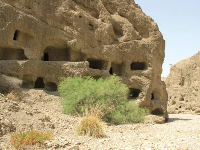
These historical names change from time to time. We see that Rambagh in Karachi is now changed to Arambagh. Muhammad Bin Qasim’s army passed through a place which the Arab writers have mentioned as Armael or Armanbellah in 711 AD Muhammad Bin Haroon, the governor of Makran, also accompanied the Arab general during this campaign.
Travel writer Salman Rashid writes regarding Rhambakia:
"Upon leaving Rambakia, Alexander entered a 'narrow pass' where the local tribe of the Oreitai, having teamed with the Gedrosians from further west, were waiting. This pass is none other than the tortuous and desiccated Jhao in Balochistan."
Who Were the Ichthyophagoi or the Fish-Eaters?
The land of the Ichthyophagoi (fish-eaters) was on the coast, west of the mouth of the Hingol River, in the region between Cape Malan and Cape Jask. Arrian and Strabo mention that these people lived in stifling huts, which had been constructed by heaping up mussel shells, while the roofs were formed of the backbones of fish. Diodoros mentions that,
"Alexander next advanced towards Kedrosia, following the route along the seacoast. He encountered on the way an inhospitable and utterly savage tribe, for there the natives let their nails grow without ever cutting them from the day they are born to old age, allow their growth of hair to become matted, have complexions scorched with the heat of the sun, and are dressed with the skins of wild beasts. They subsist on the flesh of whales stranded on their shores. Their houses they prepare by running up walls and forming the roofs of the ribs of the whale, these supplying beams of a length of 18 cubits (27 ft). For covering over the roofs, they use, instead of tiles, the scales of fish. Alexander, in passing through the country of these savages, was much distressed by the scarcity of provisions; but in the next country he entered, he fared still worse, for it was desert and bare of everything useful to support life. As many perished from sheer want, the stout hearts of the Macedonians yielded to despondency, and Alexander was overwhelmed with no ordinary grief and anxiety; for it seemed a terrible thing that his men, who surpassed all mankind in bravery and in arms, should perish ingloriously in a desert land and in utter destitution. He therefore dispatched messengers posted into Parthyaia, Drangiane, and Areia, and the other states bordering on the desert, enjoining them to send quickly to the passes of Karmania dromedaries and other beasts of burden laden with food and other necessaries." (298)
The Ichthyophagoi ate raw fish. According to Eggermont, the Oreitans were most probably controlled by the satrap of Arachosia, for the latter levied tribute in the Punjab, and when Alexander founded Alexandria near Oritene, he settled Arachosians in the new town. (59)
The area of the Ichthyophagoi stretched from Ormara to Pasni and Gwadar. Presently, this route is called the Makran Coastal Highway / N-10, which is 278 km long. The Meds (fishermen), Jadgals, Kalmatis, Bizanjo, Puzh, Wardilis, Reganis, and Mehdizais have inhabited this coast for many centuries.
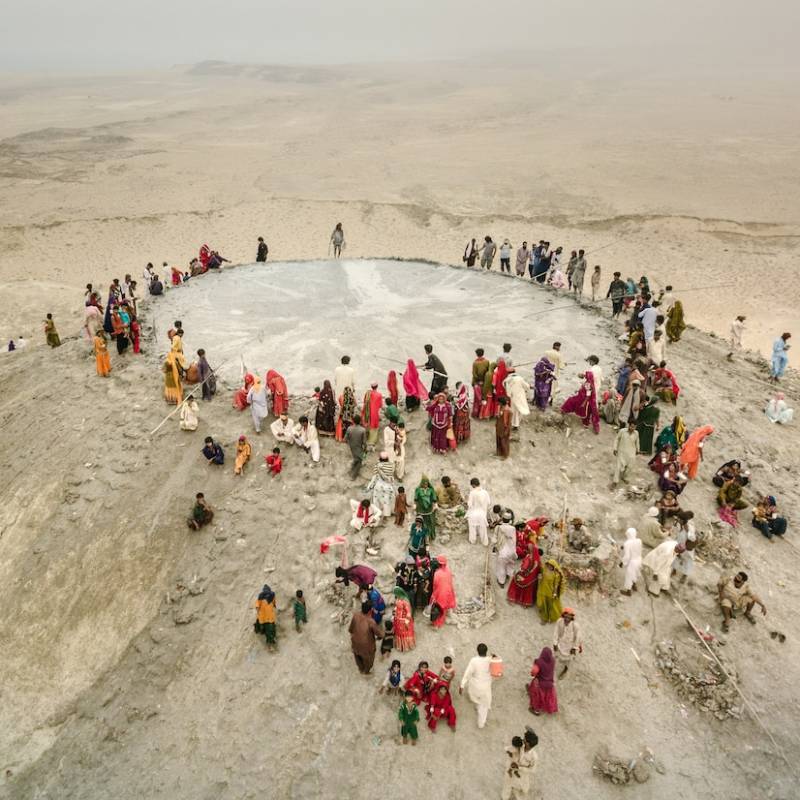
Nearchos, having sailed round the coast of Ora and Gedrosia, and that of the Ichthyophagoi, finally anchored on the port of the Karmanian coast. The Ganz Cemetery lies between Jiwani-Gawadar (Pakistan) and Khash City (Iran), dating back to the Parthian Empire (247 BC to 224 AD). Vase-shaped tombs from the same period were discovered by Iranian archaeologists in Ahvaz, the capital of Khuzestan Province in southwestern Iran. These tombs are said to be built according to the principles of Mithraism. The Cult of Mithras was a Roman mystery religion centered around the god Mithras, a deity with roots in ancient Iranian mythology, particularly in Zoroastrianism, where Mithra was a god of light, justice, and covenants.
Alexander’s hellish march to the Gedrosian desert
Robin Lane Fox (1973) states in his book Alexander the Great:
"While the fleet was detained by adverse winds at the mouth of the Indus, the land army set out through the barren and sandy plains which stretch to the northwest of modern Karachi. It was late August, and water was in very short supply, but by the River Hab, the Oreitan tribesmen, for long an independent people, were driven back in a skirmish. No quarter was shown; and near Lake Siranda, the troops could briefly satisfy their thirst. They had already marched 150 miles in a temperature of more than 100°F, and many were suffering from a skin irritation caused by the sand; they were still burning and slaughtering all local resistance, but they showed no signs of flinching from the task before them. The king’s ambitions, therefore, deserve to be closely considered."
Harpalos, son of Machatas, also accompanied Alexander during his Gedrosian march. Harpalos was a nephew of one of Philip’s wives, which gave him importance in Alexander’s court.
Route of Queen Semiramis and King Cyrus of Persia
Queen Semiramis was the legendary Lydian-Babylonian wife of Onnes and of Ninus. She was married to King Shamshi-Adad V, who reigned from 823 to 811 BC, and was the mother of King Adad-Nirari III (Ninias). Her name is mentioned in the two statues dedicated to Nabu, the Babylonian god of knowledge and writing, in the ancient city of Nimrud, Iraq. Several ancient historians, including Herodotus, Diodorus Siculus, and Plutarch, mention her in their works. Tradition holds that Semiramis built the Hanging Gardens of Babylon.
In the Census of India, 1911, Vol IV: Baluchistan, Denys Bray, ICS, describing Makran, writes that,
"To the ancient Greeks, to whom it was known under the name of Gedrosia, it seemed a waterless waste of sun-scorched sand, across which Alexander deliberately chose to pass his army simply to prove, as Arrian puts it, that he could succeed where Cyrus and Semiramis had failed before him." (23)
Sir Aurel Stein has also described Semiramis’s attempt to invade India in his book An Archaeological Tour in Gedrosia (1931). The Hill of Semiramis was the place where Alexander and Nearchos met. Nearchos, a Greek from Crete, was a close friend of Alexander. He successfully completed his voyage from the Indus Delta to the head of the Persian Gulf. This voyage began in September 326 BC and ended at Susa in early 324 BC. The fleet consisted of 800 ships with Alexander’s soldiers—17,000 to 20,000 men in total.
Nearchos’s fleet had anchored at the eastern branch of the Indus River on these locations:
- Crocala
- Alexander’s Harbour
- Domai Island
- Saranga
- Sacala
- Ladies Harbour
- Hab River
The Ladies Harbour has been identified with Karachi Harbour of Mai Kolachi. The important stages after Karachi were Manora Reef, Cape Monze, Naka Kharari, Sonmiani, Miani Hor, Rama Chaudra, Cape Malan, Ormara, Cape Mogal, Kalmat, and Makran.
According to Hughes Buller, R Baluchistan District Gazetteer Series, Vol. VII: Makran and Kharan (1907):
"Sir Thomas Holdich, Dr. Bellew, and Sir Oliver St. John consider Makran a corruption of the Persian Mahi Khoran, i.e., 'fish-eaters,' and point out that the Greeks in Alexander’s times also called the people Ichthyophagoi, also signifying fish-eaters." (4) Some believe that it was the waste of the Maka people. Maka is a Sindhi tribe. Muhammad Qasim Maka (b. 1953) is a famous poet, musician, and social activist.
Robin Lane Fox (1973) writes in Alexander the Great that,
"His admiral Nearchus, held up meanwhile at the Indus, has left a brief explanation. It was not that Alexander was ignorant of the difficulties of the journey, but he had heard that nobody yet who had passed that way had come safely with an army; Queen Semiramis, on her return from India, had only brought back twenty survivors, King Cyrus a mere seven. These rumours inspired Alexander with a wish to rival Cyrus and Semiramis; at the same time, he wished to be near to his fleet and keep it supplied with what it needed.
The desert tribes had sent envoys to surrender five years earlier, and the difficulties of their land were indeed familiar. But no known legend already linked Semiramis, heroic Queen of Babylon, with such a desert march. Her only local memorial was the Hill of Semiramis at the far end of the journey, where Alexander and Nearchus remet. By then, the troops had suffered appallingly, and any excuse was welcome. Semiramis’s name greeted the survivors, so she could be said, for solace, to have gone through the desert too; only twenty, said the officers, had managed it, whereas Alexander had saved thousands. Bagoas and other Persians could add a similar story of Cyrus. When he set out, neither precedent was needed nor suggested by the landscape. The adventurer’s difficulties attracted him and his men, as always. Mishaps of other kings were only invented at the end. But it was the fleet which kept him down on his fateful route."
Foundation of Alexandria in Makarene on the River Maxates & Coccala Island
Describing Alexandria in Makarene, Robin Lane Fox (1973) writes:
"Alexandria Rhambaceia is said to be founded near the sea. Periplus of the Red Sea 37 knows of a capital town seven days inland, on a river. Steph. Byz. s.v. Alexandria names an Alexandria in Makarene (Makran), on the River Maxates; probably it was near Coccala (Ind. 23.5 for Leonnatus’s meeting with the fleet), perhaps on the modern River Purali and doubtless on an ancient site. Julius Valerius pointed out Alexandria Apud Origala in his list of Alexander’s foundations. Tomaschek corrected Alexandreia Apud Origala to Alexandreia Apud Cocala. We also see different names of this eparchy: Oritana, Origana, and Origala. While Tarn suggested Cocala was at or near the mouth of the Porali River, which today reaches the sea via the Miani Hor Lagoon. He also believed that Leonnatos settled both the harbour town (Cocala) and the city. According to Arrian (Ind. 23.4), Cocala was an anchorage where Nearchos stopped and met Leonnatos. We do not know the precise location of Cocala. Tomaschek searched for it at the mouth of the Phor River."
(See: The Hellenistic Settlements in the East from Armenia and Mesopotamia to Bactria and India (2013))
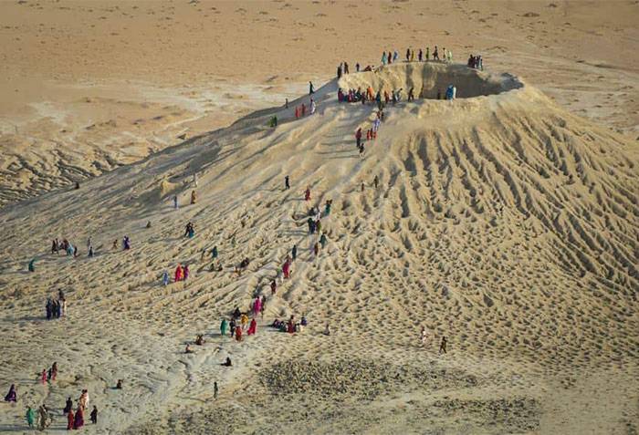
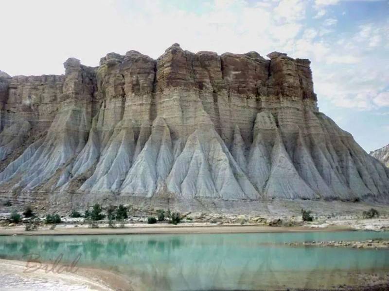
The Purali River, the Hub River, the Phor River, and the Hingol River are the main rivers in Lasbela District, in south Balochistan. The Phor River is situated in Las Bela Town, on the Regional Cooperation for Development (RCD) Highway that connects Quetta and Karachi at a distance of over 700 km. The Phor River rises in the Jhalawan hills and falls into the Arabian Sea some 10 miles east of old Kuehli Bandar. Pilgrims en route from the Phor River to Sangal generally make a detour to the Chandra Gup: the mud volcanoes. The Phor River causes most of the damage in Lasbela during flood season. A rock inscription of Devanagari or Sharada script was discovered from Lasbela in 2024, dating back to the 5th to 7th century A.D. The Buddhist cave-dwelling site of Shehre Roghan (7th century A.D.) is situated 18 kilometers northwest of Lasbela. The princely state of Lasbela was founded in 1742 by Jam Ali Khan I and later acceded to Pakistan in 1948.
Alexander’s Army and the Shrine of Bibi Nani or Mesopotamian Goddess Nanaya
The Shrine of Hinglaz or Hinglaj was in existence before the days of Alexander the Great. This shrine is also known as Hingula Devi and Nani Mandir, which is located 240 km from Karachi, Sindh. It is 12 miles (19 km) inland from the Arabian Sea. According to Baluchistan District Gazetteer Series, Vol. VIII: Las Bela:
"Hinglaj is the best-known place of pilgrimage in Baluchistan, situated in 25°30’ N., and 65°31’ E., below the peak of the same name on the banks of the Hingol River. The shrine, which is dedicated to a goddess known as Nani by Muhammadans and Parbati, Kali, or Mata by Hindus, lies in a verdant basin with mountains on either side rising perpendicularly to nearly 1,000 feet in height… Here Hindu and Mesopotamian pilgrims alike resort, each claiming the divine protection of the presiding goddess or of the departed saint, according to the tenets of their faith; not recognising that the object of their veneration is probably the same goddess who was known to the Chaldeans under the same old-world name (Nana) a thousand years before the time of Abraham." (36)
Nanya, the goddess of love, was closely associated with Inanna. Captain Hart from the Bombay Army visited the Hinglaj Shrine around 1840. He left an interesting account of his journey entitled "Some Account of a Journey from Kurrachee to Hinglaj, in the Lus Territory, Description of the Intermediate Country, and of the Port of Soumeanee."
(to be continued)