

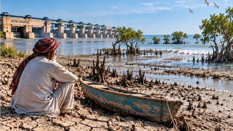
Water reaching the Arabian Sea is called waste. That sentence has been emptying the Indus Delta for seventy years. “We can understand the pain of downstream people and the river if, and only if, we think of ourselves as the lower riparian.” Kharo Chan once held some forty villages. A handful remain. The census that counted about 26,000 people there in the 1980s now counts about 11,000. They left because the sea came inland, the wells turned saline, the rice fields crusted with salt, and the river that had held back the tide no longer arrived. This is not a sudden disaster. It is a slow eviction, made possible by decisions taken far above the last barrage on the Indus. The official name for those decisions is water allocation. The working language is blunter: Pani zaya ho raha hai. Water is being wasted to the sea. That sentence is the most successful political idea in Pakistan’s water history. It is also untrue. And it survives because the people who repeat it do not live where the river ends.
The quarrel is older than the state. In 1945, the Chief Engineers of Sindh and Punjab gave the lower riparian about three-quarters of the main-stem Indus and required its consent for new upstream works. Partition broke that compact. One Unit then allowed barrages and link canals to be built without a provincial veto. The Chashma–Jhelum and Taunsa–Panjnad links, raised as replacement works after the 1960 Treaty, are still opened in seasons when Sindh’s early Kharif is already short. The 1991 Water Apportionment Accord remains the law of the river: 55.94 million acre-feet for Punjab and 48.76 million acre-feet for Sindh. Yet it contains one unfinished sentence. Paragraph 7 recognised “the need for certain minimum escapage to sea, below Kotri, to check sea intrusion.” Sindh proposed 10 million acre-feet. The parties agreed to study the figure. That study has never been conclusively settled.
In shortage years, another ambiguity does the real work: whether the cut should follow the baseline shares of Paragraph 2 or the historic uses recognised in Paragraph 14(b). The mouth of the river has no seat in that argument. The claim that water reaching the sea is unused is a colonial inheritance. Canal-colony science classified undiverted flow as waste. Post-colonial institutions inherited that mission. Success is still counted in storage, megawatts and commanded acres. The estuary does not appear on that list. New canals and storage projects then arrive as the recovery of a squandered asset. Downstream objections are dismissed as regional intransigence. The ledger is partial. Much of what is called waste is floodwater that reservoirs cannot store. The same water is working at the mouth: holding back the salt wedge, delivering silt, feeding mangrove nurseries and triggering the run of palla. Seepage in upper commands is treated as a technical loss. Water reaching Kotri is treated as a scandal. That asymmetry is not hydrology. It is the politics of resource capture.
Delta collapse is cumulative, while irrigation decisions are often made season by season. The imbalance between those two timescales has consequences that cannot be reversed quickly.
There is a psychology underneath it. Empathy follows proximity. The planner at a headworks lives hundreds of kilometres from the tide. He does not watch a graveyard go under or taste a well turned to brine. Because the ocean cannot be seen from a gated headworks, the freshwater reaching the mouth looks optional — a concession made at the expense of national output. The upper command, naming itself the breadbasket, then feels entitled to decide. To accept the opposite would be to acknowledge that upstream prosperity has been subsidised by a sinking coast. Before the modern cascade, the Indus delivered on the order of 150 million acre-feet of water and some 400 million tonnes of sediment to its delta each year. Seventeen creeks reached the sea. Mean discharge below Kotri has since fallen by about 80 per cent. In dry years, the channel runs empty for months.
The salt wedge now reaches 75 to 84 kilometres inland. About 88 per cent of the delta shows subsurface intrusion. The historic plain has contracted from roughly 13,000 square kilometres to about 1,000. Only two creeks still function. A 2005 international panel, asked to resolve Paragraph 7, recommended 5,000 cusecs year-round below Kotri, along with a flood pulse — about 8.6 million acre-feet as a holding regime, rather than a restoration target. Even that floor has not been secured as a right. A delta is a balance between river and sea. Remove the river and the sea occupies the void. Without silt, the land cannot rise. Mangroves lose the gradient in which freshwater meets brine. Palla meets a closed gate.
Mohana fishing households, Jat herders and smallholders from Keti Bandar, Shah Bandar and Kharo Chan move towards Karachi. More than a million people have left the wider delta in two decades. They are not simply migrants in search of better wages. They are people whose river was reclassified as a leak. International water law rejected absolute upstream sovereignty long ago. It calls for equitable use and imposes a duty not to cause significant harm. A newer jurisprudence reflected in cases involving the Whanganui, Atrato and rivers in Bangladesh adds a simpler premise: a river cut off from the sea is a dying river.
The irrigation system need not be dismantled. It must recognise a fifth user: the river mouth. That means a binding baseflow below Kotri, with the 2005 figure as a floor; a sediment pulse in high-flow years, written into IRSA’s rules rather than left as a residual; an environmental-water account so that the delta is not bargained away during shortages; link canals operated as surplus works, rather than as a second claim on the river in a dry April; and a pause on new diversions that consume the same unallocated floodwater the coast requires. These steps would complete the 1991 Accord. They would not repeal it. Irrigation accounting is seasonal. Delta collapse is cumulative. The tide does not pause. A living delta is not a gift from a generous upper basin. It is a condition of a just allocation. And it will not be understood until we are willing, even for the sake of an argument, to think of ourselves as the lower riparian.