

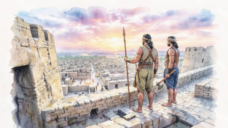
Mr RD Banerji had excavated the remains of a fortress at Site No 3 of Mohenjo-Daro. He mentions Site No 3 with the following headings in his Mohenjo-Daro Excavation Report (1922-23): 1) The Situation, 2) The Nature of the Structure, 3) The Masonry, 4) Burial Customs, 5) The Pottery, 6) Objects of Stone, 7) Objects of Faience and Bones, and 8) Objects of Metal. According to Mr RD Banerji, Site No 3 was an oblong mound in shape, built on a small island. He further describes some structures like a temple (shrine), a solid square platform, a round pavement of limestone or marble, a brick floor, a brick drain, a sink, a stairway, retaining walls or buttresses, and triangular bastions, etc. The retaining walls or buttresses were built on both sides of this structure in order to protect it from the floods of the River Indus.
Banerji discovered a silver bead, a broken bowl of copper, several fragments of copper implements, fragments of a table of oblation in copper, complete specimens of tumbler-shaped urns with red vases, and post-cremated urns with soil or ashes resembling Athenian culture. According to modern archaeologists, the Black and Red Ware (BRW) is a South Asian earthenware which is associated with the Neolithic Phase, the Bronze Age, and the Iron Age in India. The Black and Red Ware sites of the Western Ganges Plains belong to 1450 BC to 800 BC. The Painted Grey Ware (PGW) was introduced later.
But Banerji also discovered from Site No 3 the remains of a fortress and a bull seal from the brick drain near the above-mentioned sink, alongside a small saucer, a tumbler, a water jar, and a stone scraper. One stone Tawiz inscribed with a charm in Persian (probably from the 16th to the 19th century AD) was also found by Banerji from the mound. Banerji had also excavated the following miniature animals from Site No 1, Site No 2, and Site No 3 during the 1922-23 excavations at Mohenjo-Daro: 1) humped bulls, 2) caparisoned horses or donkeys, 3) rhinoceroses, 4) tapirs or hippopotami, 5) birds, and 6) dolls.
Sir John Marshall and the City Walls at Mohenjo-Daro (1925-26)
Describing the possibly demolished city walls, Sir John Marshall writes in Mohenjo-Daro and the Indus Valley Civilisation (1931) that, “ Up to the present no evidence has been found that the city of Mohenjo-daro was protected either by walling or by fortifications. That these once existed, as on other large cities of ancient times, seems more than probable. And it is quite possible that the city walls, if built of burnt brick, would have been demolished by brick-robbers in common with the buildings inside them. Indeed, the outer walls, if they existed, would certainly have been removed before the buildings inside. As fortified walls would necessarily have had very substantial foundations, we may possibly come across the latter when we reach the earlier levels. As an example of fortified walls being completely removed by the brick-robber or by denudation, we can instance those of Kish in Mesopotamia. The city we know from documentary evidence to have been encircled by one, or even more than one, wall. There are now no surface traces whatever to be found of these walls; nor has excavation revealed their whereabouts.”
“Judging from the small number has been found of weapons of offence and defence, the people of Mohenjo-daro appear neither to have been a warlike people nor to have feared invasion. On the other hand, it is possible that soldiers were quartered outside the city and that when these quarters, if they exist, are excavated, we may find ample evidence that the city was well protected from the enemy. Reasons have already been given for thinking that the desertion of the city took place gradually. If this were so, it is probable that armaments were slowly removed at the same time.” (p 282) Sir John Marshall further writes in the footnotes below the page that, “My own view is that the city walls would naturally be buried beneath the deep alluvium of the surrounding plains, where no excavations have yet been done.” Regarding the soldiers' quarters, he again writes that, “The possibility of soldiers being quartered outside the city must have been a remote one.”
After Sir John Marshall, Mr EJH Mackay also tried to identify and excavate fortifications at Mohenjo-Daro. He writes in Further Excavations at Mohenjo-Daro (1938) that, “In the search for possible fortifications, gates, and a city wall, early in 1931 we cut a deep trench through an irregular mound (Pl. VIII, H, 4), situated about 100 yards beyond and slightly to the east of the point where the northern end of First Street debouches into the plain (Pl. I, 164). The extent of this mound just above the level of the plain is some 200 ft E-W by 170 ft N-S, but it is, of course, much larger in area below the present surface of the alluvium. At its highest part which is now 13 ft. below datum, there is a depth of nearly 16 ft of rubbish. This mound was found to consist solely of broken pottery, ashes and humus, of which the latter seems to be the product of decayed vegetable matter; there were no traces of masonry except deep down near the water level in the soil.” (p 3)
Decades ago, Sir John Marshall had suggested that Mohenjo-Daro's original city walls might have been dismantled by brick-robbers or buried under deep alluvium
The above mound is denoted by the letter H. The Annual Reports of the Archaeological Survey of India for the Years 1930-31, 1931-32, 1932-33 and 1933-34 Part One, edited by CL Fabri, PhD, DLitt, provides the following details on this structure’s excavation:
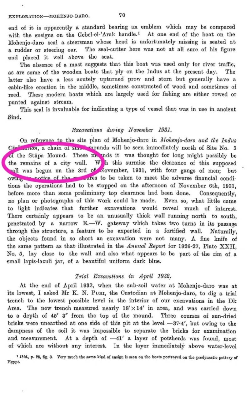
“On reference to the site plan of Mohenjo-Daro in Mohenjo-Daro and the Indus Civilisation, a chain of small mounds will be seen immediately north of Site No 3 of the Stupa Mound. These mounds it was thought for long might possibly be the remains of a city wall. With This surmise the clearance of this supposed wall was begun on the 3rd of November, 1931, with four gangs of men; but owing to notice of the measures to be taken to meet the adverse financial conditions the operations had to be stopped on the afternoon of November 6th, 1931, before more than some preliminary top clearance had been done. Consequently, no plan or photographs of this work could be made. Even so, what little came to light indicates that further excavations would reveal much of interest. There certainly appears to be an unusually thick wall running north to south, penetrated by a narrow E.-W. gateway which takes two turns in its passage through the structure, a feature to be expected in a fortified wall. Naturally, the objects found in so short an excavation were not many. A fine knife of the same pattern as that illustrated in the Annual Report for 1926-27, Plate XXII, No5, lay close to the wall and also what appears to be part of the rim of a small lapis-lazuli jar, of a beautiful uniform dark blue.” (p 70)
Mr KN Puri, the Custodian at Mohenjo-Daro, started trial excavations at the DK Area in April 1932. This trench measured nearly 18x14 feet in area and was carried down to a depth of 45 feet and 3 inches from the top of the mound. Sun-dried bricks, terracotta figures of bulls, buffalo, and rams, frames of model carts, a pottery model of a socketed axe, pottery pieces, cones, balls, rattles, charcoal, and ashes were found.
Mr EJH Mackay writes, “With a view to a more detailed exploration of the low ground outside the northern entrance of the city, I then had a number of trenches cut in a line at right angles to the periphery of the mound, to a distance of well over 500 feet from it and passing across the previously cut trench in the rubbish mound. In the course of this work we came across parts of buildings of good though now ruined masonry, but it was unfortunately impossible in several cases to ascertain the level of their foundations owing to the water level being reached on January 13th, 1931, at a depth of 34.2 ft. below datum. In the limited view afforded by these trenches, we were unable to determine the purpose of these buildings, but quite clearly none of them had ever formed part of the walls or fortifications of the city. We did, however, find incontrovertible proof that this low ground outside the city was flooded on more than one occasion. In fact, the stratification of the soil in these trenches has proved illuminating. By it a considerable light has been thrown on the condition of the buildings that have been explored layer by layer in the neighbouring mound and elsewhere in the city.” (p 3)
From Banerji to Kenoyer: a century of searching for Mohenjo-Daro's fortifications
Since the 1920s, archaeologists have debated whether the great Indus Valley city of Mohenjo-Daro was ever fortified or walled. Here is an overview of major archaeological expeditions and key discoveries from 1922 to 2026
RD Banerji
Site No 3 (Stupa Mound)
- Structures: Remains of a fortress, shrine, solid square platform, limestone/marble pavement, brick drain, sink, and triangular bastions to protect against Indus floods.
- Artifacts: Silver bead, broken copper bowl, tumbler-shaped urns, black and red ware, and a bull seal.
- Miniatures: Humped bulls, horses/donkeys, rhinos, birds, and dolls.
- Late additions: A 16th-19th century Persian inscribed stone Tawiz.
Sir John Marshall
City Walls and General Topography
- Theories on Fortification: Found no direct evidence of city walls at the time. Theorized they were either demolished by brick-robbers or buried under deep alluvium.
- Societal Observations: Due to a lack of weapons found, he hypothesized the people of Mohenjo-Daro were not a warlike society.
EJH Mackay
Search for Fortifications
- Mound H: Cut deep trenches and discovered 16 ft. of rubbish and pottery, but no masonry until water level.
- Wall & Gateway (1931): Discovered an unusually thick wall with a narrow East-West gateway taking two turns, characteristic of a fortified wall.
- Artifacts: A fine knife and a rim of a lapis-lazuli jar.
- Flood Evidence: Proved the low ground outside the city flooded on multiple occasions.
Sir Mortimer Wheeler & Leslie Alcock
Citadel Mound (SD and L Areas)
- The Great Granary: Re-discovered solid cubes of brickwork with air ducts/corridors, originally featuring a timber framework.
- Fortifications: Discovered a massive 6-meter (20-foot) thick mud-brick wall/platform raising the Citadel above flood plains.
- Defenses: Found a south-east corner tower linked by a parapet containing 1,000 baked clay missile balls.
- Pumping Experiments: Used pumps to dig below the water level, revealing even older occupation layers.
Dr Jonathan Mark Kenoyer
Pak-USA Mission (Wheeler's Trench)
- Ancient City Wall: Excavated a massive 6.5-meter (21-foot) wide mud-brick perimeter wall/platform.
- Radiocarbon Dating: Charcoal analysis dated the earliest wall construction to 2700-2600 BC (Early Harappan Period).
- Kot Diji Phase: Deep coring revealed Kot Dijian pottery, indicating occupation dating back to 3300-2800 BC.
- Artifacts: Recovered 581 items including terracotta bangles, copper artifacts, stone tools, and inscribed sherds.
It seems that once a small fort existed in the north-east corner of the Citadel or the fortification. Mr RD Banerji excavated this structure in March 1923. He called it Site No 3 of Mohenjo-Daro. Mr EJH Mackay writes, “To the north-east of the Great Court (Bl 10 in Pl.VI) in the SD Area, where a small amount of excavation was done in an earlier season, a deep deposit of sandy clay was also found on the outer side of what may be a small fort on the city wall (Site No 3 in Pl. I) This building has several features of unusual interest, including curious triangular shaped projections, a 14 ft. thick outer wall, stairways leading up to the rooms on a platform reared high upon a solid mud-brick core, and a staircase on the outside, whose descent we followed right down to the water level in the soil. It was intended to examine this fortress like structure and the curious ghat-like staircase outside it for decisive evidence in support of the suggestion of the late Mr. R. D. Banerji that the river, or a branch of it, washed the city wall at this point. Unfortunately, excavations had to be suspended just as we were working towards this point along the top of what we are inclined to think was a part of the city wall. It is to be hoped that at some future date this important piece of excavation will be completed and the topography of this most interesting part of the site elucidated.” (p 4)
There is also the chain of little mounds north of Site No 3.
Discovery of Watchtowers by Sir Mortimer in 1950 at Mohenjo-Daro
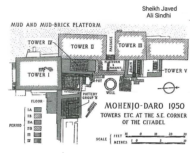
The lowest levels of Mohenjo-Daro have never been reached by excavations due to the difficulties of a high water table in the ground. Sir Mortimer Wheeler made attempts in the 1950s to reach the lower levels that caused subsequent flooding which happened overnight. Wheeler excavated and identified the remains of a state granary, fortifications, and a group of towers in the SD and L areas of the Citadel Mound. He also provided details regarding the Mohenjo-Daro section through the Bund and the North-West Quarter of the Granary in the same year. His excavation there exposed the remains of a more than 6-metre (20-foot) thick mud-brick wall, with an inner filling which formed the foundations for the buildings of the Citadel. Leslie Alcock (Glasgow University, Scotland) worked with Sir Mortimer Wheeler. He was born on the 24th of April 1925 and died on the 6th of June 2006. He served as Superintendent of Exploration for the Department of Archaeology, Government of Pakistan, in 1950. He published an article entitled Exploring Pakistan's Past: The First Year’s Work in Quarterly Pakistan (Karachi, January 1952). This article is spread between pages 12 and 16. Alcock writes that, “Excavations at Harappa in 1946 proved the existence of the mud brick fortification wall, and therefore appeared to clinch the argument. But it remained to be proved that the Citadel mound at Mohenjo-Daro had been similarly fortified.”
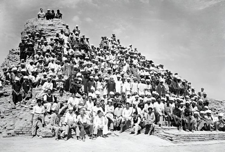
Alcock writes that, “So, in late February, 1950, as the temperature in Middle Sindh started to rise, the embryonic Exploration Branch of the Archaeological Survey (Pakistan) assembled at Mohenjo-Daro to re-examine the city in the light of the discoveries at Harappa. The excavations were financed by the Pakistan Government, with the welcome addition of a grant from the British Academy. Dr. Wheeler directed operations, with the assistance of Mr. Ahmed Hassan Dani and myself; and with us were a number of students both from the Survey and from Universities. Two sites on the Citadel Mound, one a stretch of the supposed fortification Wall and the second a tower at the south east corner of the defenses were chosen for the attack, and the pick men were soon at work.” According to Wheeler, his excavation was part of a training program for members of the newly established Department of Archaeology and Museums, Government of Pakistan. Wheeler excavated the Citadel Mound at two sites called ACC; the Citadel Gateway South-East Corner (L Area) and the REM Granary (SD Area).
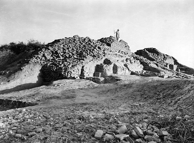
Leslie Alcock again writes, “The scale of work proved vaster than we had ever experienced before, even on the great Roman cities of North Africa; and heroic efforts were demanded. On most archaeological sites, one may expect to come upon the walls and floors of buildings no more than a couple of feet below the present surface; at Mohenjo-Daro, up to 8 feet of junk and debris overlay the remains of the Great Granary. Similarly the yield of broken crocks, clay figurines and other objects was astounding. From one small room alone, we took a thousand (1000) clay beakers, in addition to innumerable goblets, tankards, jars and dishes.” Regarding the discoveries of the parapet, Alcock writes that, “Nevertheless, the work on the south-east tower proceeded smoothly. After two months of excavation there stood revealed an assemblage of solid blocks of masonry, which still rise more than 10 feet above the level of the surrounding country. On the east, these solid towers were linked by a parapet, which looked out over a low valley to the residential quarters of the city. On the parapet itself we found almost a hundred (1000) balls of baked clay, which had clearly been intended as missiles. The western face of the towers, on the other hand, was built into a solid platform of mud and sundried brick. This platform, it seems, forms the base of the entire Citadel Mound, and its intention was to raise the administrative and religious centre of the city above the heads of the common people, and incidentally, out of reach of the Indus floods.”
“Rampart turns out to be Granary: At first, we seemed to be equally successful on the second site. We quickly uncovered a stretch of brick wall some 25 yards (75 feet) long, standing over 20 feet high, and with its face inclined slightly to give it greater strength. This, we thought, must be a baked brick facing or revetment to a defensive wall of mud brick, such as Wheeler had found at Harappa. The fact that the wall ran back at right angles to its main face at either end of our 25 yards stretch did not perturb us; clearly we had discovered a salient, standing forward from the main defensive line. But when we started to clear the debris from off the top of wall, it did not correspond at all to the Harappa pattern. Moreover, the side walls of the salient seemed to run back indefinitely, so that the thing defied all known rules of military architecture. Wheeler has confessed that at the end of the first month’s work, he still had no idea what kind of a building he was uncovering.”
“The answer came, at last, in a lighting revelation and with all the shock effects of lighting. It occurred to us one day that the fragments of building which we had uncovered had the same plan as other fragments 50 yards (150 feet) away which had been partially uncovered by the earlier excavations. To form a coherent picture from these fragments, to understand what the building really was, it would be necessary to uncover the whole area between our own dig and the earlier work. But in this area the building was overlain not only by the debris of ages up to 8 feet deep, but also by the refuse of our own excavations. All this had to be cleared away and in a limited time. Those who are familiar with Sindhi labourers will doubt the possibility of making them run with baskets of earth throughout the 8 working hours of a summer’s day; but now it was necessary that they should run- and so they did.”

Again, Alcock writes that, “Out of such efforts, then, was reborn the Great Granary of Mohenjo-Daro; for such the building proved to be. Only the base of the Granary had escaped destruction, but even so it forms one of the outstanding buildings in an area noted for its impressive remains. Solid cubes of brick work, up to 20 feet high, form a block over 50 yards long and 25 yards wide. Above this masonry base the Granary proper was raised on timber frame-work. The base was divided by a grid of corridors or air ducts, which served to ventilate the Granary and to keep the grain fresh. Along the northern face ran a loading platform, with a small recess or yard into which bullock carts from country districts could bring the grain, and where sacks could be hauled up for storage. The great size of the Granary suggests that it must have been a public building, comparable in this to other nearby edifices. To it tribute and taxes were brought in the form of grain and here was stored the country’s wealth, against times of famine. Thus it served both as State Bank and Treasury to the ancient city of Mohenjo-Daro.”
“Two curious architectural features prove that the corner tower and the granary were roughly contemporary. In both, experiments had been made strengthening brick buildings with a skeleton of Timber work. From the state of the Granary Walls it is clear that the experiments had been unsuccessful, for the timber had rotted, and the brick work had started to collapse. This device of timber frames can only have been tried out for a short time before being abandoned as unsatisfactory. Secondly, both the Granary and tower lie on or against the mud brick platform of the Citadel. This platform must mark a whole-sale re-organization of the public and religious centre of Mohenjo-Daro, in which any earlier buildings were obliterated under a mound of mud 20 feet high, and new buildings on the grand scale were erected high above the rest of the city.”

“Our excavations also gave us some hint of the means of access from the plains to the Citadel, for to the south of the Granary we uncovered the foundation of a monumental ramp or stairway leading up between parallel walls to the level of the streets around the Granary and the Great Bath. Among the minor structures of interest were a small bath room, paved with a water-proof floor, and several of the wells and drains for which Mohenjo-Daro is celebrated.”
“The Obstacles and the Achievement: Not only the scale of the work but also the excessive heat lent a touch of the heroic to our efforts. In April, our students asserted so frequently that the heat was unbearable that we were surprised, even disappointed, that they did not fizzle away to spots of grease on the red-hot brick work. The very idea of digging in March and April was revolutionary, for our predecessors had always closed their excavation season in February. But by doing so, they had denied themselves any chance of uncovering the lowermost and earliest levels of the city. Since the days when Mohenjo-Daro flourished, the water table of the Indus Valley has been slowly rising, and now the lowest levels of the city, which had originally been high and dry, are submerged in subsoil water. The water level is not constant, however, but fluctuates according to the amount of water in the Indus itself; it is lowest during the early summer. Since it was part of our plan to seek for the very beginnings of the Indus Civilization, we had perforce to dig during the hot weather when the water was at its lowest. We also planned to use pumps to remove what water we might find.”
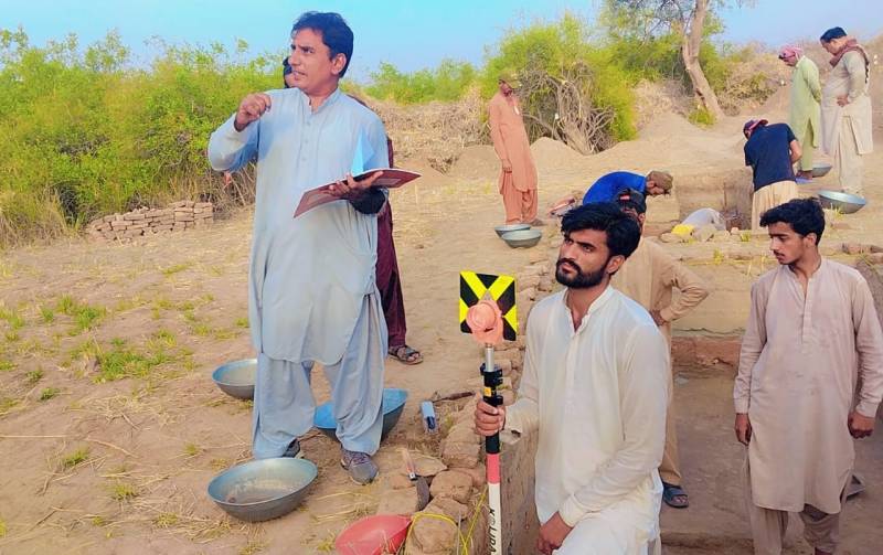
Alcock writes that, “Our experiment with the pumps was not a wholly successful. A number of minor but untoward accidents hindered their smooth working; for instance one of the mechanics poked his hand into the fan of the pump engine to make sure that it was working and for the rest of his stay with us mourned the loss of a finger. But the most serious difficulties arose because we reached water at a higher level than we had anticipated, and before our pumps were ready for action. Standing water sapped at the sides of the trench; ominous cracks began to appear; and one morning part of one side collapsed where, a moment before, I had been at work on a ladder. No damage was done except to the morale of 2 of our draftsmen who scuttered out of the trench like frightened rabbits, but thereafter excavation became a race against further collapse. Whether or not the handful of pottery we recovered 16 feet below water level just before abandoning the trench really represents the earliest remains of the Indus Civilization cannot yet be confirmed; but certainly these relics are far earlier than anything previously discovered on the site. Moreover, we now understand the technique of digging below water level, and we can confidently look forward on some future occasion to discovering the very roots of this fascinating ancient civilization.”
Was Mohenjo-Daro Unfortified in its Heyday?
Alcock writes that, “But our work below water level was not simply a matter of grubbing for older and yet older crocks. Outside the main mounds of ruins, and below the present level of the plain, we came upon a massive wall of sun-dried brick which had been repaired and strengthened on its outer face by the addition of yet more courses of mud brick work. Its purpose was to defend the city against floods as much as against human enemies. Now this wall goes back to a considerably earlier period than that of the Granary and the other buildings of the Citadel, and indeed it was probably in ruins when the Citadel was raised. But there are no convincing signs of a defensive wall in the Citadel period. The south east tower may have formed part of a system of walls which have been washed away by the Indus floods. The Granary, on the other hand, must have been immediately accessible from the open country; this is confirmed by the staircase which flanks it.”
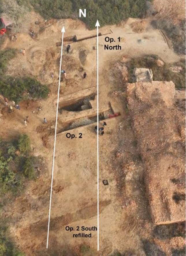
“If it be true that the great public centre of Mohenjo-Daro was unfortified, then the Citadel thesis, as it has been stated previously, requires some modification. Of course, it has never been necessary to see in the Citadel the seat of a despotic power, for a strong minded oligarchy or even a democracy of the Greek type would have been as capable of creating a well planned and socially disciplined city as any tyrant. But now it appears that the two leading cases, Mohenjo-Daro and Harappa, are not strictly comparable. At Mohenjo-Daro we have the public buildings appropriate to a citadel-but no fortifications. At Harappa we have a high fortified mound and no trace of public buildings on it. It is true that the buildings at Harappa have been so savagely damaged that no complete plans can be recovered, but we have a good sample of walls and other fragmentary structures, none of which can be compared in massiveness to the Great Bath, the Granary or other buildings on Mohenjo-Daro Citadel. And it is surely significant that the Granary at Mohenjo-Daro stands with the other public buildings on the citadel mound whereas that at Harappa lies nearly 200 yards beyond the foot of the walled mound; for the Granary, as the storehouse of the city’s wealth, must have been a focal point of social organization. It is clear that further exploration will be required before these problems, which are fundamental to an understanding of the Indus Civilization, can be finally solved.” Alcock published the Wheeler excavation details and maps in his book entitled A Pottery Sequence from Mohenjo-Daro: REM Wheeler’s 1950 Citadel Mound Excavations in 1986.
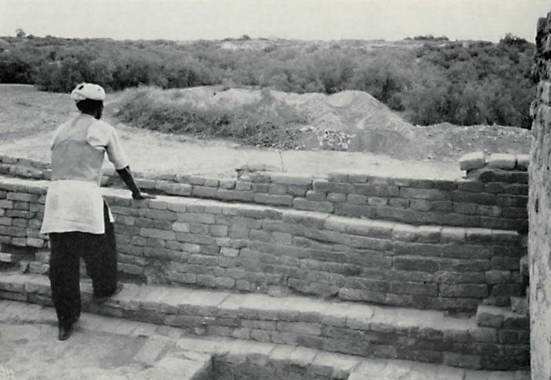
Dr Jonathan Mark Kenoyer’s Excavations at Mohenjo-Daro (2025-26)
The recent archaeological excavations at Mohenjo-Daro were started by the Directorate General of Antiquities and Archaeology, Government of Sindh, in collaboration with the Sindh Exploration and Adventure Society (SEAS) Pakistan and international partners in May 2025. This study was part of a Pak-USA mission which focused on Wheeler’s Trench (1950) at Mohenjo-Daro. The summer excavations at Mohenjo-Daro began on Sunday the 18th of May 2025 and continued until Friday the 6th of June 2025. Meanwhile, the winter excavations were conducted from the 26th of December 2025 to the 20th of January 2026. These latest excavations were carried out for 46 days. The benchmark was selected which stands beside the replica Dancing Girl statue in the garden at Mohenjo-Daro. It lies at 47.597 or 156 feet AMSL.
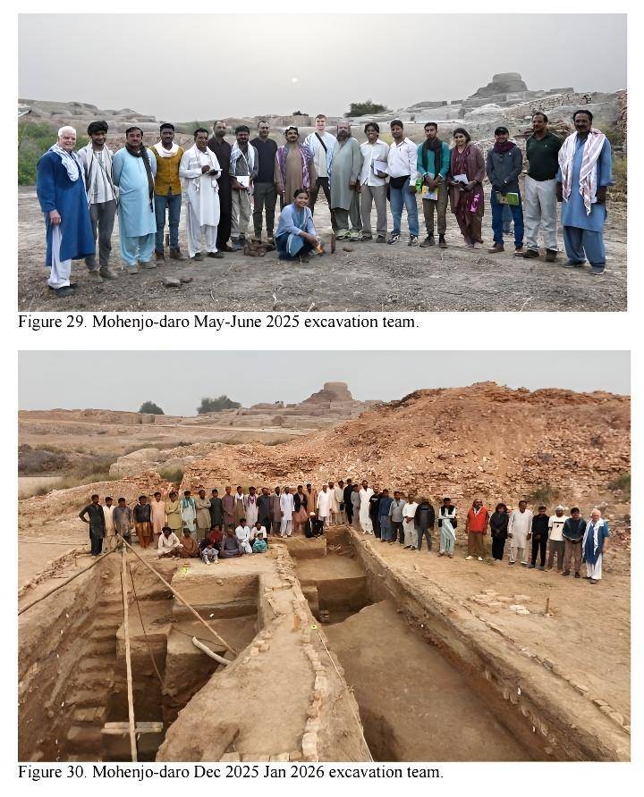
As a director, Dr Jonathan Mark Kenoyer, PhD, a US archaeologist, supervised these excavations. The other team members were Dr Kaleemullah Lashari, Dr Asma Ibrahim, Dr Syed Shakir Ali Shah, Dr Qasid Hussain Mallah, Dr Tooba Shafaq Rajput, Ali Lashari, Zahida Qadri, Lucas Wirick (USA), Syed Faraz Ali Shah, Danish Ahmed Shaikh, Ayaz Ali Mashori, Amir Ahmed Memon, Mehar Ali Shar, Sana Gul Channa, Syed Ali Shah Lakyari, Sheikh Javed Ali Sindhi, Nawazish Ali Dayo, Abid Ali Shar, Muhammad Salim Hyder, Aizaz Pirzado, and Noor Hussain Detho, etc. Ayaz Mashori, Abid Hussain Ansari, and Zahid Hussain Detho served as the surveyor, draftsman, and field manager during the excavations.
Mr Abdul Fattah Shaikh, Director General of Archaeology, and Ihsan Ali Abbassi, Curator of the Mohenjo-Daro Archaeological Site and Museum, alongside other staff members, supported the teams during the summer and winter excavations in 2025-26. The author of this story is highly thankful to Mr Abdul Fattah Shaikh who provided the 31-page The Preliminary Report of Mohenjo-Daro Excavations 2025-26. A permanent datum point was also established on the ground at N 1500-E 1100, in the north-western corner of the Granary. An assessment of the museum display and reserve collection was also conducted for considerable renovation and reorganisation during the summer excavation period. A team of 53 workers from the Syed, Machhi, Abra, Solangi, Channa, Shaikh, Kandhro, Soomro, Mugheri, and Detho castes took part in the excavations.
At the initial stage of this excavation project, four areas were proposed for understanding Mohenjo-Daro chronology. The first area of excavation was selected to the west of the Great Bath and the State Granary. This area had been designated as the REM Granary after Sir Robert Eric Mortimer Wheeler in the 1950s. Wheeler had claimed that the deep digging in 1950 “….revealed how the citadel platform had to be protected wholly or in part by a mud brick embankment or bund 43 feet wide at a relatively early date. At the same time a large burnt brick drain, which ran along the foot of the platform was rebuilt 14 feet higher up; and later the bund was itself reinforced extremely. Against the outside of the Bund layers of alluvium accumulated to the present level of the plain.” (Wheeler, 1968, p. 38)
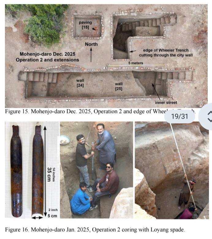
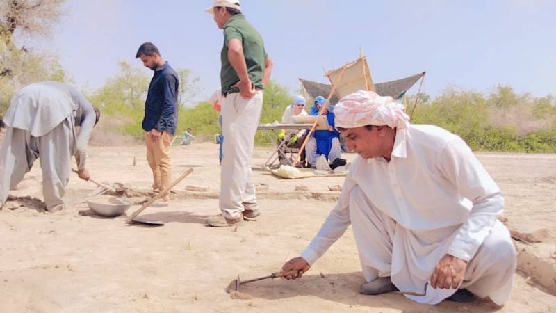
After an introductory meeting held on the 17th of May 2025 at the Mohenjo-Daro Guest House, the excavation work was started on the 18th of May 2025 at the SD Area. Clearing wild bushes and cutting the jungle was the first step, which was done with equipment and other needed tools. The next step was to collect wood and leaf samples of grown vegetation from the selected area for charcoal study. Afterwards, soil-colour activity was conducted on the ground. After the site set-up and grid system, the topsoil was removed and wooden pegs were fixed. In this way, proper stratigraphic excavation was resumed at Mohenjo-Daro. In the start of the excavation, two 4x4-metre squares were excavated to the west of the Granary. The excavated subsurface levels contained modern glass, modern baked bricks, eroded ancient pottery, bangle pieces, and chert blades. Beneath the top level, layers of reddish, black, clay, black-brown, pure clay, and sand were found during the excavation work. A modern north-south paving was also discovered approximately 50 cm (1 foot 7 inches) below the modern surface.
According to Dr Jonathan Mark Kenoyer, “It is not known when this was constructed but it appears to have been constructed using ancient Harappan bricks 6.5x14x28 cm (1:2:4 ratio) along with some possible modern replica Harappan bricks, but none of the bricks had any mold notations to indicate that they were made more recently.” (p 4) This brick-on-edge paving or platform was measured as 1.8 metres or 180 cm or 5 feet 10 inches in width. The paving must have been built between the 1950s and 1990s as per the old staff’s oral traditions. Some of the modern replica bricks had an MCC stamp, which indicates that these bricks had been prepared by the Mohenjo-Daro Conservation Cell (MCC) for conservation work. The MCC was established around 1991-92 and was abolished in 2006. After proper documentation and photography, this modern brick paving was removed for further deep diggings.
Discovery of the Ancient City Wall at Mohenjo-Daro
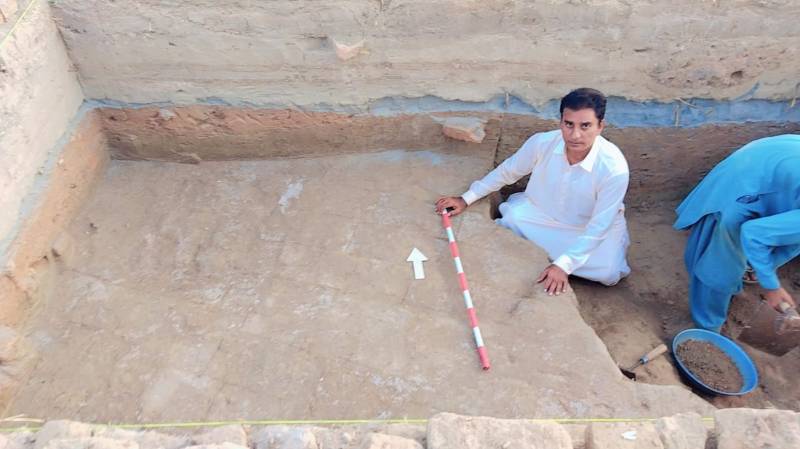
The remains of a mud-brick platform or the City Wall were excavated from the Citadel Mound on the 2nd of June 2026. This discovery was made under the supervision of Dr Jonathan Mark Kenoyer on the Citadel mound in the west of the Great Bath and the Granary. This City Wall was excavated at 90 cm or 3 feet below the common surface of the ground. This City Wall came out from the author’s (Sheikh Javed Ali Sindhi) trench, i.e., MD25, Lot 211, Fe 12. The size of these large Harappan mud bricks used for the City Wall or platform is 10x20x40 cm (a ratio of 1:2:4). Such kinds of large mud bricks had also been found earlier from the foundations of houses in the Lower Town: HR Area.
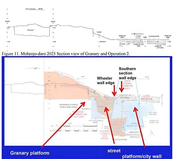
Dr Kenoyer, describing this City Wall, writes that, “After mapping in the modern brick paving in the western trench, this modern structure was removed and below it the western edge of the ancient city wall or mud brick platform was identified at around 47.74 meters AMSL The main mud brick wall appears to have a repair or addition along the western edge of the wall, and this was given feature number. The total width of the two sections of the mud brick wall is approximately 6.5 meters, but the edges are eroded and it is likely that the wall is much wider at base. The mud bricks used to make the ancient platform were approximately 10x20x40 cm in size with some minor fluctuations. The brick colours range from yellow brown to light yellow brown. The clay was quite clean with no organic or artificial inclusions, and the mortar was slightly darker clay mortar.” (p 4)
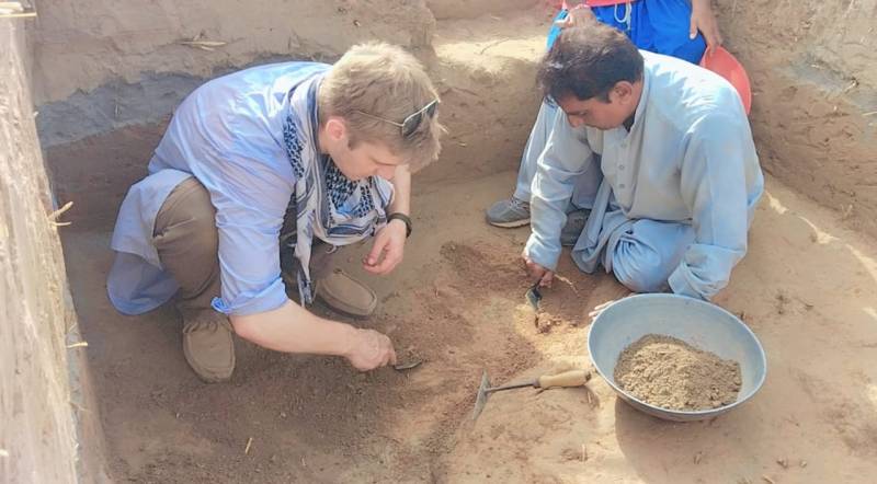
Describing the 6.5-metre or 21-foot-wide City Wall, Dr Kenoyer further writes that, “The eroded eastern western edges need to be investigated in future excavations to determine the overall structure of the wall and its original width. A section of drawing was made to connect the mud brick wall excavations with the existing eroded and conserved section of the so called Granary. This section view was then correlated with the original drawing published by Wheeler for his excavations to confirm that we had in fact reached the same levels and identified the same mud brick wall structure”.
“These initial excavations were intended to extend beyond the area exposed by Wheeler to better define the nature of the mud brick platforms or walls that surround the mound. Due to limited time during the summer season, it was only possible to expose the surface of the mud brick wall, and the actual edge of Wheeler’s trench was assumed to be in the unexcavated area between Operation 1 and Operation 2 trenches.” According to a voice note from Dr Jonathan Mark Kenoyer on the 25th of March 2026, “The date for the lowest levels has not been collected yet. The date we have is for the first city wall: 2700-2600 BC.”
What Were the Major Discoveries, Antiquities, and Findings?
The following 581 artifacts were excavated from the Mohenjo-Daro excavations in 2025-26: 1) TC/bangles, 2) stoneware bangles, 3) copper artifacts, 4) shell bangles and man waste, 5) stone tools, 6) limestone fragments, 7) ground stone fragments, and 8) modern objects like glass, plastic, etc. The above list also included TC animal figurines of bulls or buffalo, TC pointed cones, inscribed sherds, TC cakes, TC disks, copper rods/wires/pins, chert blades, beads, pendants, agate, steatite, and rings. All the pottery was taken to the camp for cleaning, washing, and tabulation. Kot Dijian pottery from deep coring was also found during the Mohenjo-Daro excavations in January 2026. A Loyang spade did this work.
The Preliminary Report of the Mohenjo-Daro Excavations 2025-26 provides the following data on the discovery of the Kot Dijian pottery from Mohenjo-Daro. This report was prepared by Dr Jonathan Mark Kenoyer, Asma Ibrahim, and Ali Lashari, and was submitted to the Directorate of Archaeology, Government of Sindh, on the 16th of March 2026. Dr Jonathan Mark Kenoyer writes in the report, “The pottery however provides clear indication of the presence of Kot Dijian occupation prior to the construction of the first mud brick perimeter wall. The samples of mud brick from within the earliest wall also contained small pieces of Kot Dijian pottery that must have been in the mortar used to construct the wall. This indicates that the lowest section of the mud brick city wall dates to the Kot Dijian Period, approximately 3300-2800 BC based on comparative pottery at Harappa and other Sites”. (p 6) Mud-brick replicas were also made by the team.
Dr Jonathan Mark Kenoyer writes, “The main area where carbon samples were collected is in Operation 2 on the interior of the city wall. In this area, it was possible to document dumps of pottery and other artifacts, including bone, ash and charcoal. These deposits were sealed by layers of eroded mud brick that came from the massive perimeter wall or city wall. Charcoal samples from the upper levels were collected from Lots MD25-251 and 252. The dates for these deposits range from around 2460 to 2280 cal BC (87 to 94% confidence level. This corresponds to Harappa 3B, which is an important period for urban expansion and trade. The fact that the city wall was eroding at this time and there are no later occupation deposits in this part of the site, suggests that the perimeter or city wall was not being maintained and was beginning to erode. The lower levels of these upper street layers (MD25-253 and 254) have two very different dates, one of which corresponds to the dates from the upper levels of the street circa 2466-2286 cal BC (94.5% confidence level). The other date is much earlier, circa 2696-2556 cal BC (63% confidence level) and probably is the result of someone burning old wood and dumping this along with more recent burned wood.” (p 7)
“The final date from Lot MD25-262 is based on charcoal that was collected from the coring done in the lower levels of the mud brick perimeter wall. When a core was removed from a specific level the depth was noted and the sediment was collected and examined for the presence of pottery, bone or charcoal. From Core 5, at the depth of 1.8 to 2.0 meters, only one small fragment of non diagnostic pottery was recovered and some charcoal fragments. However, this level corresponds to the lower levels of the mud brick perimeter wall associated with street levels containing Context A or Early Harappan pottery. The charcoal sample was dried and then sent for dating and came back with a date of 2708-2576 cal BC (50% confidence level). This date fits well with the period of Early Harappan wall construction found at Harappa, 2800-2600 BC and provides the first concrete radiocarbon date for the Early Harappan wall at Mohenjo-daro. There are other earlier occupation deposits below this wall which were cored and provided evidence for diagnostic Early Harappan pottery.” (p 8) Mohenjo-Daro radiocarbon results were obtained on the 20th of February 2026. The charcoal sample (MD25-262) was obtained from coring 5, at a depth of 180 to 200 cm or 6 feet 6.74 inches.
What, then, are the conclusions from the most recent excavations at the Mohenjo-Daro sites?
Dr Kenoyer notes the following:
“The most important discovery was the massive mud brick perimeter wall itself and since this area was mainly covered with recent erosion of the mound, there were relatively few artifacts relating to the original occupation during the Harappan period. In one area near the edge of the mound some important pottery, figurines, terracotta cones and lithic artifacts were recovered, and these will be reported separately once they have been properly documented and analysed. A total of 581 artifacts were carefully tabulated and are being processed with cleaning, desalination and recording. Selected objects have been scanned and photographed or drawn and a full report will be included in the final report. The pottery has all been tabulated and weighed. Selected rim, base and body sherds were saved for further conservation, desalination and documentation with photographs and drawings.” (p 11)
Note: The author is greatly thankful to Dr Jonathan Mark Kenoyer for his academic support.