From time immemorial, humans’ curiosity about the world we live in and their desire for knowledge and adventure have been unquenchable Now of course this has led us into the exploration of space - to what end we are far from sure. However, as to terra firma, one of its most recent explorers was the British Charles Blackmore, whose desire to find a place not yet explored led him, aided by a satellite tracking system, into the first successful crossing of the Taklamakan Desert near the China-Tajikistan border - one of the most unforgiving landscapes on earth, with unfriendly inhabitants.
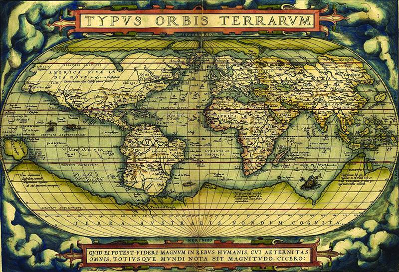
Just as this desert had for so long fascinated and destroyed many would-be explorers, legends of an unknown southern continent (Terra Australis Non Cognita) date back to Roman times and earlier, and were commonplace in medieval geography, though not based on any documented knowledge of the continent. Furthermore, Greek philosophers believed that the world was spherical, and that therefore the existence of Terra Australis was probable in order to balance the huge land mass north of the equator. Many beautiful world maps were made over the ages, cartography becoming an important practice involving both scientific and artistic elements, with Terra Australis featuring rather largely in a number of these.
For a time in the Middle Ages, the Church’s insistence that the Earth was flat eradicated all belief in a southern continent, but the great years of exploration in the 15th and early 16th centuries confirmed its approximately spherical shape. Maps of that period showed Terra Australis as a vast continent centred on the South Pole, extending far north, and in the Pacific Ocean almost up to the equator. The rounding of the Cape of Good Hope by Barthomew Diaz in 1478, and of the southernmost point of South America by Ferdinand Magellan in 1530 stimulated the search for Terra Australis by many navigators, notably by the Dutch Willem Janszoon Tasman.
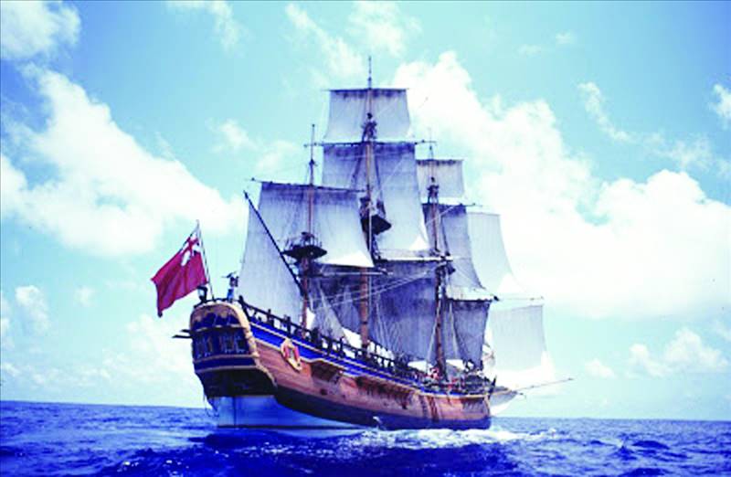
The 'Endeavour' at sea
In fact, Tasman landed on the west side of Cape York Peninsula, Australia, and charted about 300 km of the coastland. This was the first documented landing in Australia by a European. He named Australia New Holland, though generally, the supposed southern continent was called Terra Australis, sometimes shortened to Australia. And in 1644 the name of New Holland was changed to Australia by Abel Tasman, who declared, “This land looks like being a very beautiful land, and we trust that this is the mainland coast of the unknown South Land.”
However, the Dutch explorers did not maintain their interest.
Enter the hero! James Cook, son of a poor Scottish farm labourer, joined the Royal Navy as an adult, soon being recognised as an excellent map maker and navigator. And in fact, using a sextant and chronometer he made astonishingly accurate maps of the Pacific and the east coast of Australia. The sextant was particularly helpful, being an instrument with a graduated arc of 60” and a sighting mechanism, used for measuring the angular distance between 2 visible objects. At sea it is used either to measure the distance between the horizon and a visible object, or that between 2 visible objects.
Cook discovered New Zealand in 1769, but news of his intended voyage leaked out in the London Gazette the previous year, in the statement that, “We have reason to believe (Cook’s) orders are for a voyage of discovery, and will carry the Endeavour to lands far distant in the South Pacific, and even to that vast Continent which is said to be as big as Europe and Asia put together, and which is now marked on maps as Terra Australis Nondum Cognita [...] He has been commended to the Admiralty as a genius, well qualified for great undertakings.”
His first voyage (1768-1771 demonstrated by circumnavigating New Zealand that it was not attached to a larger land mass to the south, and was composed of 2 main islands.(Actually, there are 3, the 3rd being Stewart Island, just below the South Island.) At 2 p.m. on Saturday, 7th October, 1769, one of his crew sighted land, i.e. New Zealand. Accordingly the ship’s artist and botanist, Joseph Banks, wrote “Much difference of opinion and many conjectures about Islands, rivers, inlets, &c, but all hands seem to agree that this is certainly the Continent we are in search of.”
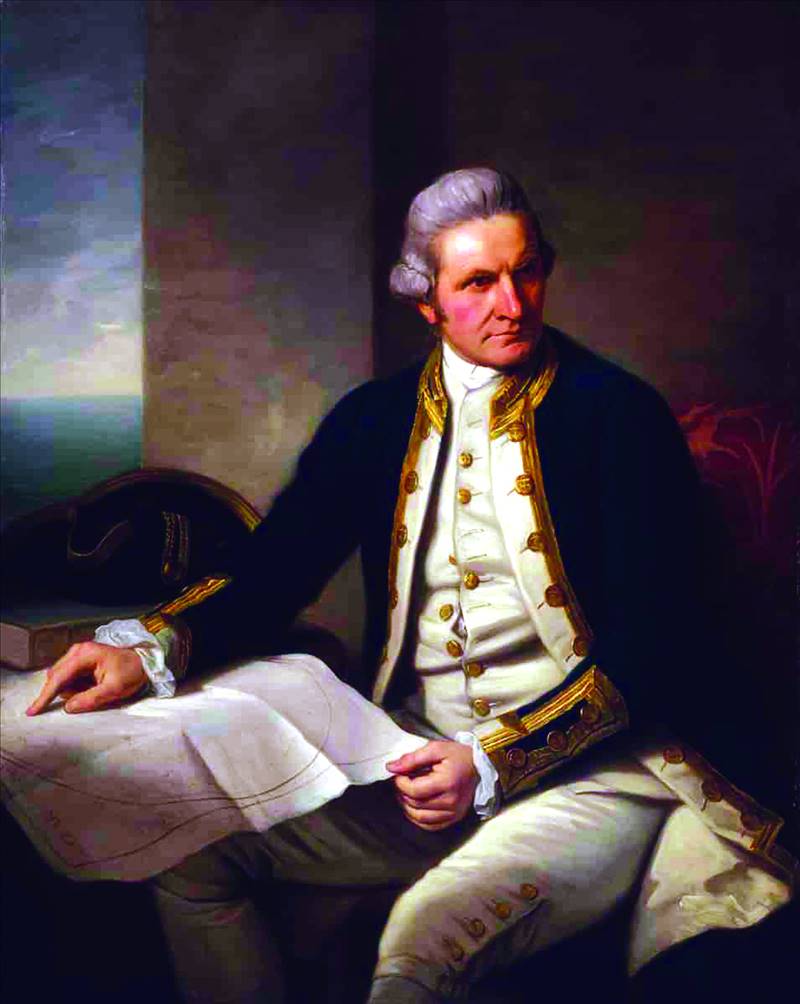
Captain James Cook
One of Cook’s orders while in the south seas was to mark the transit of Mercury across the sun, a phenomenon due on 9th November, 1769. Fortunately, on that day the sun rose in a cloudless sky, and there is no doubt about the accuracy of his observations of the transit, and their bearing upon the longitude of New Zealand. One of the local Maori leaders watching Cook and his men noted his kindness, and described him as “A noble man - a rangatira (chief), who would not be lost in a crowd.”
But having explored New Zealand, all hands then agreed that this was not the country they sought. Therefore Cook sailed west to Australia, where he charted almost the entire eastern coastland, showing that this country was continental in size, though he believed that Terra Australis was further south. In fact, he mapped the Pacific extensively and revealed many of its secrets. For this and other reasons, he came to be regarded as the greatest of navigators and cartographers in European exploration history.
However, he could not know of the drama which awaited him among the treacherous coral reefs off the Australian coast. Much less could he forsee the tragedy awaiting his crew in the disease-ridden tropics, where malaria and dysentery turned the Endeavour into a floating hospital. Not much of a reward for a captain who had paid such attention to diet, to keep his men free of the dreaded curse of scurvy.
Nevertheless, at 3 p.m. on Monday, 22nd November 1772, his new ship, the Resolution, accompanied by the Adventure, headed out from England for the winter voyage, again hoping to find Terra Australis. “Circumstances,” he wrote, seem to point out that there is no southern continent, but this is too important to be left to conjecture; facts must determine it, and these can only be had by (viseting) the remaining parts of this sea.” This time his first task was to find Cape Circumcision, discovered and named by the French explorer Lozier de Bouvet (1705-1786) in 1739. Bouvet’s directions were accurate as to latitude, but sadly astray in longitude, quite inadequate for finding such a minute dot in a thousand miles of ocean.
Next came the first foray into seas far south of New Zealand. But the pack ice, the fog and the icebergs made the voyage a nightmare. Even so, by 17th January 1773, the ships had become the first to penetrate the Antarctic Circle. And by 17th February of the same year, the Resolution was again in the ice, all aboard fascinated by the brilliant Aurora Australis. The size of the icebergs had increased, and Cook was aware both of their beauty and of their danger, and wrote, “The view at once fills the mind with admiration and horror [...] for was a ship to fall aboard one of these large pieces of ice, she would be dashed to pieces in a moment.” The following year they again explored the seas below New Zealand. Eventually, after losing contact with the Adventure during a mighty storm they reached a point far beyond the Antarctic Circle - further south than man had ever been. There was nothing but solid ice ahead, and Cook had no option but to turn his ship northward.
This was a moment of climax, as he was now certain that there was no southern continent in the south seas. Despite the theories and protestations of eminent geographers, after some years of arduous exploration he knew that Terra Australis did not exist - except perhaps in the unnavigable regions of the icecap.