In the previous part of this travelogue, our drive from Naran to Lulusar Lake and upto the Triple Point ahead of Gittidas was narrated. Here, the journey continues via Babusar Top and Indus Valley to Gilgit.
From Naran, we had started at eleven in the morning and reached Babusar at half past two. A distance of 65 km that should have taken two hours of straight driving, had been covered in three-and-a-half hours due to frequent pleasure breaks. We still had to cover 180 km to Gilgit, and Google said it would take a little under four hours. With two breaks, we expected to make it by evening twilight, before dark set in.
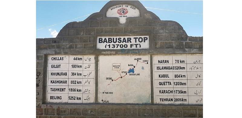
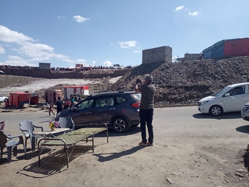
When we left the Kunhar Valley, it was a bright sunny day with snow reflecting sunlight far over the horizon. At Babusar Top, a 13,700 feet-high pass connecting Kunhar and Indus Valleys, we found ourselves over the hump. We stopped for a bit of site-seeing amid high peaks all around. It is a busy place as a lot of people travel here by their own cars or jeeps from Kaghan/Naran for a day trip. Many general stores, restaurants and tea stalls have been set up though we encountered no hotels. There were many dried fruit sellers, whose rates, we found, were similar to those in Islamabad. All shops were temporary structures, which is understandable as the pass remains closed for six months a year due to heavy snowfall. In the absence of garbage bins, the place was littered with wrappers, shopping bags, teacups and fruit peels. The national character of a people is visible at public places – and ours doesn’t reflect civilised behaviour.
Babusar Top - the bazaar in the background, toilets and snow visible
Availability of makeshift latrines was a welcome feature at Babusar Top. The setup is nothing more than tin shacks, empty water bottles and water drums. Forced by the diuretic tablets, I had to use the facility twice. It was a dark stinking room with a wobbly setup and open drainage on the sloping side of the Top. I felt uncomfortable and resolved to switch to our national norm of standing behind a rock or a tree – should the need arise again. However, it was a welcome facility for ladies who find it hard to wait for the next adequate stop. As I wrote in the last part of the article, local governments or the hospitality businesses need to look into providing decent, paid public toilets and litter bins.
We left Babusar a little after 3 pm. We had gained an elevation of 5,500 feet in 65 km from Naran to Babusar and now we were going to lose 10,000 feet to main Karakoram Highway (KKH) in 40 km.
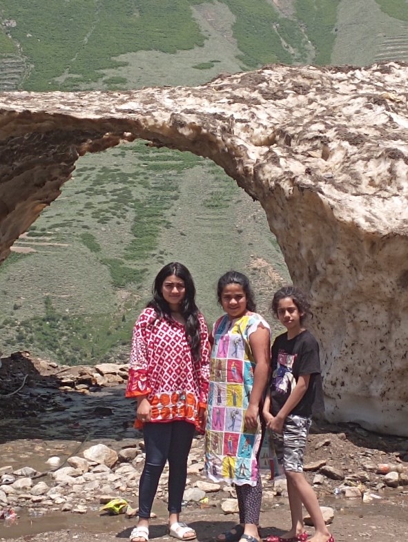
Kunhar valley - the children under a vanishing glacier
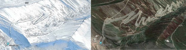
The road below Babusar, along the Thak stream, curved over several snaking turns. The picture below shows why it is closed for the winter months. We were prepared for its windings as we had seen the road in Google Maps, and counted 35 U-turns. We drove slowly as we lost height rapidly. The kids counted that we had actually made nearly 40 U-turns before the road somewhat straightened out through a very narrow and dry valley. In the Thak valley, poverty is discernible and writ large on the faces of the locals who run small vending stalls for local grown fruits. There is absence of employment opportunities and the valley appeared unsuitable for subsistence agriculture. Tourists find nothing attractive to stop here.
On initial descent, we saw harvesting of glaciers. Some pickup-carriers were parked next to glaciers and workmen were shoveling hardened snow into its open hold. These were stall owners who would stuff their cold-drinks and juices in the ice. I was reminded of history of the Abbasid Caliphate when snow was harvested from the Alborz and the Zagros mountains and brought to Baghdad for royal and elite palaces to cool their water and sherbets – or whatever they sipped.
The language spoken in Kunhar is Hindko and Gojri, while Shina is spoken in the Indus valley. Tourism thrives in the former but is absent in the latter. There is no religious discord in the Kunhar valley, whereas the Indus valley is frequently in the news for the wrong reasons. The flies in the former are lazy and mild, but ferocious in the latter
As the road descends towards the Indus River to join the Karakoram Highway a little upstream of Chilas, several differences accentuate the transition from the Kunhar Valley to the Indus Valley.
Babusar Top in winters and summers
The road along the Kunhar was interspersed with several enchanting waterfalls; some a trickle, others a torrent. The beauty of water gushing down the hills, rushing over the road and falling into the fast-flowing river can't be captured into words. There were plenty of unmatched natural charms in the valley. No documentary, no national geographic video can capture the enchanting serenity the views offered. Several peaks were still snow covered when we drove past on the last day of June. The entire road up to the Top was enriched by several hues of green. The pine trees rose gracefully above the terrain. The slopes were strewn with grass, shrubs and brushes that, from a distance, appeared like a green carpet. In the valley, alternatingly, deep down or at eye level, flowed the rushing clear waters of the Kunhar; striking against the rocky outcrops, creating whirlpools and throwing up sprays of icy water. There were numerous glacial streams, some small, others large, with their crystal-clear water flowing over the road; splashing down as waterfalls or as torrents.
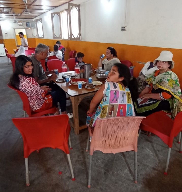
Tired looks in Gini Chilas, Indus Valley
The Kunhar valley, though cut off from the main monsoon currents by the Pir Panjal ranges, receives good rainfall in summers and heavy snowfall in winter. Average annual rain/snowfall is 30 inches. The valley offered great sights where tourists stopped to feel the fresh, icy water. At a few points, last grimy remnants of glaciers sat on the road edge. Some vendors had stuck their drinks and juices into the glacial ice. People walked up the streams, sat on their bank and enjoyed the water or snow chilled cold drinks. These were lovely scenes inspiring tranquility. Kunhar river is crisp, clean, shining and has the exuberance of a frolicsome youth without any worries. I understood why Naran is the end point of excursion of many people. We wanted to stop more often and for longer durations on our drive but the thought of reaching Gilgit before nightfall kept us moving.
For its part, the Indus valley is harsh and inspires awe: a place where tourists strive to pass through as quickly as possible. The landscape is stony, dry and completely devoid of any greenery because it receives scant rainfall with Gilgit averaging less than 10 inches per year. Indus river flows in a broad valley. It has large volume of water, muddy texture, sandy islands and large boulders. Its pace and demeanor is that of a mature serious person with onerous duties. In the end June period, when we crossed through the valley, the surroundings were very hot, extremely humid and very uncomfortable. Large sections of igneous and metamorphic rocks lay next to each other. My geographical proclivity tempted me to stop and capture the grandiose landscape of sand dunes within the bed of a mighty river enclosed by high mountains. But my grandkids, who were delighted at each stop in the Kunhar, were now irked by the foul weather and urged me to keep moving. It was a sharp contrast with Kunhar Valley where they frequently asked to be stopped.
The local population in Kunhar find employment opportunities in the tourism economy. Such opportunities don't exist in Indus Valley.
The language spoken in Kunhar is Hindko and Gojri, while Shina is spoken in the Indus valley. Tourism thrives in the former but is absent in the latter. There is no religious discord in the Kunhar valley, whereas the Indus valley is frequently in the news for the wrong reasons. The flies in the former are lazy and mild, but ferocious in the latter.
The two valleys belong to different worlds. The Kunhar Valley is clearly painted with love with delicate strokes by the Al-Musawwar trait of the Creator, whereas the Indus valley reflects more Al-Qahar or Al-Jabbar.
The above comparison is limited to the impressions of a tourist who transits from one to the other valley. This author, however, is fully cognizant of the fact that the 166-km-long Kunhar can only be properly compared with its 245-km-long sister stream of Kishanganga-Neelum, or, at best with 240-km-long Gilgit or 190-km-long Hunza rivers. The Indus at 3,180 km is the longest river in the Subcontinent, as compared to the 2,510-km-long Ganges, 2,900-km-long Brahmaputra or 1,900-km-long Krishna rivers.
We stopped for lunch at Gini Chilas on the bank of the river. It was very hot and stuffy, with flies swarming around. The fan whirling overhead couldn’t lift our spirits. After a meal of dal-roti, we restarted our journey towards Gilgit. The road from here up to Raikot bridge, about 60 km long, was in poor condition, perhaps due landslides. It was broken at several places and difficult to drive on. The road itself is a wonder, as it has been built by cutting niches in the granite mountain slopes. The steep stone slopes without any vegetation are prone to landslides and indicate the difficulty in maintaining this strategic lifeline. The normal driving time of an hour-and-a-half to the bridge got extended by an additional hour. The road conditions and the hostile weather made the children sick.
Nanga Parbat viewing point - Chongra Peak is on the left
Past Raikot, the road became better and terrain became friendly, although the hot and humid conditions continued. We drove through the Astore Chowk from where a road branches off to the east, gaining elevation as it goes over and beyond the Indus over Ramghat Bridge to Astore. Later, its one branch goes over the legendary Deosai Plains and joins a track to Skardu city. Its other branch veers off south of Deosai, passes through Gultari cantonment (3,322m/10,900ft) and terminates at LOC. A track links it with Indian-held Kargil.
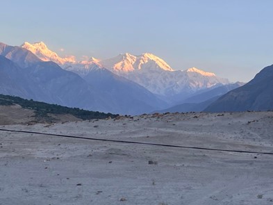
Astore is also the viewing point for Nanga Parbat mountain in all its majesty. We saw its long massif comprising many lower peaks, one of them being Chongra Peak at 6,830 m or 22,410 ft high. The main peak at 8,126 m (26,660 ft) is the 9th highest in the world. I recalled from my aviation days that because of its numerous peaks, the local airline pilots and air traffic controllers at Cherat Approach Control had named it “seven sisters” and used it as a navigation check-point. It certainly presented a striking view from where we stood – at a distance of 25 to 30 km as the crow flies.
Picture-perfect view: three ranges in one click at Jaglot
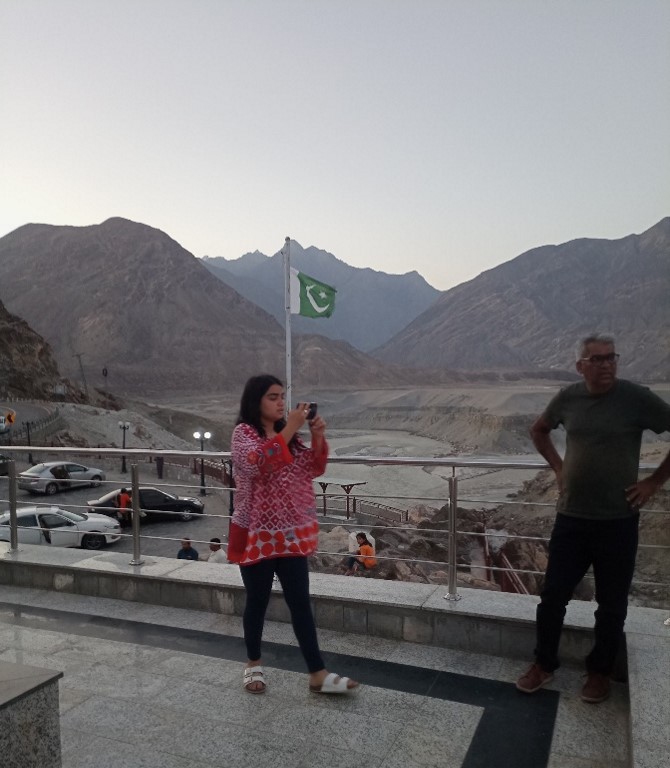
Our next stop was Jaglot, about 40 km short of Gilgit where we reached at sunset. Jaglot is a tourist site because of two reasons. First, this is the starting point for the road to Skardu, Shigar and Baltistan. Second, this is the view-point from where all the three mighty mountain ranges of the world can be seen. The western-most hills of the Himalayas and the eastern foothills of the Hindukush merge here with the mighty Karakorum forming the background. Also, the Gilgit river joins the Indus at this place. These two merges can be captured in one click at Jaglot. A raised platform has been erected here to facilitate the tourists to have a better view of the three mountain ranges.
It was now getting dark and we were apprehensive of driving on an unfamiliar mountain road at night. We had expected the weather to improve with sundown, but it continued to be stiflingly hot. We finally reached our guest house in Gilgit after 8 pm for our dinner – and a much-needed rest.
The fourth part of this travelogue will cover our visit to the Gilgit valley.
Parvez Mahmood retired as a Group Captain from the Pakistan Air Force (PAF) and is now a software engineer. He lives in Islamabad and writes on social and historical issues. He can be reached at: parvezmahmood53@gmail.com