In recent years, our country has witnessed a surge in internal tourism. Popular summer tourist sites in Pakistan’s northern areas are the hill resorts of Murree-Galiat, Skardu, and the valleys of the Swat, Neelam, Hunza and Kunhar rivers. We, as a family, decided to take a trip to Naran, Gilgit, Naltar and Hunza this year. From Hunza, we wanted to drive to Attabad Lake, Passu Cones viewpoint and Khunjerab Pass at the Pakistan-China border; and on the way, we also hoped to taste the now popular apricot cake at the Glacier Breeze Restaurant.
The trip would afford visits to some exquisite alpine lakes, mighty glaciers, torrential rivers, towering peaks and some of the most beautiful natural scenes in the world. The route is a tourist's delight with thousands crowding the area in summers. A wide road, including portions of motorway, has made travel on this difficult terrain possible.
We started off early in the morning from Islamabad in the last week of June. Besides my wife, my two daughters, sons-in-law and four grandkids constituted the travelling party crammed in two cars. Although the drive was to be long, we had the advantage of five experienced drivers. Speeding on Islamabad-Peshawar motorway up to Burhan, we entered Hazara motorway. A drive on this engineering marvel is a pleasant experience; one that generates confidence in the technological possibilities of our nation if we choose to apply our skills in a coherent manner. This road hugs mountain cliffs, winds up and down the sloping tracks and passes through tunnels. The landscaping on the hill side of the road too is a good effort.
As we turned off the Qalandar Abad exit and drove around Mansehra city, the driving conditions changed from superb to crude. Our average speed dropped from 100 to 35 kph as we were hampered by heavy traffic and poor road conditions. Crossing Mansehra, we stopped at a roadside restaurant for a paratha-egg breakfast followed by milky tea. The restaurant, though, could have benefitted from some training in cleanliness of premises and toilets – which would certainly help its business. This observation is valid for most of the eating places that we frequented during our sojourn.
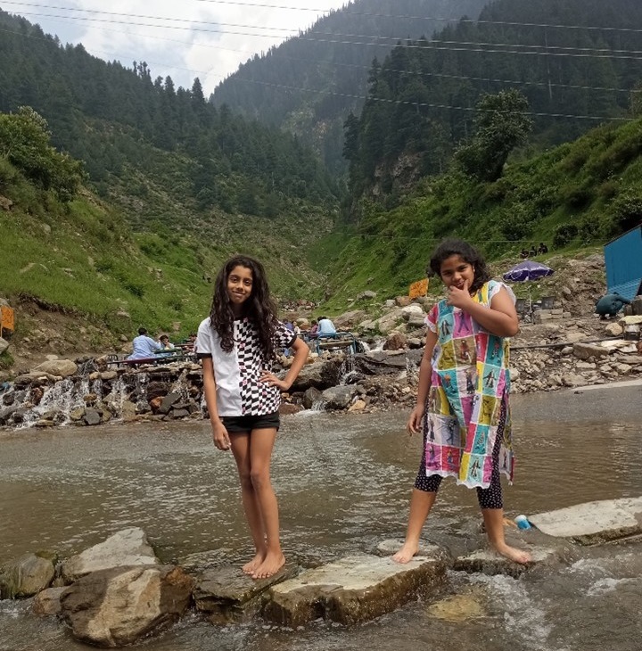
A stream on Kaghan Road
Soon after Mansehra, the road started zigzagging on a twisting hilly track. The turns were few and low-angled initially, but were the harbinger of more adventures ahead. Passing through some great scenes in lush green hills, we reached Bisian from where the swift currents of the Kunhar River, its many tributaries, their feeding glaciers and some of the most enchanting terrain in the world were to be our constant and pleasant companions till we crossed over the Babusar Top three days later.
From Bisian, the road runs on the right bank of the fast-flowing River Kunhar through popular stops at Shogran, Kaghan, Naran, Batakundi, Jhalkand and all the way to Babusar Top. The beauty of these sites is enhanced by glacial streams flowing into the river; some as waterfalls and others as fast torrents. On some streams, the restaurant owners have placed chairs, cots and tables for clients to take food or sip tea, with their feet dangling in frigid water. The drive along river valley through a lush green heavenly landscape is a veritable feast of eyes and a tonic for tired, depressed souls. At river crossings, as the road descends to the river, the raucous uproar of foaming water overpowers every other element, and then the road winds up the twisting slopes on the other side, leaving the fading sound behind. The road crosses the river at Balakot to be on the left bank, where it stays well beyond Naran. It re-crosses the river thrice more; at Burawai, with an enchanting view of a sliding glacier, at Lulusar Lake, and at Gattidas a little short of Babusar Top, where it leaves the Kunhar Valley to enter the Indus Valley.
There are over a thousand hotels, restaurants, roadside food stalls and shops in Naran. That is a manpower-intensive economy requiring a lot of cooks, waiters, cleaners, maintenance technicians, jeep-drivers, rafters, a host of suppliers etc
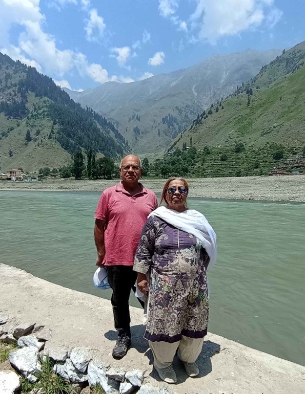
On the bank of the River Kunhar
We crossed Kawai village – the site of a beautiful waterfall and from which a road branches off to the popular tourist spots of Shogran and Sri Paye – and Kaghan town on the river bank surrounded by 14,000-feet high mountains on the east as well as the west, and from where road leads to Maidan Meadows. We stopped at Kaghan to have tea while children played in water. About fifteen kilometers short of Naran, the road turned into an unpaved track because of construction of the 874 MW Suki-Kinari Hydroelectric project. A 15-minute drive turned into a one-hour slog. We swayed over stone tracks and dirt piles but found the scale of work, on one hand, a testament to human endeavor, and, on the other, a sign of how human activity disrupts nature. The project will produce more electricity than the Mohmand Dam. We drove with great patience and care as the road crisscrossed the river past huge machines and around gigantic earthworks. Chinese and Pakistani construction crews were hard at work. Having crossed the construction area, we drove smoothly the rest of the way to Naran amid lush green surroundings.
Naran town is situated on the left bank of the River Kunhar along a narrow 300-metre-wide and 1.5-kilometre-long swath of clearing. The town lies along the road between two bridges; one over Kapan da Katha stream, a small watercourse flowing down steep slopes and the other over a medium-sized stream flowing out of Lake Saiful Malook. Not more than a thousand people form the permanent population of the town. As the Kunhar River flows through a narrow valley with low scope for terraced farming and is surrounded by 10 to 15,000-feet-high peaks that are snow-covered for the better part of the year, the entire length of the valley from north of Balakot to Babusar sustains a sparse permanent population. We saw a few small clusters of thatched or semi-brick houses on mountain slopes. Education or vocational training for children and the youth seemed remote.
To be sure, Naran is truly a beautiful place. There is abundance of water as cool springs and fast-flowing streams exist in every crevice of the mighty mountains. While it was not cold during the day in the sun, it was very pleasant in the evening. The mountain slopes – there is scarcely any level ground – wore a rich thick carpet of grass, bushes and shrubs. I noticed very few trees in the area. People spoke of a political family that had earned a name for felling and selling trees to feed the construction business in the country. That may be true, but the reason probably is that a combination of low temperature and high elevation restrains the growth of trees. However, the surroundings wore a green look due to heavy low-height vegetation.
Our hotel was located on the left bank of Jheel Saiful Malook river, whose volume of water is not big but flow speed is astronomical. That is not surprising given that the river descends 2,500 feet in merely 6 kilometres at an average incline of 12.5%; enough for gravitational pull to really speed up the water. I walked along its banks but did not dare to venture into it except for wetting my feet while sitting safely on one of the many rocks along its flow. A little carelessness can cost one’s life in these fast-flowing, cold-water streams. The soothing sound of water splashing against rocks permeates the surroundings throughout the day and resonates in the quiet of the night.
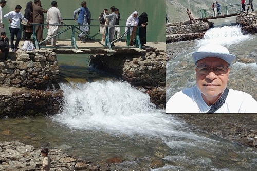
Water overflowing the Lake. Inset: The author, taking a selfie in the middle of the water
Sitting in peace, enjoying the calming music created by the water, I was reminded that humans are mesmerised by the sound and sight of water. One can sit by a sea or a river for hours, listening to the aquatic symphony and seeing the rhythm of waves without getting weary. In fact, all soothing music employs sounds of water in their various forms. Perhaps it is so because life itself is borne of water and much of the human body is made up of this life-giving fluid.
The shops, I thought, could be better organised and made more festive – it was my constant refrain during the trip
There are over a thousand hotels, restaurants, roadside food stalls and shops in Naran. That is a manpower-intensive economy requiring a lot of cooks, waiters, cleaners, maintenance technicians, jeep-drivers, rafters, a host of suppliers etc. Speaking to the people, we learnt that most of these people are seasonal workers. Investors of most businesses, too, were outsiders. The decently furnished hotel that we stayed in, was owned by two partners from Islamabad hospitality industry. A friendly talk with them revealed that they had taken the land on lease for fifteen years and hoped to recoup their investment in only 3-4 years. I also learnt that on realising the increasing potential and worth of their land, especially on the river front, the locals had stopped selling their properties – instead preferring short-term lucrative lease arrangements.
The place that attracts tourists to Naran lies ten kilometres away by road. Lake Saiful Malook is a glacier-fed waterbody, at an elevation of 10,580 feet, covering an area of 2.75 sq km with a maximum depth of 113 feet. Its temperature remains below 100 C and its surface freezes during the winter months. It was formed 0.3 million years ago when the glaciers started receding at the end of the last ice age. Its an enchanting natural feature in the bowl of high snow-clad mountains.
We went there on the second day of our visit. The steep climb, treacherous turns and unpaved track necessitate that the trip can only be undertaken in jeeps, and that too, as told by the drivers, with modified suspension to sustain the rigours of the rugged course.
We hired the first two jeeps that we saw parked outside our hotel. It is normal for drivers to bring their jeeps to the road outside the hotels or at the point where the track to the lake commences. The first driver offered to take all ten of us in one jeep but, being apprehensive about safety and to avoid putting all eggs in one basket, we decided to hire two. The jeeps are hired for the two-way trip with a stay of one-and-a-half hours at the lake. The road to the lake is very rough and narrow. It was also our first experience of what nearly is offroad driving. The average inclination of the road is nearly 7.5%, which is a little more than that of the Kallar Kahar section of Motorway M-2 – but with bad driving conditions. The road consists of loose stones and pebbles that fly off in all directions under the pressure of the tires. The ones falling over into the depths of the valley reminded us of our vulnerability.
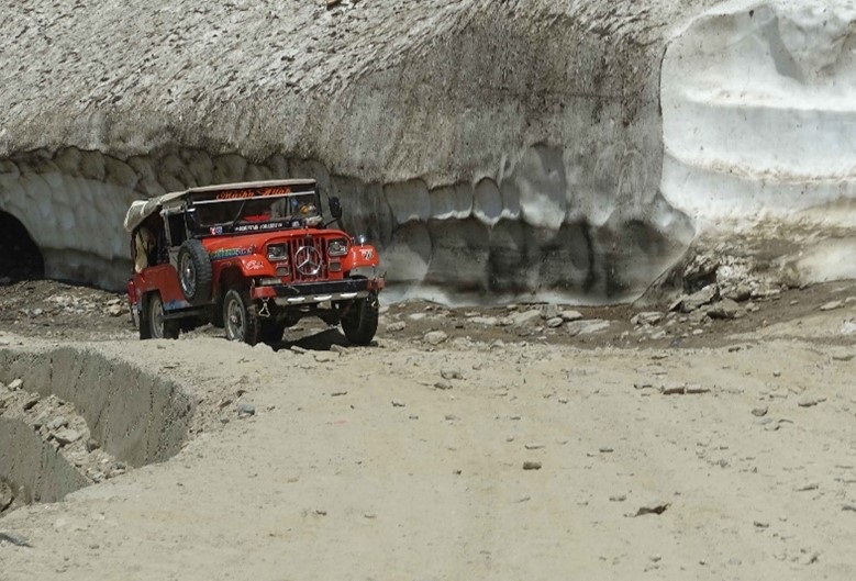
Jeeps cross a glacier on the track to Lake Saiful Malook
The initial few hundred metres of the road are on the left bank of the river and the entire remaining length is on its right. It is a steeply twisting climbing road with high mountains on the left and a deep valley on the right. It has been chiseled out of a steep slope.
The entire 45-minute drive was nothing but rolling, jumping, creaking and falling over each other. We struck against the side door repeatedly and our hands froze from the tight hold on the handles. We wished that the vehicles had been fitted with seat belts. The jeep raised dust as it took steep jerky turns, frighteningly close to the unprotected edges. In most places, the road was too narrow to let the opposing jeep cross. Given that it was the peak of the season, there was a steady two-way stream of jeeps, with drivers cheerfully hailing each other. The high rugged mountains on the sides provided a breathtaking backdrop to the discomfort of the drive. Finally, we sighted the greenish-blue jewel of nature down below on our right. The charm of the view quickly wore off our discomfort.
This lake is a small body of crystal-clear water surrounded by high mountains. It has several small glaciers feeding it constantly with fresh cold water from its southern and eastern sides. There is little vegetation around it which can be attributed to its elevation and heavy snow coverage most of the year. Alighting from the jeep, we walked through a makeshift bazaar with souvenir shops and eateries. The shops, I thought, could be better organised and made more festive – it was my constant refrain during the trip.
Then there is a long flight of stairs that descends from the cliff to the lake.
The lake is surrounded by several peaks of Malika Parbat, the highest being 5,290 metres (17,360 ft) high. The ridge of these peaks creates a semi-circle towards the south, creating a bowl within which the water accumulates in a depression. In ages gone by, this was a glacier stretching some way to the River Kunhar. Visiting in the peak of summers, we took the right track round the lake to the glaciers at the far end. Several people walked into the snow to take pictures. More daring ones took a stroll round the lake. On the far side, a track along a stream was visible that led to the higher peaks, across which lay Ansoo Lake to the right and Neelum Valley to the left.
Lake Saiful Malook is rated as one of the top tourist attractions in Pakistan, attracting hundreds of thousands of tourists every year. It generates an economy amounting to billions of rupees per year. Apart from hotels and restaurants in Naran, the jeeps do a tremendous business employing hundreds of drivers, who make two to three trips a day during the season, charging Rs, 7,000 per trip. In addition, the sport of rafting has also developed, offering a unique experience – one that will be shared in the next part of this long narrative.
Parvez Mahmood retired as a Group Captain from the Pakistan Air Force (PAF) and is now a software engineer. He lives in Islamabad and writes on social and historical issues. He can be reached at: parvezmahmood53@gmail.com