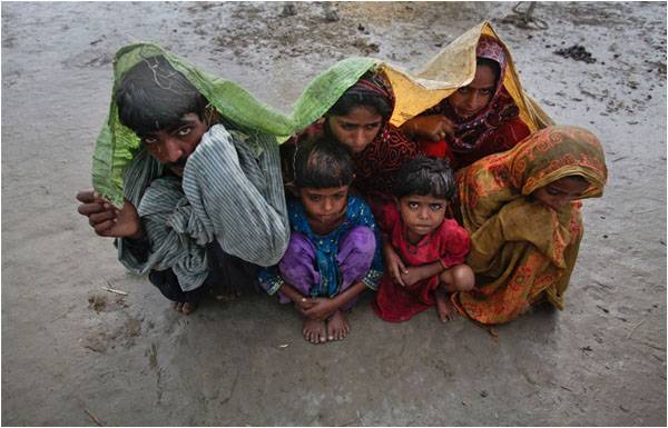
Pakistan faced the worst floods in its history in 2010, affecting 20% of its land and 20 million people, and caused a gross economic loss of $9.7 billion. Flash floods, overflowing eastern and western tributaries of the river Indus, and breaches of its embankments affected all four provinces. About 1,780 people died, mostly in the northern areas of Pakistan. In the last four years, floods have caused losses of $2 billion annually. This year’s floods have already caused bigger damages.
Since 2003, Pakistan has had a monsoon flood every year. Khyber Pakhtunkwa and Gilgit Baltistan suffered flash floods in 2007, 2010, 2012, 2014 and this year. Balochistan had floods most of the years since 2003, caused by hill torrents, the flooding of river Indus, and cyclones. A cyclone killed 380 people in 2007, while the Indus river was flooded in 2005, 2010, 2014 and 2015.
River floods and hill torrents caused losses in Punjab in 2005, 2010, 2014 and this year.
Sindh had more than average rains in 2003, 2006, 2007 and 2009, causing inundation in lower Sindh, coastal areas and Karachi. The large floods of 2010 caused the heaviest damages in Sindh, followed by exceptional rains and damages in 2011. More than 10 million people were displaced during these two years.
Drought conditions and heat waves occurred in June in 2010 and 2015. Then, a forecasted weak monsoon turned into a cloudburst, flash floods and uncontrolled rivers. Regular floods over the last 6 years show increased uncertainty of prediction. There are no improvements in flood control, increased inundations, higher infrastructure damages, more and more evacuations and higher economic costs.
The increasingly lost resilience of the waterways and flood prone areas on one side and the inability to take effective flood and damage control measures on the other, show a bleak picture of the future. After the mega floods of 2010 and exceptional rains in 2011, the Punjab and Sindh governments spent billions of rupees on the improvement of barrages, dikes and drainage systems. The impact of these investments is not visible on the ground. That is leading to a perception that floods in Pakistan are an unavoidable disaster, and we should focus on improving response and rescue operations.
But that is not correct. Most of the recent floods are manageable and the good news for Pakistan is that the current climate change trends – although not fully understood – can be exploited for the benefit of the population and the economy. However, that is not easy work, and there is no one strategy that would work in all situations.
Chitral and Northern Areas:
It remains to be understood what makes the stormwater runoffs in Chitral so intense, and why flood tides follow unexpected paths. The meteorological office’s interpretation is that heavy rains spread to the drier regions of the valley, generating flash floods. The cloudburst of 2015, they believe, is caused by the orographic rains – where dense clouds collide with the mountain sides. However, hourly rain data available on the Met office website does not show cloudbursts.
The situation report of the Provincial Disaster Management Authority (PDMA) says contribution from the Glacial Lake Outburst Floods (GLOF) are responsible for the runoffs. The UN has recently finished two projects on GLOFs in Chitral. UNDP’s inventory shows that the district hosts 487 glaciers and 187 glacial lakes, with 4 to 5 meters of annual glacial melt. There is no information about the quantities of flows caused by the expected GLOF events, their triggers factors, and their link with rainfall.
One can imagine that the Met office will blame lack of monitoring stations and data for the “uncertain and generalized” weather predictions starting from early summer. A mild monsoon was expected this year.
But it is high time we accepted that we do not know the behaviour of glaciers and glacial lakes in the Northern Areas of Pakistan. How can the rains increase the snow or glacier melt and trigger additional outflow? We do not have data on rainfall-to-flood-runoff relations for Chitral, or any other northern district.
The damage to the six water supply schemes and five hydroelectric power stations shows that environmental assessment was not properly done for these projects. Other reports say the Galion hydroelectric power project, which was washed out, was installed at the lower end of 26 glaciers.
The effects of deforestation are obvious from the way soils have been washed. Landfalls and debris flows with water have been high. Land sliding and land erosion occur virtually everywhere.
The way the water streams eroded the banks, expanded or changed their paths, and washed out bridges and entire villages, is dangerous for any hilly terrain. The existing streams need widening, removal of encroachments, and bank strengthening. Land consolidation cannot be postponed as a long-term measure.
Each village needs protection and flood diversion structures – a practice used for the smaller groups of houses, and abandoned with unplanned expansions. Instead of a provincial master-plan, each district needs land use and protection measures implemented before the next floods.
Rod Kohi floods:
Another sign of warning is increasing losses from hill torrents, or Rod Kohi. Such torrents from the Sulemanki Range cause perennial flood disposal problems. The local drains andNallas of DG Khan, Peshawar, Sindh and other areas are abused in many different ways. Their water is used for agriculture, their banks are used for business, houses are built on summer water paths, and garbage is dumped inside or along the banks.
The sanitation department and drainage agencies are responsible for the misuse of these waterways. Unauthorized diversion structures are built on the large flood drains – sometimes in hundreds. These unplanned interventions increase the risk of local flooding.
Large displacements and damages along Indus:
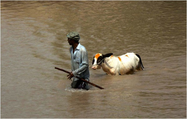
After heavy investment on river structure following the floods of 2010 and 2011, extensive inundation and evacuation occurred during the low and medium floods in the river Indus. About 500 villages have been flooded, and half a million people displaced (Relief News, 27th July).
Most of the flood losses in the riverine area (kacha belt) are avoidable. A post-2010 inquiry tribunal of the Lahore High Court produced a detailed report on the causes of river breaches – “A Rude Awakening”. The report suggested many legal and technical measures, but unfortunately, the government could not find a way to implement them.
The first and the foremost problem is that the actual demarcation of riverine areas does not exist any more. The land has been allotted to individuals and departments. There are terms like “kacha” and “pakka kacha”. Practically, Kacha is managed by thousands (perhaps millions) of users and there is a variety of vested interests of individuals and departments.
To control such flood damages is really easy:
i) No settlements should be allowed inside floodbanks, especially within the active areas of medium floods.
ii) All departments should be banned from installing public infrastructure inside the floodbanks, especially water supply schemes.
iii) Only seasonal crops should be allowed in kacha areas with a commitment from the farmers that damages will not be paid from taxpayer money. Kacha dwellers are already freeriders in the use of water and outside any tax net. The damages inside the kacha areas are not unexpected “disaster losses”. The federal government should not take responsibility for these losses.
Based on the pattern in the last 10 years, we can expect medium floods in Ravi and Chenab every year. Housing schemes and infrastructure along these rivers should be beyond the “medium flood zone”.
Inundation between Guddu and Sukkur barrages during medium floods (between 300,000 to 400,000 cusecs, against a capacity of 1.2 to 1.4 million cusecs) rings alarm bells. The flooding close to barrage ponds and upstream cannot be blamed on nature only. An inundation would occur if floodbanks are broken or barrage gates do not release sufficient water, raising upstream water levels. During this year’s floods, time lags between barrages have so far been close to expectations. Longer time lags in the past, especially in 2010, caused major water accumulation within the river reaches.
The Indus is one of the few large basins of the world where the operating agency is working without any operational optimization and flood model. The one developed by foreign consultants of WAPDA and NESPAK became obsolete in 2010.
Flood prone areas of Punjab:
More than 500 villages were inundated and more than 200,000 acres of crops were damaged by floods this year in Layyah, Rajanpur and Rahim Yar Khan, including more than 30,000 acres of cotton and sugarcane, according to the Punjab PDMA. The inundation continued on July 27, as a second tide of high flows (about 450,000 cusecs) arrived in Indus. According to a Relief-web report on 25th July, inundation of these areas is normal and the population is usually evacuated before floods. Some of the creeks start swelling when the discharge in Jhelum goes to the level of 200,000 cusecs.
The shallow and wide river reaches at the Jhelum and Chenab’s confluence with Indus are traditionally not provided with high floodbanks. The summer flows here are a good source of groundwater recharge, which is extensively used in winter. With the passage of time, tree cover has disappeared, and flood-prone areas have been used for settlements and farming. Some of these locations provide a unique opportunity to Punjab to develop large wetlands providing cushions to the floods and sustainable groundwater recharge.
Urban inundation:
Urban drainage failure occurs even in case of normal rains in Pakistan. Cities like Karachi, Lahore, Peshawar, Rawalpindi, and Hyderabad, face severe drainage problems.
The situation is worsening with new development projects, which create new low lying areas, consume the capacity of the existing system, or obstruct natural evacuation paths. New housing societies and slums add to the sewage quantities, without extending the drainage network.
Managing the basin with overwhelming climate change:
A professional discussion about basin-level water management has become painful. In global literature, Pakistan is severely water scarce, highly disaster prone and among the lowest performing in water governance (ADB, 2014). Our existing water availability is about 1,200 cubic meters/capita/annum. But 70% of this water is available during threemonths and 30% during nine months.
All provinces and water users face water stress during eight or nine months, and floods during two months. All municipalities face drinking water shortage, even during floods. Hepatitis is becoming an epidemic, particularly in freshwater areas of Punjab, as the ground water is heavily depleted and being polluted with all type of waste. No water reaches to the tail end of river Indus for eight months. A study by the FFC and World Bank recommended continuous flows released from the Kotri barrage to protect the mangroves and theecology of the Indus delta. A demand for the environmental flows is often raised.
But where will this water come from? By transferring only 30% of flood flows to winter, high and medium floods in Indus can be converted into medium and low floods respectively. The only cheap electricity resource for Pakistan is hydroelectric power. By storing just 30% of the flood flows, the existing power shortage can be addressed.
Thus, water resources and floods in Pakistan can be managed with substantial economic benefits. The question is, when will the country start taking serious steps?
Dr Zaigham Habib is an independent consultant on hydrology and water resources. She has carried out modeling studies of the Indus Basin to analyze water distribution, agriculture performance, environmental flows, rainfall runoff and hydraulic improvement of the LBOD drainage system.
Email: zaihabib@yahoo.com
Since 2003, Pakistan has had a monsoon flood every year. Khyber Pakhtunkwa and Gilgit Baltistan suffered flash floods in 2007, 2010, 2012, 2014 and this year. Balochistan had floods most of the years since 2003, caused by hill torrents, the flooding of river Indus, and cyclones. A cyclone killed 380 people in 2007, while the Indus river was flooded in 2005, 2010, 2014 and 2015.
River floods and hill torrents caused losses in Punjab in 2005, 2010, 2014 and this year.
Sindh had more than average rains in 2003, 2006, 2007 and 2009, causing inundation in lower Sindh, coastal areas and Karachi. The large floods of 2010 caused the heaviest damages in Sindh, followed by exceptional rains and damages in 2011. More than 10 million people were displaced during these two years.
Drought conditions and heat waves occurred in June in 2010 and 2015. Then, a forecasted weak monsoon turned into a cloudburst, flash floods and uncontrolled rivers. Regular floods over the last 6 years show increased uncertainty of prediction. There are no improvements in flood control, increased inundations, higher infrastructure damages, more and more evacuations and higher economic costs.
Climate change trends can be exploited to help the people and the economy
The increasingly lost resilience of the waterways and flood prone areas on one side and the inability to take effective flood and damage control measures on the other, show a bleak picture of the future. After the mega floods of 2010 and exceptional rains in 2011, the Punjab and Sindh governments spent billions of rupees on the improvement of barrages, dikes and drainage systems. The impact of these investments is not visible on the ground. That is leading to a perception that floods in Pakistan are an unavoidable disaster, and we should focus on improving response and rescue operations.
But that is not correct. Most of the recent floods are manageable and the good news for Pakistan is that the current climate change trends – although not fully understood – can be exploited for the benefit of the population and the economy. However, that is not easy work, and there is no one strategy that would work in all situations.
Chitral and Northern Areas:
It remains to be understood what makes the stormwater runoffs in Chitral so intense, and why flood tides follow unexpected paths. The meteorological office’s interpretation is that heavy rains spread to the drier regions of the valley, generating flash floods. The cloudburst of 2015, they believe, is caused by the orographic rains – where dense clouds collide with the mountain sides. However, hourly rain data available on the Met office website does not show cloudbursts.
The situation report of the Provincial Disaster Management Authority (PDMA) says contribution from the Glacial Lake Outburst Floods (GLOF) are responsible for the runoffs. The UN has recently finished two projects on GLOFs in Chitral. UNDP’s inventory shows that the district hosts 487 glaciers and 187 glacial lakes, with 4 to 5 meters of annual glacial melt. There is no information about the quantities of flows caused by the expected GLOF events, their triggers factors, and their link with rainfall.
One can imagine that the Met office will blame lack of monitoring stations and data for the “uncertain and generalized” weather predictions starting from early summer. A mild monsoon was expected this year.
But it is high time we accepted that we do not know the behaviour of glaciers and glacial lakes in the Northern Areas of Pakistan. How can the rains increase the snow or glacier melt and trigger additional outflow? We do not have data on rainfall-to-flood-runoff relations for Chitral, or any other northern district.
The damage to the six water supply schemes and five hydroelectric power stations shows that environmental assessment was not properly done for these projects. Other reports say the Galion hydroelectric power project, which was washed out, was installed at the lower end of 26 glaciers.
The effects of deforestation are obvious from the way soils have been washed. Landfalls and debris flows with water have been high. Land sliding and land erosion occur virtually everywhere.
The way the water streams eroded the banks, expanded or changed their paths, and washed out bridges and entire villages, is dangerous for any hilly terrain. The existing streams need widening, removal of encroachments, and bank strengthening. Land consolidation cannot be postponed as a long-term measure.
Each village needs protection and flood diversion structures – a practice used for the smaller groups of houses, and abandoned with unplanned expansions. Instead of a provincial master-plan, each district needs land use and protection measures implemented before the next floods.
Pakistan is severely water scarce, highly disaster prone and poor in water governance
Rod Kohi floods:
Another sign of warning is increasing losses from hill torrents, or Rod Kohi. Such torrents from the Sulemanki Range cause perennial flood disposal problems. The local drains andNallas of DG Khan, Peshawar, Sindh and other areas are abused in many different ways. Their water is used for agriculture, their banks are used for business, houses are built on summer water paths, and garbage is dumped inside or along the banks.
The sanitation department and drainage agencies are responsible for the misuse of these waterways. Unauthorized diversion structures are built on the large flood drains – sometimes in hundreds. These unplanned interventions increase the risk of local flooding.
Large displacements and damages along Indus:
After heavy investment on river structure following the floods of 2010 and 2011, extensive inundation and evacuation occurred during the low and medium floods in the river Indus. About 500 villages have been flooded, and half a million people displaced (Relief News, 27th July).
Most of the flood losses in the riverine area (kacha belt) are avoidable. A post-2010 inquiry tribunal of the Lahore High Court produced a detailed report on the causes of river breaches – “A Rude Awakening”. The report suggested many legal and technical measures, but unfortunately, the government could not find a way to implement them.
The first and the foremost problem is that the actual demarcation of riverine areas does not exist any more. The land has been allotted to individuals and departments. There are terms like “kacha” and “pakka kacha”. Practically, Kacha is managed by thousands (perhaps millions) of users and there is a variety of vested interests of individuals and departments.
To control such flood damages is really easy:
i) No settlements should be allowed inside floodbanks, especially within the active areas of medium floods.
ii) All departments should be banned from installing public infrastructure inside the floodbanks, especially water supply schemes.
iii) Only seasonal crops should be allowed in kacha areas with a commitment from the farmers that damages will not be paid from taxpayer money. Kacha dwellers are already freeriders in the use of water and outside any tax net. The damages inside the kacha areas are not unexpected “disaster losses”. The federal government should not take responsibility for these losses.
Based on the pattern in the last 10 years, we can expect medium floods in Ravi and Chenab every year. Housing schemes and infrastructure along these rivers should be beyond the “medium flood zone”.
Inundation between Guddu and Sukkur barrages during medium floods (between 300,000 to 400,000 cusecs, against a capacity of 1.2 to 1.4 million cusecs) rings alarm bells. The flooding close to barrage ponds and upstream cannot be blamed on nature only. An inundation would occur if floodbanks are broken or barrage gates do not release sufficient water, raising upstream water levels. During this year’s floods, time lags between barrages have so far been close to expectations. Longer time lags in the past, especially in 2010, caused major water accumulation within the river reaches.
The Indus is one of the few large basins of the world where the operating agency is working without any operational optimization and flood model. The one developed by foreign consultants of WAPDA and NESPAK became obsolete in 2010.
Flood prone areas of Punjab:
More than 500 villages were inundated and more than 200,000 acres of crops were damaged by floods this year in Layyah, Rajanpur and Rahim Yar Khan, including more than 30,000 acres of cotton and sugarcane, according to the Punjab PDMA. The inundation continued on July 27, as a second tide of high flows (about 450,000 cusecs) arrived in Indus. According to a Relief-web report on 25th July, inundation of these areas is normal and the population is usually evacuated before floods. Some of the creeks start swelling when the discharge in Jhelum goes to the level of 200,000 cusecs.
The shallow and wide river reaches at the Jhelum and Chenab’s confluence with Indus are traditionally not provided with high floodbanks. The summer flows here are a good source of groundwater recharge, which is extensively used in winter. With the passage of time, tree cover has disappeared, and flood-prone areas have been used for settlements and farming. Some of these locations provide a unique opportunity to Punjab to develop large wetlands providing cushions to the floods and sustainable groundwater recharge.
Urban inundation:
Urban drainage failure occurs even in case of normal rains in Pakistan. Cities like Karachi, Lahore, Peshawar, Rawalpindi, and Hyderabad, face severe drainage problems.
The situation is worsening with new development projects, which create new low lying areas, consume the capacity of the existing system, or obstruct natural evacuation paths. New housing societies and slums add to the sewage quantities, without extending the drainage network.
Managing the basin with overwhelming climate change:
A professional discussion about basin-level water management has become painful. In global literature, Pakistan is severely water scarce, highly disaster prone and among the lowest performing in water governance (ADB, 2014). Our existing water availability is about 1,200 cubic meters/capita/annum. But 70% of this water is available during threemonths and 30% during nine months.
All provinces and water users face water stress during eight or nine months, and floods during two months. All municipalities face drinking water shortage, even during floods. Hepatitis is becoming an epidemic, particularly in freshwater areas of Punjab, as the ground water is heavily depleted and being polluted with all type of waste. No water reaches to the tail end of river Indus for eight months. A study by the FFC and World Bank recommended continuous flows released from the Kotri barrage to protect the mangroves and theecology of the Indus delta. A demand for the environmental flows is often raised.
But where will this water come from? By transferring only 30% of flood flows to winter, high and medium floods in Indus can be converted into medium and low floods respectively. The only cheap electricity resource for Pakistan is hydroelectric power. By storing just 30% of the flood flows, the existing power shortage can be addressed.
Thus, water resources and floods in Pakistan can be managed with substantial economic benefits. The question is, when will the country start taking serious steps?
Dr Zaigham Habib is an independent consultant on hydrology and water resources. She has carried out modeling studies of the Indus Basin to analyze water distribution, agriculture performance, environmental flows, rainfall runoff and hydraulic improvement of the LBOD drainage system.
Email: zaihabib@yahoo.com